- Elevation
- 924 m
- above sea level
- Local time
- UTC+00:00
- Europe/London · UTC+00:00
- Airports
- LPL Liverpool John Lennon Airport85 km
- IOM Isle of Man Airport112 km
About Elidir Fawr
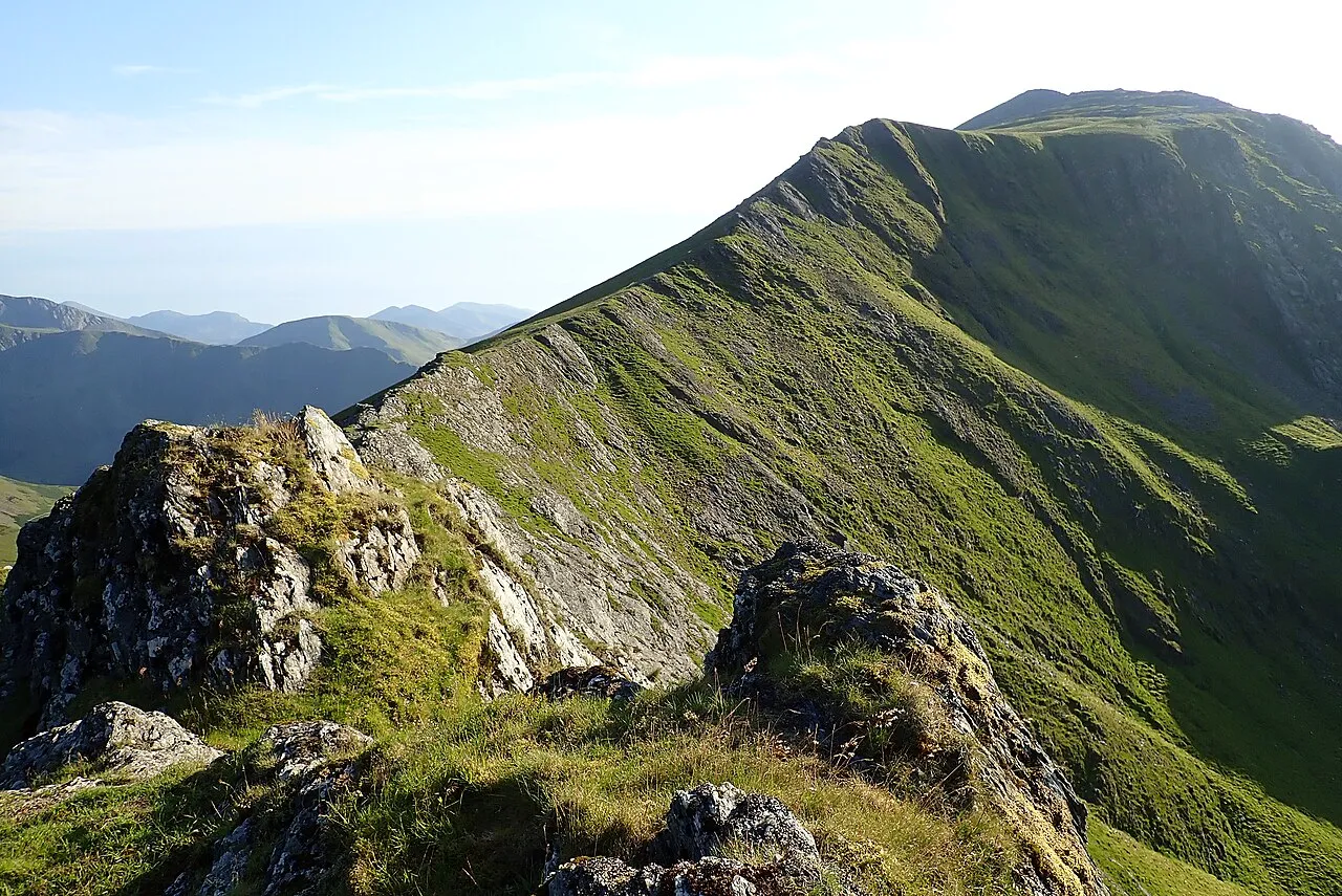
Elidir Fawr is a mountain. Location: Llanddeiniolen, Gwynedd. Elevation: 924 m.
Elidir Fawr is a mountain in Snowdonia, north Wales, the northernmost peak in the Glyderau. Its name means 'Big Elidir', named after a legendary warrior king of the 6th century also known as Eliffer Gosgorddfawr (Elidir of the Great Army). To the north of the summit is a small lake, Marchlyn Mawr, which is the upper reservoir for Dinorwig power station, a pump-storage power station hidden inside the mountain. Water from this lake flows through huge tunnels into the lower reservoir Llyn Peris.
Source: Wikipedia · CC BY-SA 4.0
At a glance
- Topographic prominence
- 212 m
Source: Wikidata
Photos of Elidir Fawr
-

Seraaron · CC BY-SA 4.0 -

Seraaron · CC BY-SA 4.0 -

Richard Hoare · CC BY-SA 2.0 -

No machine-readable author provided. Rhion assumed · Public domain -

Ben Brooksbank · CC BY-SA 2.0


Climate of Elidir Fawr
This month · November
A wet month
Day 5° · Night 0° · Rain 177 mm
- Hottest month
- July (day 14°)
- Coldest month
- February (night -3°)
- Wettest month
- November (177 mm)
- Driest month
- May (88 mm)
Bars: average monthly low and high temperature. Below: precipitation. Monthly averages for 1970–2000 at about 18 km resolution, adjusted for elevation. Highlighted months are mild and relatively dry. Source: WorldClim 2.1 (CC BY 4.0).
Show values as a table
| Month | Jan | Feb | Mar | Apr | May | Jun | Jul | Aug | Sep | Oct | Nov | Dec |
|---|---|---|---|---|---|---|---|---|---|---|---|---|
| Average high (°C) | 2° | 2° | 4° | 6° | 10° | 12° | 14° | 14° | 12° | 8° | 5° | 3° |
| Average low (°C) | -3° | -3° | -2° | -1° | 2° | 5° | 7° | 7° | 5° | 3° | 0° | -2° |
| Precipitation (mm) | 157 | 116 | 139 | 96 | 88 | 94 | 97 | 115 | 131 | 161 | 177 | 168 |
How to get to Elidir Fawr
The nearest airport is Liverpool John Lennon Airport (LPL), 85 km to the east as the crow flies. The nearest large city is Birkenhead, 77 km to the northeast.
Airports
- Liverpool John Lennon Airport (LPL) Liverpool 85 kmeast
- Isle of Man Airport (IOM) Castletown, Rushen 112 kmnorth
- Manchester Airport (MAN) Manchester, Greater Manchester 122 kmeast
Nearby large cities
- Birkenhead Population: 325.3K 77 kmnortheast
- Liverpool Population: 496.8K 80 kmnortheast
- St Helens Population: 183.2K 96 kmeast
- Blackpool Population: 145K 102 kmnortheast
- Warrington Population: 172.3K 104 kmeast
Straight-line distances; road distances are longer. Airport data: OurAirports.
Day trips from Elidir Fawr
Within 100 km: 352 historic and cultural sites, 1,584 natural sites, 162 lakes, rivers and coasts.
0–25 km348 places
- Anglesey Island 24 kmNW
- Ynys Tywyn Island 23 kmS
- Puffin Island Island 21 kmN
- Llanddwyn Island Island 23 kmW
25–60 km723 places
- Whistling Sands Beach 54 kmSW
- Traeth Penllech Beach 49 kmSW
- Porth Towyn Beach Beach 45 kmSW
- Traeth Lligwy Beach 29 kmNW
60–100 km1,027 places
- British Isles Island 97 kmN
- Thurstaston Beach Beach 66 kmE
- Formby Beach Beach 81 kmNE
- Ainsdale Beach Beach 86 kmNE
Straight-line distances.
Nearest towns and villages
Nearby attractions & nature
Everything nearby-
Marclyn Mawr Lake, Llanddeiniolen0.9 km NE
-
Mynydd Perfedd Mountain, Llanddeiniolen1.3 km NE
-
Maclyn Bach Lake, Llanddeiniolen1.3 km N
-
Carnedd y Filiast Mountain, Llanddeiniolen1.7 km NE
-
Foel-goch Mountain, Llandygai1.7 km E
-
Y Ceiliog Mawr Mountain, Llanberis2.2 km SW
-
Y Garn Mountain, Llanberis2.6 km SE
-
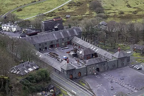 National Slate Museum Museum, Llanddeiniolen2.8 km SW
Sources & licences
Data last updated: · 2 independent sources