Coedffranc
Located in Neath Port Talbot, Wales Coordinates: 51°38′14″ N 3°51′39″ W
- Elevation
- 91 m
- above sea level
- Local time
- UTC+00:00
- Europe/London · UTC+00:00
- Places inside
- 11
- listed under Coedffranc
About Coedffranc
Coedffranc is a municipality. Location: Neath Port Talbot, Wales. Elevation: 91 m.
In comparison
- Nearest larger town: Briton Ferry, 3 km E
- 49 sights and natural places within 10 km Pen Pant-y-sais, Coed Darcy
- Listed here: Mountain: 5, Village: 3, Historic site: 1, Natural site: 1
Airports nearest to Coedffranc
- Cardiff International Airport (CWL) Cardiff 45 km
- Bristol Airport (BRS) Bristol 84 km
- Exeter International Airport (EXT) Exeter, Devon 105 km
Straight-line distance; airports with scheduled flights only. Source: OurAirports (public domain).
Places in Coedffranc
11 places-
Briton Ferry Motte Historic site
-
Coed Darcy Mountain
-
Coed yr Iaryll Mountain
-
Crymlyn Burrows Neighbourhood
-
Jersey Marine Village
-
Llandarcy Village
-
Pen Crymlyn Mountain
-
Penisa'r-coed Mountain
-
Pen Pant-y-sais Mountain
-
Skewen Village
-
Swansea Bay Natural site
Nearby attractions & nature
Everything nearby-
Shelone Hill Mountain, Briton Ferry2.3 km E
-
Mount Vernon Motte Historic site, Briton Ferry2.4 km E
-
Warren hill Mountain, Briton Ferry2.5 km E
-
Summer House Hill Mountain, Llansamlet2.5 km NW
-
River Neath River, Wales2.2 km SE
-
Cefn-hengoed Mountain, Bonymaen3.1 km W
-
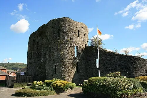 Neath Castle Historic site, Neath5 km NE
-
Neath Abbey Craig Mountain, Dyffryn Clydach3.5 km NE
Sources & licences
Data last updated: