Aberdeenshire
Nombre local: Siorrachd Obar Dheathain
Situado en Escocia, Reino Unido Coordenadas: 57°10′00″ N 2°40′00″ O

- Población
- 265.080
- 265,1 mil
- Altitud
- 381 m
- sobre el nivel del mar
- Hora local
- UTC+00:00
- Europe/London · UTC+00:00
- Lugares incluidos
- 1.391
- clasificados en Aberdeenshire
- Aeropuertos
- ABZ Aberdeen International Airport29 km
- DND Dundee Airport82 km
Acerca de Aberdeenshire
Aberdeenshire es un distrito. Ubicación: Escocia, Reino Unido. Población: 265.080.
Aberdeenshire (del gaélico escocés: Siorrachd Obar Dheathain) en escocés: Aiberdeenshire) es un concejo de Escocia en el Reino Unido. Limita con los concejos de Angus, Perth and Kinross, Highland y Moray, aunque no incluye la ciudad de Aberdeen que constituye ella sola un concejo propio. A pesar de eso, la sede administrativa del concejo de Aberdeenshire está en dicha ciudad. Esta área, excluyendo la misma Aberdeen es también un área arrendada.
Fuente: Wikipedia · CC BY-SA 4.0
Fotos de Aberdeenshire
-
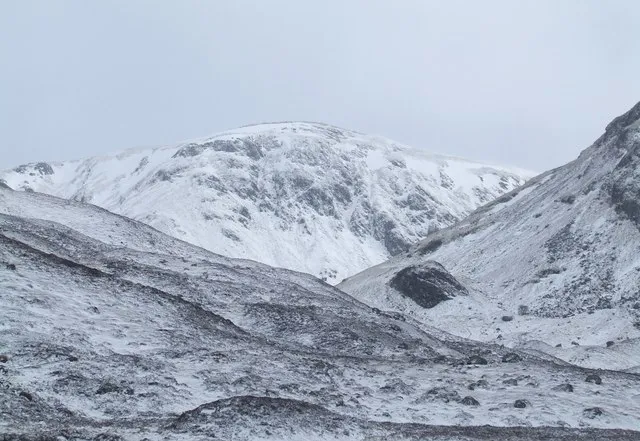
Tolmount Gwen and James Anderson · CC BY-SA 2.0 -
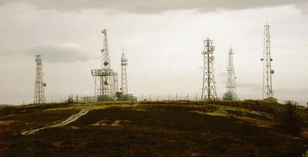
Mormond Hill Mindjammer · CC BY-SA 2.0 uk -
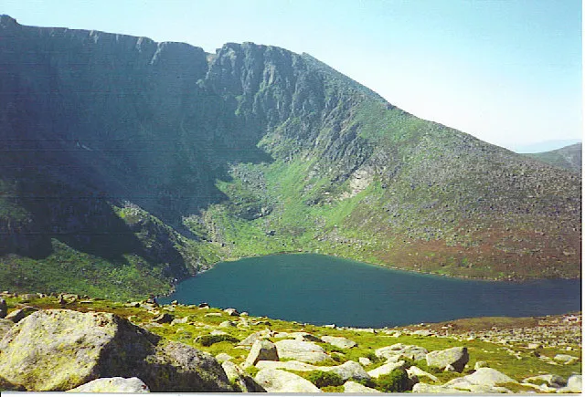
Lochnagar Colin Smith · CC BY-SA 2.0 -
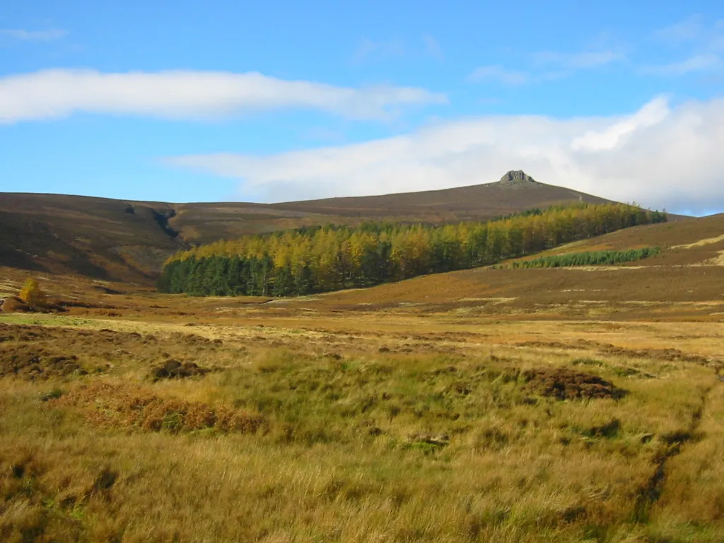
Clachnaben Original uploader was Finavon at en.wikipedia · CC BY-SA 3.0 -
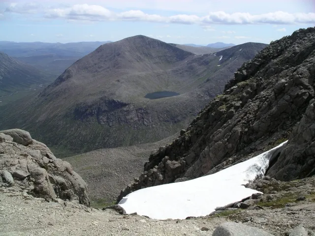
Cairn Toul Graham Ellis · CC BY-SA 2.0


Evolución de la población de Aberdeenshire
| 2008 | 246.830 | |
|---|---|---|
| 2009 | 249.020 | |
| 2010 | 251.430 | |
| 2011 | 253.650 | |
| 2012 | 255.560 | |
| 2013 | 257.770 | |
| 2014 | 260.530 | |
| 2015 | 261.960 | |
| 2016 | 262.190 | |
| 2017 | 261.800 | |
| 2018 | 261.470 | |
| 2019 | 261.210 |
Censos y estimaciones oficiales; fuente: Wikidata.
Clima de Aberdeenshire
Mejores meses para hacer turismoMejores meses para hacer turismo: junio–agosto.
Este mes · noviembre
Un mes frío
Día 7° · Noche 0° · Lluvia 84 mm
- Mes más cálido
- Julio (día 17°)
- Mes más frío
- Febrero (noche -2°)
- Mes más lluvioso
- Octubre (90 mm)
- Mes más seco
- Abril (56 mm)
Barras: temperatura mínima y máxima media mensual. Debajo: precipitación. Promedios mensuales de 1970–2000 con una resolución de unos 18 km, corregidos según la altitud. Los meses destacados son templados y relativamente secos. Fuente: WorldClim 2.1 (CC BY 4.0).
Ver los valores en una tabla
| Mes | ene. | feb. | mar. | abr. | may. | jun. | jul. | ago. | sep. | oct. | nov. | dic. |
|---|---|---|---|---|---|---|---|---|---|---|---|---|
| Máxima media (°C) | 4° | 5° | 6° | 9° | 12° | 15° | 17° | 17° | 14° | 10° | 7° | 5° |
| Mínima media (°C) | -2° | -2° | 0° | 1° | 4° | 7° | 9° | 8° | 6° | 4° | 0° | -1° |
| Precipitación (mm) | 87 | 60 | 64 | 56 | 59 | 57 | 59 | 70 | 74 | 90 | 84 | 76 |
Cómo llegar a Aberdeenshire
El aeropuerto más cercano es Aberdeen International Airport (ABZ), a 29 km en línea recta hacia el este. La gran ciudad más cercana es Aberdeen, a 35 km hacia el este.
Aeropuertos
- Aberdeen International Airport (ABZ) Aberdeen 29 kmeste
- Dundee Airport (DND) Dundee 82 kmsur
- Inverness Airport (INV) Inverness, Highland 93 kmnoroeste
Grandes ciudades cercanas
- Aberdeen Población: 198,6 mil 35 kmeste
- Dundee Población: 148,2 mil 80 kmsur
- Edimburgo Población: 515 mil 139 kmsur
- Glasgow Población: 626,4 mil 175 kmsuroeste
- Newcastle-upon-Tyne Población: 300,1 mil 253 kmsur
Distancias en línea recta; por carretera son mayores. Datos de aeropuertos: OurAirports.
Excursiones desde Aberdeenshire
A menos de 100 km: 85 sitios históricos y culturales, 2.061 espacios naturales, 348 lagos, ríos y costas.
0–25 km256 lugares
- Balbithan Island Isla 22 kmNE
- Loch of Skene Lago 19 kmE
- Loch Kinord Lago 19 kmSO
- Loch Davan Lago 18 kmSO
25–60 km1.044 lugares
- Findlay's Seat Montaña 55 kmNO
- Sunnyside Beach Playa 59 kmN
- Newburgh Seals Beach Playa 44 kmE
- Aberdeen Beach Playa 36 kmE
60–100 km1.194 lugares
- Lossiemouth East Beach Playa 72 kmNO
- Mugdrum Island Isla 98 kmS
- Keith Inch Isla 66 kmNE
- Moncreiffe Island Isla 99 kmSO
Distancias en línea recta.
Lugares en Aberdeenshire
1.391 lugaresCiudades y pueblos2
- Hill of Goval · Pueblo
- Hill of Keir · Pueblo
Montañas y naturaleza58
- Hill of Carlincraig · Montaña
- Hill of Chattie · Montaña
- Hill of Christ's Kirk · Montaña
- Hill of Cleftbog · Montaña
- Hill of Coldwells · Montaña
- Hill of Corrachree · Montaña
- Hill of Corskie · Montaña
- Hill of Crannabog · Montaña
- Hill of Cruchie · Montaña
- Hill of Culbirnie · Montaña
- Hill of Cummerton · Montaña
- Hill of Cumrie · Montaña
- Hill of Dens · Montaña
- Hill of Draidland · Montaña
- Hill of Drumwhindle · Montaña
- Hill of Duchery · Montaña
- Hill of Dudwick · Montaña
- Hill of Dunmeath · Montaña
- Hill of Dunnideer · Montaña
- Hill of Easter Echt · Montaña
- Hill of Edendocher · Montaña
- Hill of Fare · Montaña
- Hill of Fetterangus · Montaña
- Hill of Fishrie · Montaña
- Hill of Flinder · Montaña
- Hill of Foudland · Montaña
- Hill of Foulzie · Montaña
- Hill of Frendraught · Montaña
- Hill of Garvock · Montaña
- Hill of Glanderston · Montaña
- Hill of Goauch · Montaña
- Hill of Gothie · Montaña
- Hill of Greenfold · Montaña
- Hill of Greenstile · Montaña
- Hill of Janetstown · Montaña
- Hill of Johnston · Montaña
- Hill of Keir · Montaña
- Hill of Kinellar · Montaña
- Hill of Lendrum · Montaña
- Hill of Lethenty · Montaña
- Hill of Lightnot · Montaña
- Hill of Little Folla · Montaña
- Hill of Loanhead · Montaña
- Hill of Longhaven · Montaña
- Hill of Maryfield · Montaña
- Hill of Megray · Montaña
- Hill of Milleath · Montaña
- Hill of Montsnaught · Montaña
- Hill of Morphie · Montaña
- Hill of Mungo · Montaña
- Hill of Newleslie · Montaña
- Hill of Newton · Montaña
- Hill of Newtongarry · Montaña
- Hill of Noth · Montaña
- Hill of Oldmerdrum · Montaña
- Hill of Ord · Montaña
- Hill of Pitcow · Montaña
- Hill of Rothmaise · Montaña
Atracciones y naturaleza cercanas
Todo lo cercano-
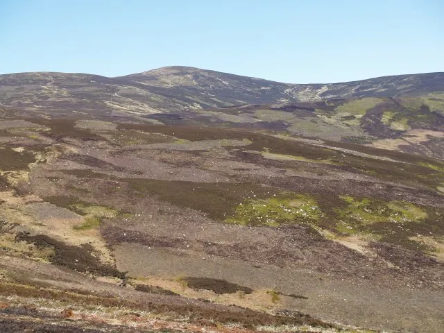 Mount Battock Montaña, Angus25 km S
-
Balbithan Island Isla, Escocia22 km NE
-
Hill of Cat Montaña, Angus24 km SO
Fuentes y licencias
Datos actualizados por última vez: · 2 fuentes independientes