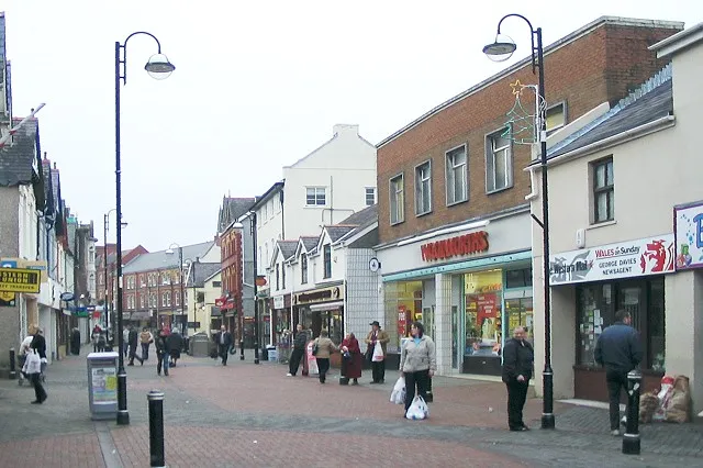
Carmarthenshire
Situado en Gales, Reino Unido Coordenadas: 51°50′00″ N 4°10′00″ O
El nombre de este lugar aún no se ha verificado en este idioma; se muestra en su forma original.
- Población
- 190.800
- 190,8 mil
- Altitud
- 89 m
- sobre el nivel del mar
- Hora local
- UTC+00:00
- Europe/London · UTC+00:00
- Lugares incluidos
- 82
- clasificados en Carmarthenshire
- Aeropuertos
- CWL Cardiff International Airport75 km
- BRS Bristol Airport112 km
Acerca de Carmarthenshire
Carmarthenshire es un distrito. Ubicación: Gales, Reino Unido. Población: 190.800. Los mejores meses para visitarlo: junio–septiembre. El aeropuerto más cercano es Cardiff International Airport (75 km). Cerca se encuentran Penlle'r Castell y Loughor Castle.
Clima de Carmarthenshire
Mejores meses para hacer turismoMejores meses para hacer turismo: junio–septiembre.
Este mes · noviembre
Un mes lluvioso
Día 11° · Noche 6° · Lluvia 132 mm
- Mes más cálido
- Julio (día 19°)
- Mes más frío
- Febrero (noche 3°)
- Mes más lluvioso
- Noviembre (132 mm)
- Mes más seco
- Mayo (64 mm)
Barras: temperatura mínima y máxima media mensual. Debajo: precipitación. Promedios mensuales de 1970–2000 con una resolución de unos 18 km, corregidos según la altitud. Los meses destacados son templados y relativamente secos. Fuente: WorldClim 2.1 (CC BY 4.0).
Ver los valores en una tabla
| Mes | ene. | feb. | mar. | abr. | may. | jun. | jul. | ago. | sep. | oct. | nov. | dic. |
|---|---|---|---|---|---|---|---|---|---|---|---|---|
| Máxima media (°C) | 8° | 8° | 9° | 12° | 15° | 17° | 19° | 19° | 17° | 14° | 11° | 9° |
| Mínima media (°C) | 3° | 3° | 4° | 5° | 8° | 10° | 13° | 13° | 11° | 8° | 6° | 4° |
| Precipitación (mm) | 120 | 85 | 90 | 68 | 64 | 74 | 73 | 92 | 98 | 121 | 132 | 125 |
Otros destinos para esta época: junio julio agosto septiembre
Cómo llegar a Carmarthenshire
El aeropuerto más cercano es Cardiff International Airport (CWL), a 75 km en línea recta hacia el sureste. La gran ciudad más cercana es Swansea, a 28 km hacia el sureste.
Aeropuertos
- Cardiff International Airport (CWL) Cardiff 75 kmsureste
- Bristol Airport (BRS) Bristol 112 kmsureste
- Exeter International Airport (EXT) Exeter, Devon 133 kmsureste
Grandes ciudades cercanas
- Swansea Población: 300,4 mil 28 kmsureste
- Cardiff Población: 372,1 mil 79 kmsureste
- Newport Población: 161,5 mil 85 kmeste
- Brístol Población: 479 mil 117 kmeste
- Exeter Población: 130,7 mil 131 kmsur
Distancias en línea recta; por carretera son mayores. Datos de aeropuertos: OurAirports.
Excursiones desde Carmarthenshire
A menos de 100 km: 711 sitios históricos y culturales, 1.873 espacios naturales, 178 lagos, ríos y costas.
0–25 km244 lugares
- Ynys Isaf Isla 4 kmSO
- Trichrug Montaña 20 kmE
- Mynydd Pen-bre Montaña 13 kmS
- Mynydd Llanybyther Montaña 23 kmN
25–60 km862 lugares
- Poppit Sands Playa 47 kmNO
- Manorbier Beach Playa 49 kmSO
- Broad Haven South Beach Playa 58 kmSO
- Mwnt beach Playa 47 kmNO
60–100 km1.656 lugares
- St Justinian Espacio natural 79 kmO
- Porth Clais Espacio natural 77 kmO
- Port Selau Espacio natural 79 kmO
- Saunton Sands Playa 82 kmS
Distancias en línea recta.
Lugares en Carmarthenshire
82 lugaresCiudades y pueblos52
- Abergwili · Municipio
- Abernant · Municipio
- Ammanford · Municipio
- Betws · Municipio
- Bronwydd · Municipio
- Carmarthen · Municipio
- Cenarth · Municipio
- Cilycwm · Municipio
- Cilymaenllwyd · Municipio
- Cwmamman · Municipio
- Cyngor Bro Dyffryn Cennen · Municipio
- Cynwyl Elfed · Municipio
- Cynwyl Gaeo · Municipio
- Eglwyscummin · Municipio
- Gorslas · Municipio
- Henllanfallteg · Municipio
- Kidwelly · Municipio
- Laugharne Township · Municipio
- Llanarthney · Municipio
- Llanboidy · Municipio
- Llanddarog · Municipio
- Llanddeusant · Municipio
- Llanddowror · Municipio
- Llandeilo · Municipio
- Llandovery · Municipio
- Llandybie · Municipio
- Llandyfaelog · Municipio
- Llanedi · Municipio
- Llanegwad · Municipio
- Llanelli · Municipio
- Llanelli Rural · Municipio
- Llanfair-ar-y-Bryn · Municipio
- Llanfihangel Aberbythych · Municipio
- Llanfihangel-ar-Arth · Municipio
- Llanfihangel Rhos-y-Corn · Municipio
- Llanfynydd · Municipio
- Llangadog · Municipio
- Llangain · Municipio
- Llangathen · Municipio
- Llangeler · Municipio
- Llangennech · Municipio
- Llangunnor · Municipio
- Llangyndeyrn · Municipio
- Llangynin · Municipio
- Llangynog · Municipio
- Llanllawddog · Municipio
- Llanllwni · Municipio
- Llannon · Municipio
- Llanpumsaint · Municipio
- Llansadwrn · Municipio
- Llansawel · Municipio
- Llansteffan · Municipio
Lagos, ríos y costas8
- Afon Brân · Río
- Afon Cothi · Río
- Afon Cynin · Río
- Afon Cywyn · Río
- Afon Dewi Fawr · Río
- Afon Gronw · Río
- Gwendraeth Fâch · Río
- Gwendraeth Fawr · Río
Atracciones y naturaleza cercanas
Todo lo cercano-
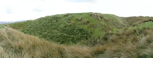 Penlle'r Castell Sitio histórico, Mawr17 km SE
-
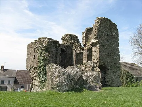 Loughor Castle Sitio histórico, Llwchwr20 km S
-
Hen Gastell Sitio histórico, Llanrhidian Higher22 km S
Fuentes y licencias
Datos actualizados por última vez: