West Berkshire
Situado en Inglaterra, Reino Unido Coordenadas: 51°25′00″ N 1°15′00″ O
El nombre de este lugar aún no se ha verificado en este idioma; se muestra en su forma original.
- Población
- 165.112
- 165,1 mil
- Altitud
- 121 m
- sobre el nivel del mar
- Hora local
- UTC+00:00
- Europe/London · UTC+00:00
- Lugares incluidos
- 64
- clasificados en West Berkshire
- Aeropuertos
- SOU Southampton Airport52 km
- LHR London Heathrow Airport55 km
Acerca de West Berkshire
West Berkshire es un distrito. Ubicación: Inglaterra, Reino Unido. Población: 165.112. Los mejores meses para visitarlo: junio–agosto. El aeropuerto más cercano es Southampton Airport (52 km). Cerca se encuentran Madejski Stadium y Wallingford Castle.
Clima de West Berkshire
Mejores meses para hacer turismoMejores meses para hacer turismo: junio–agosto.
Este mes · noviembre
Un mes frío
Día 10° · Noche 4° · Lluvia 74 mm
- Mes más cálido
- Julio (día 21°)
- Mes más frío
- Febrero (noche 1°)
- Mes más lluvioso
- Diciembre (76 mm)
- Mes más seco
- Julio (43 mm)
Barras: temperatura mínima y máxima media mensual. Debajo: precipitación. Promedios mensuales de 1970–2000 con una resolución de unos 18 km, corregidos según la altitud. Los meses destacados son templados y relativamente secos. Fuente: WorldClim 2.1 (CC BY 4.0).
Ver los valores en una tabla
| Mes | ene. | feb. | mar. | abr. | may. | jun. | jul. | ago. | sep. | oct. | nov. | dic. |
|---|---|---|---|---|---|---|---|---|---|---|---|---|
| Máxima media (°C) | 7° | 7° | 10° | 12° | 16° | 19° | 21° | 21° | 18° | 14° | 10° | 8° |
| Mínima media (°C) | 2° | 1° | 3° | 4° | 7° | 10° | 12° | 12° | 10° | 7° | 4° | 3° |
| Precipitación (mm) | 74 | 50 | 58 | 46 | 51 | 57 | 43 | 55 | 64 | 70 | 74 | 76 |
Cómo llegar a West Berkshire
El aeropuerto más cercano es Southampton Airport (SOU), a 52 km en línea recta hacia el sur. Para vuelos internacionales: London Heathrow Airport (LHR) (55 km). La gran ciudad más cercana es Reading, a 20 km hacia el este.
Aeropuertos
- Southampton Airport (SOU) Southampton 52 kmsur
- London Heathrow Airport (LHR) London 55 kmeste
- London Luton Airport (LTN) Luton, Luton 80 kmnoreste
Grandes ciudades cercanas
- Reading Población: 318 mil 20 kmeste
- Basingstoke Población: 107,6 mil 21 kmsureste
- Oxford Población: 162,1 mil 37 kmnorte
- Swindon Población: 201,7 mil 40 kmnoroeste
- High Wycombe Población: 133,2 mil 42 kmnoreste
Distancias en línea recta; por carretera son mayores. Datos de aeropuertos: OurAirports.
Excursiones desde West Berkshire
A menos de 100 km: 834 sitios históricos y culturales, 875 espacios naturales, 300 lagos, ríos y costas.
0–25 km71 lugares
- View Island Isla 21 kmE
- St Mary's Island Isla 18 kmE
- Buck's Eyot Isla 18 kmE
- Rounds Islands Isla 22 kmE
25–60 km514 lugares
- The Lynch Isla 26 kmE
- Holm Island Isla 50 kmE
- Sunbury Court Isla 60 kmE
- Rivermead Isla 59 kmE
60–100 km1.424 lugares
- Portsea Island Espacio natural 70 kmS
- Isla de Wight Isla 82 kmS
- White Hart Lane Monumento 85 kmE
- Isla de Brownsea Isla 95 kmSO
Distancias en línea recta.
Lugares en West Berkshire
64 lugaresCiudades y pueblos60
- Aldermaston · Municipio
- Aldworth · Municipio
- Ashampstead · Municipio
- Basildon · Municipio
- Beech Hill · Municipio
- Beedon · Municipio
- Beenham · Municipio
- Boxford · Municipio
- Bradfield · Municipio
- Brightwalton · Municipio
- Brimpton · Municipio
- Bucklebury · Municipio
- Burghfield · Municipio
- Catmore · Municipio
- Chaddleworth · Municipio
- Chieveley · Municipio
- Cold Ash · Municipio
- Combe · Municipio
- Compton · Municipio
- East Garston · Municipio
- East Ilsley · Municipio
- Enborne · Municipio
- Englefield · Municipio
- Farnborough · Municipio
- Fawley · Municipio
- Frilsham · Municipio
- Great Shefford · Municipio
- Greenham · Municipio
- Hampstead Marshall · Municipio
- Hampstead Norreys · Municipio
- Hermitage · Municipio
- Holybrook · Municipio
- Hungerford · Municipio
- Inkpen · Municipio
- Kintbury · Municipio
- Lambourn · Municipio
- Leckhampstead · Municipio
- Midgham · Municipio
- Mortimer Common · Pueblo
- Newbury · Municipio
- Padworth · Municipio
- Pangbourne · Municipio
- Peasemore · Municipio
- Purley on Thames · Municipio
- Shaw cum Donnington · Municipio
- Speen · Municipio
- Stanford Dingley · Municipio
- Stratfield Mortimer · Municipio
- Streatley · Municipio
- Sulham · Municipio
- Sulhamstead · Municipio
- Thatcham · Municipio
- Theale · Municipio
- Tidmarsh · Municipio
- Tilehurst · Municipio
- Ufton Nervet · Municipio
- Wasing · Municipio
- Welford · Municipio
- West Ilsley · Municipio
- West Woodhay · Municipio
Atracciones y naturaleza cercanas
Todo lo cercano-
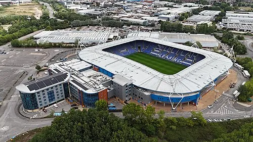 Madejski Stadium Monumento, Reading19 km E
-
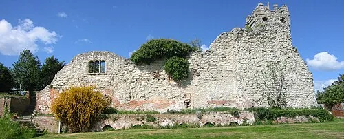 Wallingford Castle Sitio histórico, Wallingford23 km NE
-
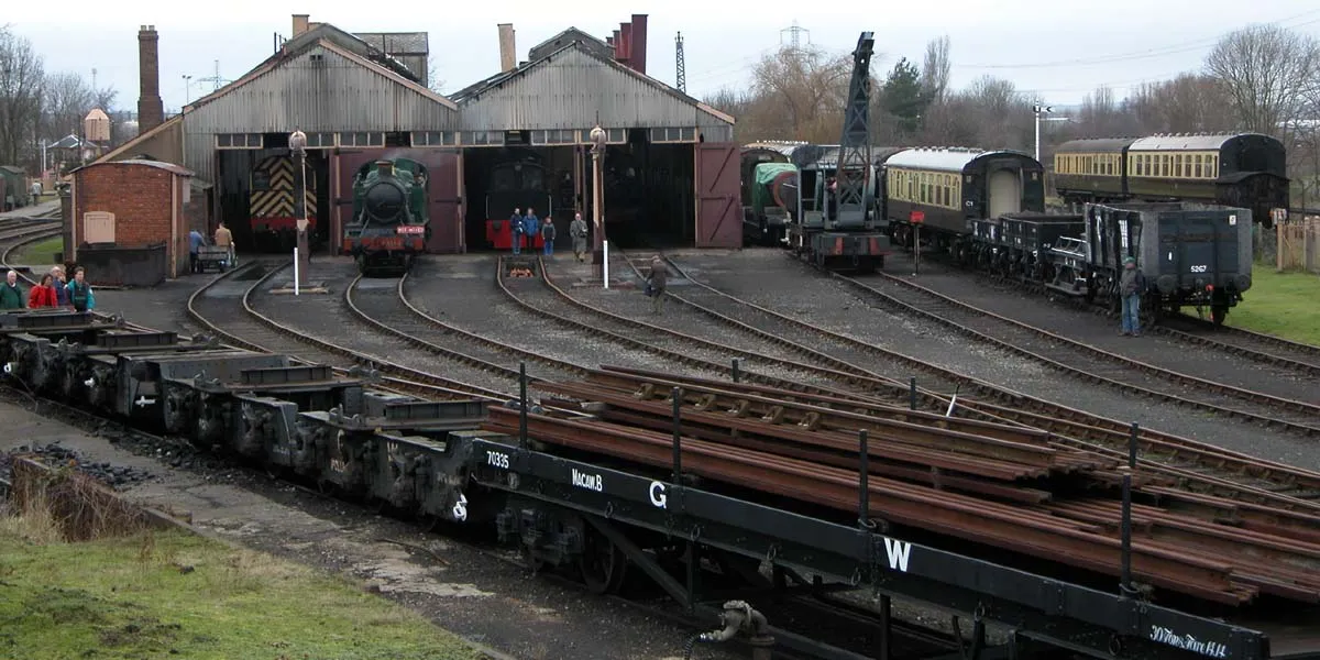 Centro del Ferrocarril de Didcot Museo, Didcot22 km N
-
Beaumys Castle Sitio histórico, Swallowfield19 km E
Fuentes y licencias
Datos actualizados por última vez: