Digaléto
Liegt in Kefalonia, Kefallonia Regional Unit Koordinaten: 38°10′26″ N 20°41′13″ O
Der Name dieses Ortes wurde in dieser Sprache noch nicht verifiziert und wird in der Originalform angezeigt.
- Einwohner
- 348
- 348
- Höhe
- 517 m
- über dem Meeresspiegel
- Ortszeit
- UTC+02:00
- Europe/Athens · UTC+02:00
- Flughäfen
- EFL Kefalonia International Airport "Anna Pollatou"17 km
- ZTH Zakynthos International Airport "Dionysios Solomos"50 km
Über Digaléto
Digaléto ist ein Dorf. Lage: Kefalonia, Kefallonia Regional Unit. Einwohner: 348. Höhe: 517 m. Die beste Reisezeit: Mai–September. Nächster Flughafen: Kefalonia International Airport "Anna Pollatou" (17 km). In der Nähe: Moni Theotokou Atrou und Agios Andreas Milapidias monastery.
Klima in Digaléto
Beste Monate für BesichtigungenBeste Monate für Besichtigungen: Mai–September.
Dieser Monat · November
Ein regenreicher Monat
Tag 15° · Nacht 9° · Regen 160 mm
- Wärmster Monat
- August (Tag 28°)
- Kältester Monat
- Februar (Nacht 4°)
- Nassester Monat
- November (160 mm)
- Trockenster Monat
- Juli (10 mm)
Balken: mittlere Monatstiefst- und -höchsttemperatur. Darunter: Niederschlag. Monatsmittel 1970–2000 bei etwa 18 km Auflösung, höhenkorrigiert. Hervorgehobene Monate sind mild und relativ trocken. Quelle: WorldClim 2.1 (CC BY 4.0).
Werte als Tabelle anzeigen
| Monat | Jan | Feb | Mär | Apr | Mai | Jun | Jul | Aug | Sep | Okt | Nov | Dez |
|---|---|---|---|---|---|---|---|---|---|---|---|---|
| Mittleres Maximum (°C) | 11° | 11° | 13° | 16° | 20° | 25° | 28° | 28° | 24° | 20° | 15° | 12° |
| Mittleres Minimum (°C) | 5° | 4° | 6° | 8° | 11° | 15° | 17° | 18° | 15° | 12° | 9° | 6° |
| Niederschlag (mm) | 122 | 116 | 87 | 63 | 29 | 14 | 10 | 14 | 42 | 111 | 160 | 154 |
Weitere Reiseziele in dieser Zeit: Mai Juni Juli August September
Anreise nach Digaléto
Nächster Flughafen ist Kefalonia International Airport "Anna Pollatou" (EFL), Luftlinie 17 km Richtung Westen. Nächste Großstadt ist Piräus, 261 km Richtung Osten.
Flughäfen
- Kefalonia International Airport "Anna Pollatou" (EFL) Kefallinia Island 17 kmWesten
- Zakynthos International Airport "Dionysios Solomos" (ZTH) Zakynthos 50 kmSüden
- Patras Araxos Agamemnon Airport (GPA) Patras 65 kmOsten
Großstädte in der Nähe
- Piräus Einwohner: 163.688 261 kmOsten
- Athen Einwohner: 664.046 268 kmOsten
Luftlinie; die Straßenentfernung ist länger. Flughafendaten: OurAirports.
Tagesausflüge ab Digaléto
Im Umkreis von 100 km: 12 historische und kulturelle Stätten, 26 Seen, Flüsse und Küsten.
0–25 km8 Orte
- Kefalonia Insel 12 kmNW
- Agios Andreas Milapidias monastery Sehenswürdigkeit 12 kmW
- Moni Theotokou Atrou Sehenswürdigkeit 6 kmO
- Saraki Insel 9 kmO
25–60 km16 Orte
- Panagia Kipouraion monastery Sehenswürdigkeit 30 kmW
- Kablafka Strand 51 kmNO
- Nisídes Falarídes Insel 41 kmNO
- Atheronisi Insel 31 kmNW
60–100 km14 Orte
- Nisída Sáranta Insel 69 kmO
- Lakopetra Beach Strand 70 kmO
- Vasiliko islet Insel 70 kmO
- Tigani Insel 79 kmSO
Luftlinie.
Sehenswertes & Natur in der Nähe
Alles in der Nähe-
Moni Theotokou Atrou Sehenswürdigkeit, Kefalonia5,9 km O
-
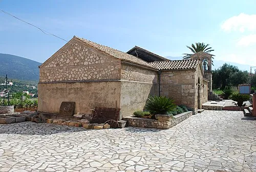 Agios Andreas Milapidias monastery Sehenswürdigkeit, Kefalonia12 km W
-
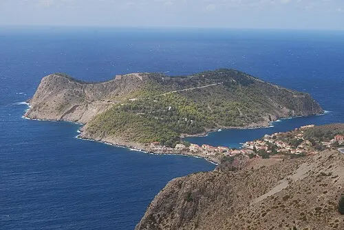 Kefalonia Insel, Kefallonia Regional Unit12 km NW
-
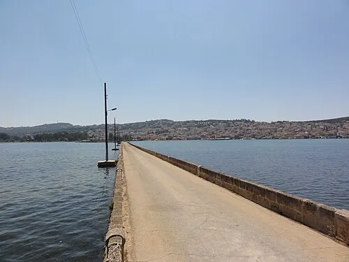 De-Bosset-Brücke Wahrzeichen, Kefalonia17 km W
-
Dionisi Kefallinias Insel, Ionische Inseln16 km SW
-
Skartsoumbonisi Ithakis Insel, Ithaca22 km N
Weitere Städte und Orte in Kefalonia
-
 Vlachata Dorf, Kefalonia7,8 km SW
-
 Simotata, Kefalonia Dorf, Kefalonia7,3 km SW
-
 Sami Dorf, Kefalonia9,2 km N
-
Michata Dorf, Kefalonia8,1 km W
-
Epanochori Dorf, Kefalonia7,9 km W
-
Peratata Dorf, Kefalonia12 km W
Quellen & Lizenzen
Daten zuletzt aktualisiert: