Pinacoteca Patiniana
Liegt in Castel di Sangro, Provinz L'Aquila Koordinaten: 41°47′09″ N 14°06′28″ O

- Ortszeit
- UTC+01:00
- Europe/Rome · UTC+01:00
- Höhe
- 810 m
- über dem Meeresspiegel
- Flughäfen
- PSR Abruzzo Airport72 km
- NAP Naples International Airport101 km
Über Pinacoteca Patiniana
Pinacoteca Patiniana ist ein Museum. Lage: Castel di Sangro, Provinz L'Aquila. Die beste Reisezeit: Juni–September. Nächster Flughafen: Abruzzo Airport (72 km). In der Nähe: Stadio Teofilo Patini und monte Arazzecca.
Auf einen Blick
- Schutzstatus
- italienisches Nationalmonument
- Fläche
- 0 ha
- Besucher pro Jahr
- 2.340 (2022)
- Offizielle Website
- comune.casteldisangro.aq.it
Quelle: Wikidata
Fotos: Pinacoteca Patiniana
-

Sailko · CC BY 3.0 -

Cristina Morettini 95 · CC BY-SA 4.0 -
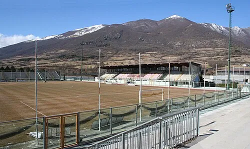
Stadio Teofilo Patini Dario Riccio · CC BY 2.5


Klima in Pinacoteca Patiniana
Beste Monate für BesichtigungenBeste Monate für Besichtigungen: Juni–September.
Dieser Monat · November
Ein kalter Monat
Tag 11° · Nacht 5° · Regen 90 mm
- Wärmster Monat
- August (Tag 25°)
- Kältester Monat
- Februar (Nacht 1°)
- Nassester Monat
- November (90 mm)
- Trockenster Monat
- Juli (47 mm)
Balken: mittlere Monatstiefst- und -höchsttemperatur. Darunter: Niederschlag. Monatsmittel 1970–2000 bei etwa 18 km Auflösung, höhenkorrigiert. Hervorgehobene Monate sind mild und relativ trocken. Quelle: WorldClim 2.1 (CC BY 4.0).
Werte als Tabelle anzeigen
| Monat | Jan | Feb | Mär | Apr | Mai | Jun | Jul | Aug | Sep | Okt | Nov | Dez |
|---|---|---|---|---|---|---|---|---|---|---|---|---|
| Mittleres Maximum (°C) | 6° | 6° | 9° | 12° | 18° | 22° | 25° | 25° | 21° | 16° | 11° | 8° |
| Mittleres Minimum (°C) | 1° | 1° | 3° | 5° | 10° | 13° | 16° | 16° | 13° | 9° | 5° | 2° |
| Niederschlag (mm) | 56 | 58 | 56 | 66 | 61 | 52 | 47 | 51 | 69 | 80 | 90 | 67 |
Weitere Reiseziele in dieser Zeit: Juni Juli August September
Anreise nach Pinacoteca Patiniana
Nächster Flughafen ist Abruzzo Airport (PSR), Luftlinie 72 km Richtung Norden. Nächste Großstadt ist Split, 271 km Richtung Nordosten.
Flughäfen
- Abruzzo Airport (PSR) Pescara 72 kmNorden
- Naples International Airport (NAP) Napoli 101 kmSüden
- Foggia Gino Lisa Airport (FOG) Foggia (FG) 125 kmOsten
Großstädte in der Nähe
- Split Einwohner: 149.830 271 kmNordosten
- Mostar Einwohner: 104.518 350 kmNordosten
- Rijeka Einwohner: 107.964 394 kmNorden
Luftlinie; die Straßenentfernung ist länger. Flughafendaten: OurAirports.
Tagesausflüge ab Pinacoteca Patiniana
Im Umkreis von 100 km: 146 historische und kulturelle Stätten, 227 Naturorte, 44 Seen, Flüsse und Küsten.
0–25 km41 Orte
- Serra Tre Monti Berg 14 kmN
- Monte Santa Luca Berg 17 kmNO
- Monti Pizi Berg 19 kmN
- Colle Nero Berg 23 kmW
25–60 km139 Orte
- Vallone Grande Naturgebiet 56 kmO
- Valle Covatta Naturgebiet 46 kmO
- Cimarone del Villaneto Berg 40 kmSW
- Serra di Vallelonga Berg 44 kmS
60–100 km237 Orte
- Ripari di Giobbe Strand 69 kmN
- Sombrero Strand 91 kmSW
- Spiaggia delle Bambole Strand 80 kmSW
- Spiaggia Dell'Agave Strand 79 kmSW
Luftlinie.
Sehenswertes & Natur in der Nähe
Alles in der Nähe-
Stadio Teofilo Patini Wahrzeichen, Castel di Sangro0,8 km SW
-
monte Arazzecca Berg, Roccaraso4 km NW
-
Valle Zappanotto Naturgebiet, Abruzzen3,8 km NO
-
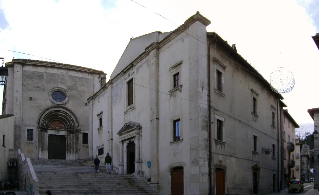 Basilica di Santa Maria del Colle Sehenswürdigkeit, Pescocostanzo12 km N
-
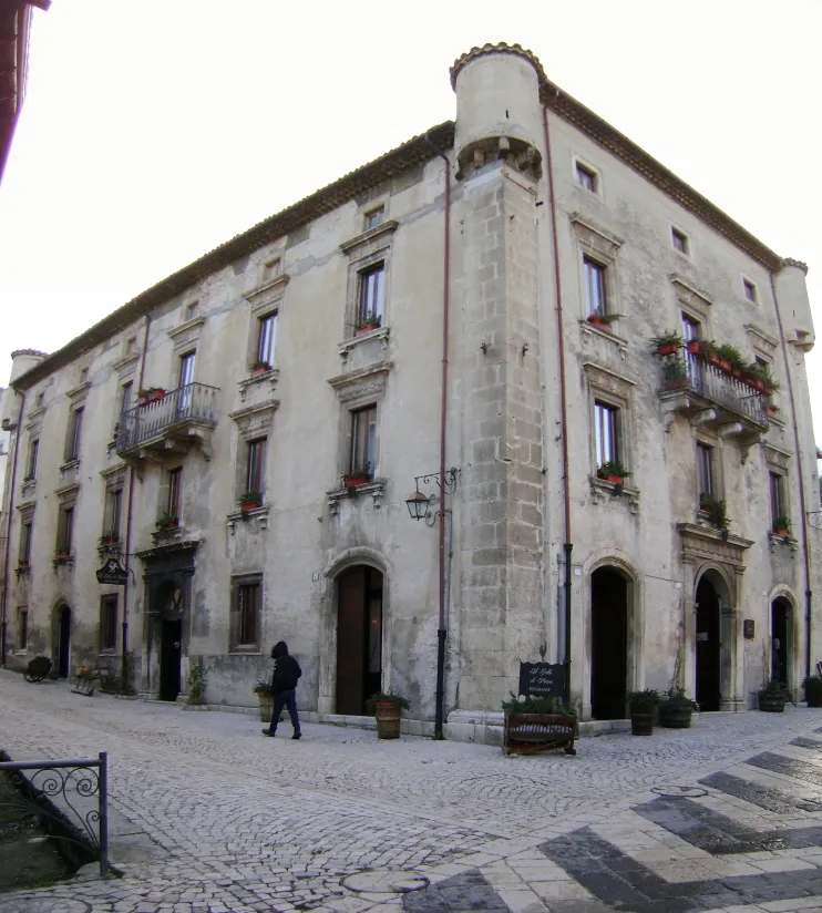 Palazzo Grilli Historische Stätte, Pescocostanzo12 km N
-
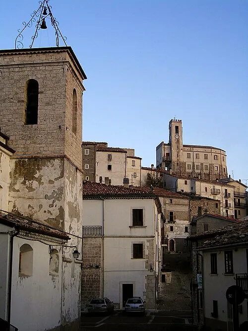 Castello di Gamberale Historische Stätte, Gamberale16 km NO
-
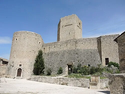 Castello Cantelmo Historische Stätte, Pettorano sul Gizio24 km NW
-
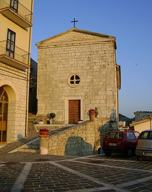 Chiesa di San Martino e Santa Giusta Sehenswürdigkeit, Montenerodomo24 km NO
Nächstgelegene Städte und Dörfer
-
 Roccacinquemiglia Dorf, Castel di Sangro3,1 km N
-
Pontone Dorf, Castel di Sangro3,9 km N
-
Villa Scontrone Dorf, Scontrone5,2 km SW
-
Soggiorno Montano Enel Dorf, Roccaraso4,4 km N
Quellen & Lizenzen
Daten zuletzt aktualisiert: · 2 unabhängige Quellen