
- Einwohner
- 976
- 976
- Höhe
- 85 m
- über dem Meeresspiegel
- Ortszeit
- UTC+01:00
- Europe/Warsaw · UTC+01:00
- Flughäfen
- WMI Warsaw Modlin Airport55 km
- WAW Warsaw Chopin Airport62 km
Über Bednary-Wieś
Bednary-Wieś ist ein Dorf. Lage: Gmina Nieborów, Łowicz County. Einwohner: 976. Höhe: 85 m. Die beste Reisezeit: Mai–September. Nächster Flughafen: Warsaw Modlin Airport (55 km). In der Nähe: Ghetto Bolimów und Ghetto Łowicz.
Fotos: Bednary-Wieś
-

MOs810 · CC BY-SA 4.0 -

MOs810 · CC BY-SA 4.0 -

German administration of Łowicz County · Public domain


Klima in Bednary-Wieś
Beste Monate für BesichtigungenBeste Monate für Besichtigungen: Mai–September.
Dieser Monat · November
Ein kalter Monat
Tag 6° · Nacht 0° · Regen 37 mm
- Wärmster Monat
- Juli (Tag 24°)
- Kältester Monat
- Januar (Nacht -5°)
- Nassester Monat
- Juli (73 mm)
- Trockenster Monat
- Februar (21 mm)
Balken: mittlere Monatstiefst- und -höchsttemperatur. Darunter: Niederschlag. Monatsmittel 1970–2000 bei etwa 18 km Auflösung, höhenkorrigiert. Hervorgehobene Monate sind mild und relativ trocken. Quelle: WorldClim 2.1 (CC BY 4.0).
Werte als Tabelle anzeigen
| Monat | Jan | Feb | Mär | Apr | Mai | Jun | Jul | Aug | Sep | Okt | Nov | Dez |
|---|---|---|---|---|---|---|---|---|---|---|---|---|
| Mittleres Maximum (°C) | 0° | 2° | 7° | 14° | 19° | 22° | 24° | 24° | 18° | 13° | 6° | 2° |
| Mittleres Minimum (°C) | -5° | -5° | -1° | 3° | 8° | 11° | 13° | 12° | 9° | 5° | 0° | -3° |
| Niederschlag (mm) | 25 | 21 | 29 | 32 | 47 | 67 | 73 | 61 | 48 | 35 | 37 | 36 |
Weitere Reiseziele in dieser Zeit: Mai Juni Juli August September
Anreise nach Bednary-Wieś
Nächster Flughafen ist Warsaw Modlin Airport (WMI), Luftlinie 55 km Richtung Nordosten. Nächste Großstadt ist Košice, 387 km Richtung Süden.
Flughäfen
- Warsaw Modlin Airport (WMI) Nowy Dwór Mazowiecki 55 kmNordosten
- Warsaw Chopin Airport (WAW) Warsaw 62 kmOsten
- Łódź Władysław Reymont Airport (LCJ) Łódź 63 kmSüdwesten
Großstädte in der Nähe
- Košice Einwohner: 225.044 387 kmSüden
Luftlinie; die Straßenentfernung ist länger. Flughafendaten: OurAirports.
Tagesausflüge ab Bednary-Wieś
Im Umkreis von 100 km: 93 historische und kulturelle Stätten, 2 Naturorte.
0–25 km6 Orte
- Ghetto Sochaczew Historische Stätte 19 kmNO
- Ghetto Bolimów Historische Stätte 7 kmSO
- Ghetto Kiernozia Historische Stätte 22 kmNW
- Ghetto Łowicz Historische Stätte 9 kmW
25–60 km25 Orte
- Ghetto Rawa Mazowiecka Historische Stätte 40 kmS
- Ghetto Tarczyn Historische Stätte 55 kmO
- Ghetto Wyszogród Historische Stätte 32 kmN
- Ghetto Gąbin Historische Stätte 40 kmNW
60–100 km64 Orte
- Diabla Góra Berg 99 kmS
- Borowa Hill Berg 97 kmSW
- Ghetto Magnuszew Historische Stätte 99 kmO
- Ghetto Sobienie-Jeziory Historische Stätte 88 kmO
Luftlinie.
Sehenswertes & Natur in der Nähe
Alles in der Nähe-
Ghetto Bolimów Historische Stätte, Gmina Bolimów7,3 km SO
-
Ghetto Łowicz Historische Stätte, gmina Miasto Łowicz9,5 km W
-
Ghetto Łyszkowice Historische Stätte, Łyszkowice17 km SW
-
Ghetto Kiernozia Historische Stätte, Gmina Kiernozia22 km NW
-
Ghetto Sochaczew Historische Stätte, Sochaczew19 km NO
-
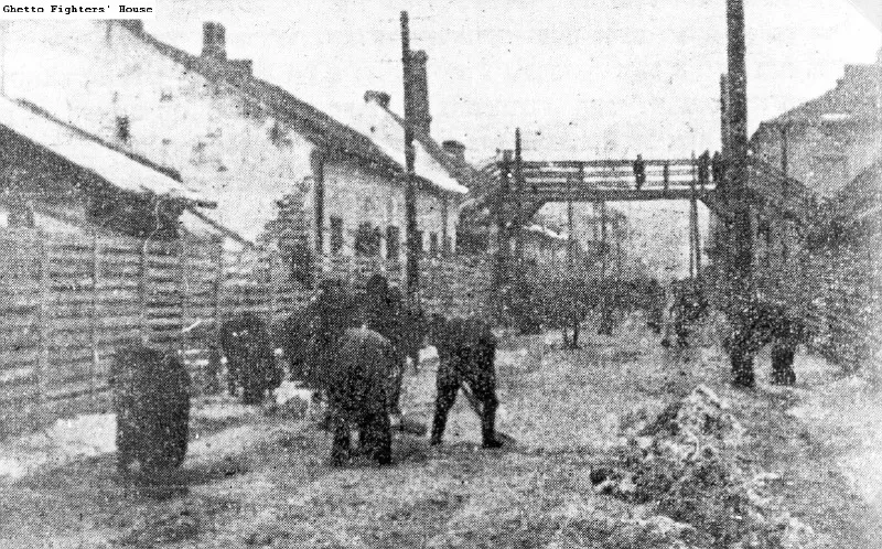 Ghetto Skierniewice Historische Stätte, Skierniewice17 km S
Quellen & Lizenzen
Daten zuletzt aktualisiert: · 2 unabhängige Quellen