- Höhe
- 85 m
- über dem Meeresspiegel
- Ortszeit
- UTC+00:00
- Europe/London · UTC+00:00
- Orte darin
- 4
- unter Kimblesworth and Plawsworth verzeichnet
- Flughäfen
- NCL Newcastle International Airport24 km
- MME Teesside International Airport37 km
Über Kimblesworth and Plawsworth
Kimblesworth and Plawsworth ist eine Gemeinde. Lage: Durham, England. Höhe: 85 m. Die beste Reisezeit: Juni–September. Nächster Flughafen: Newcastle International Airport (24 km). In der Nähe: Lumley Castle und Durham Cathedral.
Fotos: Kimblesworth and Plawsworth
-

Durham Cathedral Benjamin Smith · CC BY-SA 4.0 -
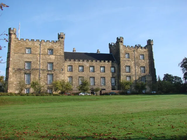
Lumley Castle Bill Henderson · CC BY-SA 2.0


Klima in Kimblesworth and Plawsworth
Beste Monate für BesichtigungenBeste Monate für Besichtigungen: Juni–September.
Dieser Monat · November
Ein kalter Monat
Tag 9° · Nacht 4° · Regen 61 mm
- Wärmster Monat
- Juli (Tag 19°)
- Kältester Monat
- Januar (Nacht 1°)
- Nassester Monat
- August (63 mm)
- Trockenster Monat
- Februar (41 mm)
Balken: mittlere Monatstiefst- und -höchsttemperatur. Darunter: Niederschlag. Monatsmittel 1970–2000 bei etwa 18 km Auflösung, höhenkorrigiert. Hervorgehobene Monate sind mild und relativ trocken. Quelle: WorldClim 2.1 (CC BY 4.0).
Werte als Tabelle anzeigen
| Monat | Jan | Feb | Mär | Apr | Mai | Jun | Jul | Aug | Sep | Okt | Nov | Dez |
|---|---|---|---|---|---|---|---|---|---|---|---|---|
| Mittleres Maximum (°C) | 7° | 7° | 9° | 11° | 14° | 17° | 19° | 19° | 17° | 13° | 9° | 8° |
| Mittleres Minimum (°C) | 1° | 1° | 2° | 3° | 5° | 8° | 11° | 11° | 9° | 6° | 4° | 2° |
| Niederschlag (mm) | 60 | 41 | 53 | 48 | 49 | 52 | 47 | 63 | 57 | 58 | 61 | 61 |
Weitere Reiseziele in dieser Zeit: Juni Juli August September
Anreise nach Kimblesworth and Plawsworth
Nächster Flughafen ist Newcastle International Airport (NCL), Luftlinie 24 km Richtung Norden. Nächste Großstadt ist Sunderland, 16 km Richtung Nordosten.
Flughäfen
- Newcastle International Airport (NCL) Newcastle upon Tyne, Tyne and Wear 24 kmNorden
- Teesside International Airport (MME) Darlington, Durham 37 kmSüden
- Leeds Bradford Airport (LBA) Leeds, West Yorkshire 107 kmSüden
Großstädte in der Nähe
- Sunderland Einwohner: 170.134 16 kmNordosten
- Newcastle upon Tyne Einwohner: 300.125 16 kmNorden
- Middlesbrough Einwohner: 142.707 36 kmSüdosten
- York Einwohner: 156.135 102 kmSüden
- Leeds Einwohner: 536.280 115 kmSüden
Luftlinie; die Straßenentfernung ist länger. Flughafendaten: OurAirports.
Tagesausflüge ab Kimblesworth and Plawsworth
Im Umkreis von 100 km: 726 historische und kulturelle Stätten, 1.287 Naturorte, 245 Seen, Flüsse und Küsten.
0–25 km129 Orte
- Match Island Insel 9 kmN
- Ryton Island Insel 20 kmNW
- Warden Law Berg 11 kmO
- Beacon Hill Berg 18 kmO
25–60 km490 Orte
- Seaton Carew Beach Strand 32 kmSO
- Redcar Beach Strand 40 kmSO
- Saint Mary’s Island Insel 29 kmN
- Coquet Island Insel 57 kmN
60–100 km1.639 Orte
- Groszbritannien Insel 96 kmS
- Longhoughton Beach Strand 67 kmN
- Whitby Beach Strand 72 kmSO
- The Island Insel 66 kmS
Luftlinie.
Orte in Kimblesworth and Plawsworth
4 OrteStädte & Dörfer4
- Kimblesworth · Dorf
- Nettlesworth · Dorf
- Plawsworth · Dorf
- Tan Hills · Dorf
Sehenswertes & Natur in der Nähe
Alles in der Nähe-
Lumley Castle Historische Stätte, Little Lumley3,9 km NO
-
Durham Cathedral Sehenswürdigkeit, Durham6,2 km S
-
Maiden Castle Motte Historische Stätte, Durham6,7 km S
-
North of England Open Air Museum Museum, Urpeth6,5 km NW
-
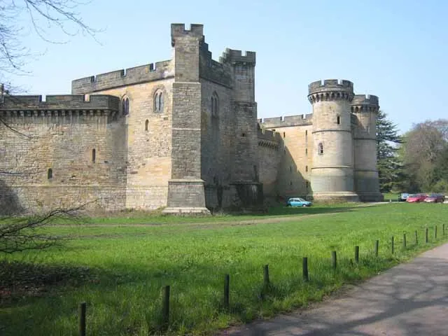 Brancepeth Castle Historische Stätte, Brancepeth11 km S
-
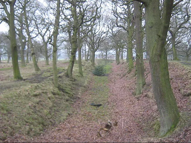 Castle Steads camp Historische Stätte, Cornsay9,9 km SW
-
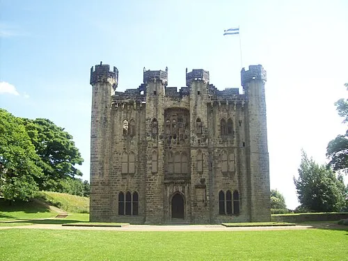 Hylton Castle Historische Stätte, Sunderland14 km NO
-
 Gateshead International Stadium Wahrzeichen, Lamesley15 km N
Quellen & Lizenzen
Daten zuletzt aktualisiert: