Sunderland
Liegt in England, Vereinigtes Königreich Koordinaten: 54°53′00″ N 1°25′00″ W
Der Name dieses Ortes wurde in dieser Sprache noch nicht verifiziert und wird in der Originalform angezeigt.
- Einwohner
- 288.606
- 288.606
- Höhe
- 56 m
- über dem Meeresspiegel
- Ortszeit
- UTC+00:00
- Europe/London · UTC+00:00
- Orte darin
- 82
- unter Sunderland verzeichnet
Über Sunderland
Sunderland ist ein Bezirk. Lage: England, Vereinigtes Königreich. Einwohner: 288.606.
Im Vergleich
- 17 Sehenswürdigkeiten und Naturorte im Umkreis von 10 km Tunstall Hills, The Moors
- Hier verzeichnet: Stadtteil: 53, Dorf: 17, Gemeinde: 3, Kleinstadt: 3
Klima in Sunderland
Beste Monate für Besichtigungen: Juni–September.
| Monat | Jan | Feb | Mär | Apr | Mai | Jun | Jul | Aug | Sep | Okt | Nov | Dez |
|---|---|---|---|---|---|---|---|---|---|---|---|---|
| Mittleres Maximum (°C) | 7° | 7° | 9° | 11° | 14° | 17° | 19° | 19° | 17° | 13° | 10° | 8° |
| Mittleres Minimum (°C) | 2° | 2° | 2° | 3° | 5° | 8° | 10° | 11° | 9° | 7° | 4° | 3° |
| Niederschlag (mm) | 61 | 42 | 55 | 46 | 49 | 52 | 52 | 65 | 62 | 61 | 65 | 63 |
Monatsmittel 1970–2000 bei etwa 18 km Auflösung, höhenkorrigiert. Hervorgehobene Monate sind mild und relativ trocken. Quelle: WorldClim 2.1 (CC BY 4.0).
Weitere Reiseziele in dieser Zeit: Juni · Juli · August · September
Flughäfen in der Nähe von Sunderland
- Newcastle International Airport (NCL) Newcastle upon Tyne, Tyne and Wear 25 km
- Teesside International Airport (MME) Darlington, Durham 42 km
- Leeds Bradford Airport (LBA) Leeds, West Yorkshire 114 km
Luftlinie; nur Flughäfen mit Linienflügen. Quelle: OurAirports (gemeinfrei).
Orte in Sunderland
82 Orte-
Sunderland Stadt170.134
-
Washington Kleinstadt67.085
-
Houghton-Le-Spring Kleinstadt36.746
-
Ryhope Kleinstadt14.000
-
Shiney Row Dorf12.549
-
Southwick Stadtteil10.535
-
Pallion Stadtteil10.117
-
Albany Stadtteil
-
Ashbrooke Stadtteil
-
Ayre's Quay Stadtteil
-
Ayton Stadtteil
-
Barmston Stadtteil
-
Barnes Stadtteil
-
Biddick Stadtteil
-
Bishopwearmouth Stadtteil
-
Blackfell Stadtteil
-
Burdon Gemeinde
-
Burnside Stadtteil
-
Carley Hill Stadtteil
-
Chilton Moor Dorf
-
Columbia Stadtteil
-
Concord Stadtteil
-
Cox Green Dorf
-
Deptford Stadtteil
-
Donwell Stadtteil
-
Downhill Stadtteil
-
Doxford Park Stadtteil
-
East Herrington Stadtteil
-
Fatfield Stadtteil
-
Fencehouses Dorf
-
Ford Stadtteil
-
Glebe Stadtteil
-
Grasswell Stadtteil
-
Harraton Stadtteil
-
Hastings Hill Stadtteil
-
Hertburn Stadtteil
-
Hetton Gemeinde
-
High Dubmire Dorf
-
Hillview Stadtteil
-
Houghton-le-Spring Rectory park Naturgebiet
-
Humbledon Stadtteil
-
Humbledon View Dorf
-
Hylton Castle Historische Stätte
-
Hylton Castle Stadtteil
-
Hylton Red House Stadtteil
-
Lambton Stadtteil
-
Marley Pots Stadtteil
-
Middle Herrington Stadtteil
-
Monkwearmouth Stadtteil
-
Moorside Stadtteil
-
Mount Pleasant Stadtteil
-
Newbottle Dorf
-
New Town Stadtteil
-
North Hylton Stadtteil
-
Old Penshaw Dorf
-
Oxclose Stadtteil
-
Pennywell Stadtteil
-
Penshaw Hill Berg
-
Philadelphia Dorf
-
Plains Farm Stadtteil
Sehenswertes & Natur in der Nähe
Alles in der Nähe-
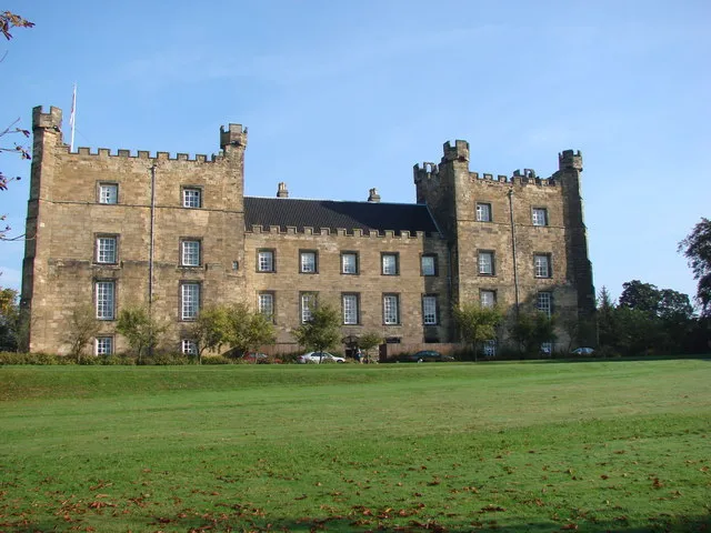 Lumley Castle Historische Stätte, Little Lumley9,4 km W
-
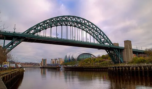 Tyne Bridge Wahrzeichen, Metropolitan Borough of Gateshead15 km NW
-
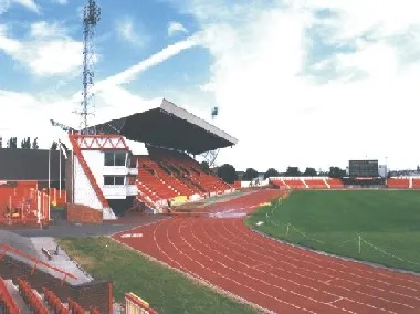 Gateshead International Stadium Wahrzeichen, Lamesley14 km NW
Quellen & Lizenzen
Daten zuletzt aktualisiert: