Ambleston
Liegt in Pembrokeshire, Wales Koordinaten: 51°53′28″ N 4°53′45″ W
Der Name dieses Ortes wurde in dieser Sprache noch nicht verifiziert und wird in der Originalform angezeigt.
- Höhe
- 126 m
- über dem Meeresspiegel
- Ortszeit
- UTC+00:00
- Europe/London · UTC+00:00
- Orte darin
- 7
- unter Ambleston verzeichnet
- Flughäfen
- CWL Cardiff International Airport121 km
- BRS Bristol Airport161 km
Über Ambleston
Ambleston ist eine Gemeinde. Lage: Pembrokeshire, Wales. Höhe: 126 m. Die beste Reisezeit: Juni–September. Nächster Flughafen: Cardiff International Airport (121 km). In der Nähe: Castlebythe und Parc y Marl Rath.
Fotos: Ambleston
-
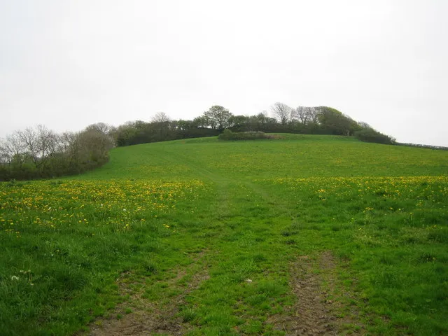
Rudbaxton Rath John Winterbottom · CC BY-SA 2.0 -
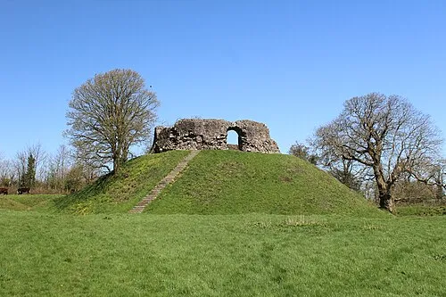
Wiston Castle Lucy Sheers · CC BY-SA 4.0


Klima in Ambleston
Beste Monate für BesichtigungenBeste Monate für Besichtigungen: Juni–September.
Dieser Monat · November
Ein regenreicher Monat
Tag 11° · Nacht 6° · Regen 122 mm
- Wärmster Monat
- Juli (Tag 18°)
- Kältester Monat
- Februar (Nacht 3°)
- Nassester Monat
- November (122 mm)
- Trockenster Monat
- Mai (65 mm)
Balken: mittlere Monatstiefst- und -höchsttemperatur. Darunter: Niederschlag. Monatsmittel 1970–2000 bei etwa 18 km Auflösung, höhenkorrigiert. Hervorgehobene Monate sind mild und relativ trocken. Quelle: WorldClim 2.1 (CC BY 4.0).
Werte als Tabelle anzeigen
| Monat | Jan | Feb | Mär | Apr | Mai | Jun | Jul | Aug | Sep | Okt | Nov | Dez |
|---|---|---|---|---|---|---|---|---|---|---|---|---|
| Mittleres Maximum (°C) | 8° | 7° | 9° | 11° | 14° | 16° | 18° | 18° | 16° | 14° | 11° | 9° |
| Mittleres Minimum (°C) | 4° | 3° | 4° | 5° | 7° | 10° | 12° | 12° | 11° | 9° | 6° | 5° |
| Niederschlag (mm) | 111 | 81 | 85 | 66 | 65 | 71 | 66 | 89 | 90 | 118 | 122 | 114 |
Weitere Reiseziele in dieser Zeit: Juni Juli August September
Anreise nach Ambleston
Nächster Flughafen ist Cardiff International Airport (CWL), Luftlinie 121 km Richtung Südosten. Nächste Großstadt ist Swansea, 72 km Richtung Südosten.
Flughäfen
- Cardiff International Airport (CWL) Cardiff 121 kmSüdosten
- Bristol Airport (BRS) Bristol 161 kmOsten
- Cornwall Airport Newquay (NQY) Newquay 162 kmSüden
Großstädte in der Nähe
- Swansea Einwohner: 300.352 72 kmSüdosten
- Cardiff Einwohner: 372.089 127 kmOsten
- Newport (Wales) Einwohner: 161.506 135 kmOsten
- Exeter Einwohner: 130.709 161 kmSüdosten
- Bristol Einwohner: 479.024 166 kmOsten
Luftlinie; die Straßenentfernung ist länger. Flughafendaten: OurAirports.
Tagesausflüge ab Ambleston
Im Umkreis von 100 km: 297 historische und kulturelle Stätten, 939 Naturorte, 125 Seen, Flüsse und Küsten.
0–25 km203 Orte
- Caerfai Beach Strand 25 kmW
- Ynys Meicel Insel 20 kmNW
- Gewni Insel 21 kmW
- Ynys Ddu Insel 18 kmNW
25–60 km405 Orte
- St Justinian Naturgebiet 28 kmW
- Porth Clais Naturgebiet 27 kmW
- Port Selau Naturgebiet 28 kmW
- Poppit Sands Strand 28 kmNO
60–100 km753 Orte
- Saunton Sands Strand 100 kmSO
- Putsborough Beach Strand 95 kmSO
- Rat Island Insel 84 kmS
- Lundy Insel 81 kmS
Luftlinie.
Orte in Ambleston
7 OrteStädte & Dörfer5
Kulturerbe & Sehenswertes2
- Haverfordwest Transmitting Station · Wahrzeichen
- Woodstock Ring · Historische Stätte
Sehenswertes & Natur in der Nähe
Alles in der Nähe-
Castlebythe Historische Stätte, Puncheston3,9 km N
-
Parc y Marl Rath Historische Stätte, New Moat4 km O
-
Castell Hendre Historische Stätte, Puncheston4,2 km NO
-
Summerton Camp Historische Stätte, Puncheston5,1 km NW
-
Wolfscastle Motte Historische Stätte, Wolfscastle5,2 km W
-
New Moat Motte Historische Stätte, New Moat5,5 km O
-
Rudbaxton Rath Historische Stätte, Rudbaxton6,9 km S
-
Wiston Castle Historische Stätte, Wiston7,3 km S
Quellen & Lizenzen
Daten zuletzt aktualisiert: