Rjava pec
Located in Ferlach, Politischer Bezirk Klagenfurt Land Coordinates: 46°26′48″ N 14°17′04″ E
- Elevation
- 1,597 m
- above sea level
- Local time
- UTC+01:00
- Europe/Vienna · UTC+01:00
- Airports
- KLU Klagenfurt Airport22 km
- LJU Ljubljana Jože Pučnik Airport28 km
About Rjava pec
Rjava pec is a mountain. Location: Ferlach, Politischer Bezirk Klagenfurt Land. Elevation: 1,597 m. The nearest airport is Klagenfurt Airport (22 km). Nearby sights include Grintoutz and Spitzargraben.
Climate of Rjava pec
This month · November
A wet month
Day 1° · Night -6° · Rain 182 mm
- Hottest month
- July (day 17°)
- Coldest month
- January (night -11°)
- Wettest month
- June (185 mm)
- Driest month
- February (83 mm)
Bars: average monthly low and high temperature. Below: precipitation. Monthly averages for 1970–2000 at about 18 km resolution, adjusted for elevation. Highlighted months are mild and relatively dry. Source: WorldClim 2.1 (CC BY 4.0).
Show values as a table
| Month | Jan | Feb | Mar | Apr | May | Jun | Jul | Aug | Sep | Oct | Nov | Dec |
|---|---|---|---|---|---|---|---|---|---|---|---|---|
| Average high (°C) | -4° | -2° | 2° | 5° | 11° | 14° | 17° | 16° | 13° | 8° | 1° | -3° |
| Average low (°C) | -11° | -11° | -8° | -4° | 1° | 4° | 6° | 6° | 2° | -1° | -6° | -10° |
| Precipitation (mm) | 95 | 83 | 119 | 152 | 153 | 185 | 164 | 150 | 164 | 179 | 182 | 127 |
How to get to Rjava pec
The nearest airport is Klagenfurt Airport (KLU), 22 km to the north as the crow flies. The nearest large city is Klagenfurt, 20 km to the north.
Airports
- Klagenfurt Airport (KLU) Klagenfurt am Wörthersee 22 kmnorth
- Ljubljana Jože Pučnik Airport (LJU) Zgornji Brnik 28 kmsoutheast
- Trieste Airport (TRS) Ronchi dei Legionari/Trieste 93 kmsouthwest
Nearby large cities
- Klagenfurt Population: 100.3K 20 kmnorth
- Graz Population: 303.3K 112 kmnortheast
- Rijeka Population: 108K 125 kmsouth
- Zagreb Population: 663.6K 149 kmsoutheast
- Salzburg Population: 157.2K 177 kmnorthwest
Straight-line distances; road distances are longer. Airport data: OurAirports.
Nearest towns and villages
-
Loibltal Village, Ferlach3.5 km NW
-
Zell-Oberwinkel Village, Zell3.3 km NE
-
Sankt Leonhard Village, Ferlach2.9 km NW
-
Zerjau Village, Zell2.3 km N
-
Zell-Mitterwinkel Village, Zell4.4 km NE
-
Bodental Village, Ferlach5.6 km NW
Nearby attractions & nature
Everything nearby-
Grintoutz Mountain, Zell1.2 km E
-
Spitzargraben Natural site, Carinthia1.3 km W
-
Loibler Prapotnik Mountain, Ferlach1.9 km N
-
Zeller Prapotnik Mountain, Zell2.1 km E
-
Petroutz Mountain, Zell1.7 km NE
-
Loibler Baba Mountain, Austria1.9 km SE
-
Villacher Becken Natural site, Zell2.2 km E
-
Tomaschberg Mountain, Zell2.8 km E
More nature in Austria
-
Neuberg Mountain, Ferlach3.8 km N
-
Großer Rain Mountain, Ferlach4.3 km NW
-
Rjautza Mountain, Ferlach4.5 km W
-
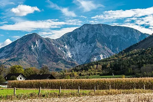 Kotla Mountain, Ferlach6.2 km NE
-
Zeller Grintoutz Mountain, Ferlach3.2 km N
-
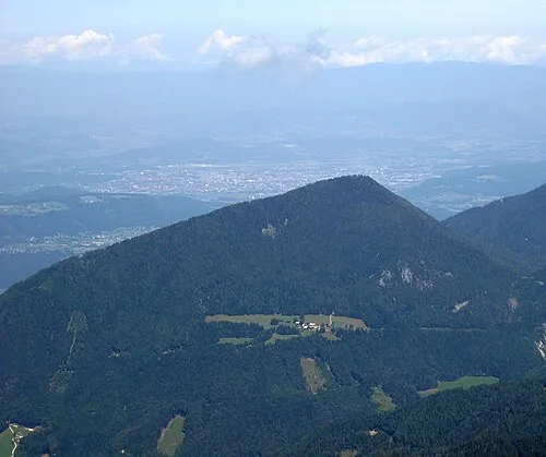 Sinacher Gupf Mountain, Ferlach8.9 km NW
Sources & licences
Data last updated: