Peterer Kogel
Located in Reichenfels, Politischer Bezirk Wolfsberg Coordinates: 47°02′00″ N 14°49′00″ E
- Elevation
- 1,588 m
- above sea level
- Local time
- UTC+01:00
- Europe/Vienna · UTC+01:00
- Airports
- GRZ Graz Airport48 km
- KLU Klagenfurt Airport57 km
About Peterer Kogel
Peterer Kogel is a mountain. Location: Reichenfels, Politischer Bezirk Wolfsberg. Elevation: 1,588 m. The nearest airport is Graz Airport (48 km). Nearby sights include Speikkogel and Peterer Riegel.
Photos of Peterer Kogel
-
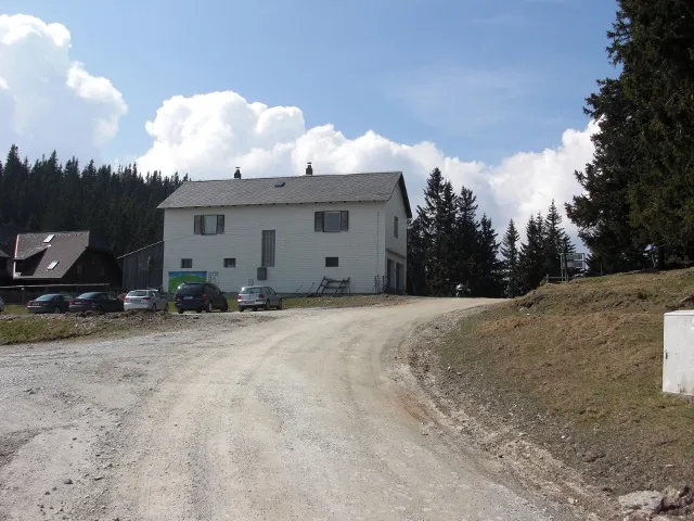
Salzstiegel Ulflulfl · CC BY-SA 3.0 -
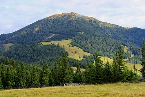
Rappelkogel WA-Wien · CC BY-SA 3.0 -
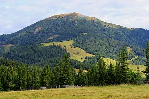
Rappoldkogel WA-Wien · CC BY-SA 3.0


Climate of Peterer Kogel
This month · November
A cold month
Day 1° · Night -6° · Rain 87 mm
- Hottest month
- July (day 17°)
- Coldest month
- January (night -11°)
- Wettest month
- July (152 mm)
- Driest month
- January (50 mm)
Bars: average monthly low and high temperature. Below: precipitation. Monthly averages for 1970–2000 at about 18 km resolution, adjusted for elevation. Highlighted months are mild and relatively dry. Source: WorldClim 2.1 (CC BY 4.0).
Show values as a table
| Month | Jan | Feb | Mar | Apr | May | Jun | Jul | Aug | Sep | Oct | Nov | Dec |
|---|---|---|---|---|---|---|---|---|---|---|---|---|
| Average high (°C) | -3° | -1° | 3° | 6° | 12° | 15° | 17° | 17° | 13° | 8° | 1° | -2° |
| Average low (°C) | -11° | -11° | -7° | -4° | 1° | 4° | 6° | 6° | 2° | -2° | -6° | -10° |
| Precipitation (mm) | 50 | 53 | 77 | 87 | 103 | 144 | 152 | 133 | 112 | 92 | 87 | 71 |
How to get to Peterer Kogel
The nearest airport is Graz Airport (GRZ), 48 km to the east as the crow flies. The nearest large city is Graz, 48 km to the east.
Airports
- Graz Airport (GRZ) Feldkirchen bei Graz 48 kmeast
- Klagenfurt Airport (KLU) Klagenfurt am Wörthersee 57 kmsouthwest
- Maribor Edvard Rusjan Airport (MBX) Maribor 91 kmsoutheast
Nearby large cities
- Graz Population: 303.3K 48 kmeast
- Klagenfurt Population: 100.3K 60 kmsouthwest
- Linz Population: 204.8K 147 kmnorth
- Salzburg Population: 157.2K 159 kmnorthwest
- Zagreb Population: 663.6K 162 kmsoutheast
Straight-line distances; road distances are longer. Airport data: OurAirports.
Day trips from Peterer Kogel
Within 100 km: 297 historic and cultural sites, 2,364 natural sites, 777 lakes, rivers and coasts.
0–25 km133 places
- Wildsee Lake 18 kmW
- Großer Winterleitensee Lake 21 kmW
- Lindersee Lake 19 kmW
- Lavantsee Lake 19 kmW
25–60 km1,011 places
- Treffnersee Lake 59 kmN
- Gemeinsee Lake 58 kmNW
- Grüner See Lake 58 kmNW
- Geißrinksee Lake 55 kmNW
60–100 km2,294 places
- Klamm Natural site 66 kmNW
- Seeriessee Lake 88 kmNW
- Untersee Lake 99 kmW
- Wildsee Lake 90 kmW
Straight-line distances.
Nearest towns and villages
-
Sankt Peter im Lavanttal Village, Reichenfels5.4 km W
-
Reichenfels Village, Reichenfels6.2 km SW
-
Großprethal Village, Obdach4.3 km W
-
Bad St. Leonhard im Lavanttal Municipality, Politischer Bezirk Wolfsberg7.5 km S
-
Kleinprethal Village, Obdach5.4 km W
-
Bad Sankt Leonhard im Lavanttal Village, Bad St. Leonhard im Lavanttal8.1 km S
Nearby attractions & nature
Everything nearby-
Speikkogel Mountain, Obdach2.2 km NE
-
Peterer Riegel Mountain, Reichenfels1.9 km E
-
Salzstiegel Mountain, Weißkirchen in Steiermark5.3 km NE
-
Packalpe Mountain, Styria3.9 km S
-
Ameringkogel Mountain, Obdach3.9 km N
-
Rappoldkogel Mountain, Hirschegg-Pack7.6 km NE
-
Größenberg Mountain, Weißkirchen in Steiermark6.1 km NW
-
Bergkogel Mountain, Bad St. Leonhard im Lavanttal7.5 km SE
Sources & licences
Data last updated: