Bad St. Leonhard im Lavanttal
Located in Politischer Bezirk Wolfsberg, Carinthia Coordinates: 46°57′56″ N 14°48′53″ E
- Population
- 4,398
- 4.4K
- Elevation
- 1,047 m
- above sea level
- Local time
- UTC+01:00
- Europe/Vienna · UTC+01:00
- Places inside
- 20
- listed under Bad St. Leonhard im Lavanttal
- Airports
- GRZ Graz Airport48 km
- KLU Klagenfurt Airport51 km
About Bad St. Leonhard im Lavanttal
Bad St. Leonhard im Lavanttal is a municipality. Location: Politischer Bezirk Wolfsberg, Carinthia. Population: 4,398. Elevation: 1,047 m. The best months to visit are June–September. The nearest airport is Graz Airport (48 km). Nearby sights include Feistritzbach and Oberes Lavanttal.
Climate of Bad St. Leonhard im Lavanttal
Best months for sightseeingBest months for sightseeing: June–September.
This month · November
A cold month
Day 5° · Night -3° · Rain 96 mm
- Hottest month
- July (day 21°)
- Coldest month
- January (night -8°)
- Wettest month
- July (154 mm)
- Driest month
- January (50 mm)
Bars: average monthly low and high temperature. Below: precipitation. Monthly averages for 1970–2000 at about 18 km resolution, adjusted for elevation. Highlighted months are mild and relatively dry. Source: WorldClim 2.1 (CC BY 4.0).
Show values as a table
| Month | Jan | Feb | Mar | Apr | May | Jun | Jul | Aug | Sep | Oct | Nov | Dec |
|---|---|---|---|---|---|---|---|---|---|---|---|---|
| Average high (°C) | 1° | 3° | 6° | 10° | 16° | 19° | 21° | 21° | 17° | 12° | 5° | 1° |
| Average low (°C) | -8° | -7° | -4° | 0° | 5° | 8° | 10° | 9° | 6° | 2° | -3° | -6° |
| Precipitation (mm) | 50 | 54 | 81 | 92 | 107 | 149 | 154 | 136 | 116 | 102 | 96 | 74 |
Other places to visit in this season: June July August September
How to get to Bad St. Leonhard im Lavanttal
The nearest airport is Graz Airport (GRZ), 48 km to the east as the crow flies. The nearest large city is Graz, 49 km to the east.
Airports
- Graz Airport (GRZ) Feldkirchen bei Graz 48 kmeast
- Klagenfurt Airport (KLU) Klagenfurt am Wörthersee 51 kmsouthwest
- Maribor Edvard Rusjan Airport (MBX) Maribor 86 kmsoutheast
Nearby large cities
- Graz Population: 303.3K 49 kmeast
- Klagenfurt Population: 100.3K 54 kmsouthwest
- Ljubljana Population: 272.2K 104 kmsouth
- Linz Population: 204.8K 154 kmnorth
- Zagreb Population: 663.6K 156 kmsoutheast
Straight-line distances; road distances are longer. Airport data: OurAirports.
Day trips from Bad St. Leonhard im Lavanttal
Within 100 km: 290 historic and cultural sites, 2,210 natural sites, 772 lakes, rivers and coasts.
0–25 km143 places
- Wildsee Lake 19 kmNW
- Großer Winterleitensee Lake 24 kmNW
- Lindersee Lake 22 kmNW
- Lavantsee Lake 21 kmNW
25–60 km928 places
- Mislinja River 46 kmS
- Meža River 45 kmS
- Eberlsee Lake 52 kmNW
- Krugsee Lake 47 kmNW
60–100 km2,201 places
- Ribnica Lake Lake 62 kmSE
- Lake Bled Lake 87 kmSW
- Triglav Mountain 99 kmSW
- Šmarna gora Mountain 97 kmS
Straight-line distances.
Places in Bad St. Leonhard im Lavanttal
20 places- 1 Bad Sankt Leonhard im Lavanttal 4.4K
- 2 Kliening 628
- 3 Wisperndorf 321
- 4 Twimberg 299
- 5 Schiefling 281
- 6 Schönberg 170
- 7 Görlitzen 121
- 8 Mauterndorf 81
- 9 Wiesenau 81
- 10 Erzberg 51
- 11 Lichtengraben 30
Bar: population relative to the most populous place in this list.
Cities & villages4
- Loben · Village
- Preblau · Village
- Prebl-Brunnen · Village
- Theissing · Village
Mountains & nature4
- Bergkogel · Mountain
- Kreuzberg · Mountain
- Schulterkogel · Mountain
- Übelskogel · Mountain
Heritage & sights1
- Talübergang Lavant · Landmark
Nearby attractions & nature
Everything nearby-
Feistritzbach River, Carinthia1.1 km W
-
Oberes Lavanttal Natural site, Carinthia2.4 km W
-
Packalpe Mountain, Styria4.1 km N
-
Waldensteiner Bach River, Carinthia6.1 km SE
-
Auerling Bach River, Carinthia6.2 km SE
-
Hirscheggeralpe Mountain, Preitenegg7.5 km NE
-
Peterer Kogel Mountain, Reichenfels7.5 km N
-
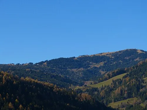 Hohenwart Mountain, Hüttenberg9.9 km W
Sources & licences
Data last updated: