St. Andrä
Located in Politischer Bezirk Wolfsberg, Carinthia Coordinates: 46°45′53″ N 14°49′28″ E
- Population
- 10,062
- 10.1K
- Elevation
- 418 m
- above sea level
- Local time
- UTC+01:00
- Europe/Vienna · UTC+01:00
- Places inside
- 73
- listed under St. Andrä
About St. Andrä
St. Andrä is a municipality. Location: Politischer Bezirk Wolfsberg, Carinthia. Population: 10,062. Elevation: 418 m.
In comparison
- No. 2 of 9 places in Politischer Bezirk Wolfsberg by population
- Nearest larger town: Wolfsberg, 9 km N
- 18 sights and natural places within 10 km Kloster Maria Loreto, Wois Bach
- Listed here: Village: 67, Mountain: 3, Attraction: 1, Landmark: 1
Places in St. Andrä
73 places-
Sankt Andrä Village1.3K
-
Jakling Village750
-
Gemmersdorf Village693
-
Eitweg Village680
-
Blaiken Village497
-
Wölzing-Fischering Village432
-
Magersdorf Village411
-
Burgstall-Sankt Andrä Village399
-
Rojach Village356
-
Sankt Ulrich Village246
-
Schönweg-Sankt Andrä Village216
-
Pölling Village203
-
Oberpichling Village176
-
Kleinrojach Village175
-
Langegg Village166
-
Paierdorf Village166
-
Mosern Village161
-
Wölzing-St. Andrä Neighbourhood157
-
Winkling-Nord Village154
-
Messensach Village148
-
Goding Village147
-
Lindhof Village144
-
Lamm Village128
-
Unterrain Village127
-
Mettersdorf Village109
-
Siebending Village107
-
Framrach Village94
-
Kienberg Village90
-
Wimpassing Village90
-
Kollegg Village88
-
Mühldorf Village88
-
Dachberg Village70
-
Sankt Jakob bei Winkling Village69
-
Unteragsdorf Village69
-
Farrach Village66
-
Pirk Village64
-
Pichling Village62
-
Oberagsdorf Village52
-
Untereberndorf Village52
-
Hainsdorf Village50
-
Fischering Village49
-
Raglach Village44
-
Schönweg-Pustritz Village42
-
Ragglbach Village41
-
Mitterpichling Village28
-
Langgen Village25
-
Winkling-Süd Village25
-
Schaßbach Village22
-
Obereberndorf Village21
-
Oberaigen Village20
-
Burgstall-Pölling Village16
-
Unteraigen Village16
-
Streitberg Village15
-
Schobersberg Village13
-
Reisberg Village11
-
Bierbaumer Village
-
Burgstall Village
-
Ellersdorf Village
-
Godinger Berg Mountain
-
Grosser Speikkogel Mountain
Nearby attractions & nature
Everything nearby-
Wois Bach River, Carinthia0.8 km NE
-
Unteres Lavanttal Natural site, Carinthia4.4 km NE
-
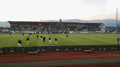 Lavanttal-Arena Landmark, Wolfsberg7.1 km N
-
Granitzthal Natural site, Carinthia7.4 km S
-
Reisberger Bach River, Carinthia4.5 km N
-
Herzogberg Mountain, St. Georgen im Lavanttal9.2 km SE
-
Schoberkogel Mountain, Wolfsberg9.6 km NE
-
Kasparstein Mountain, St. Paul im Lavanttal10 km SE
Sources & licences
Data last updated: