Liebenfels
Located in Sankt Veit an der Glan District, Carinthia Coordinates: 46°45′10″ N 14°15′20″ E
- Population
- 3,285
- 3.3K
- Elevation
- 691 m
- above sea level
- Local time
- UTC+01:00
- Europe/Vienna · UTC+01:00
- Places inside
- 52
- listed under Liebenfels
About Liebenfels
Liebenfels is a municipality. Location: Sankt Veit an der Glan District, Carinthia. Population: 3,285. Elevation: 691 m.
In comparison
- No. 6 of 20 places in Sankt Veit an der Glan District by population
- Nearest larger town: Frauenstein, 7 km NE
- 29 sights and natural places within 10 km Altliebenburg, Sörgerberg
- Listed here: Village: 46, Mountain: 4, Historic site: 2
Places in Liebenfels
52 places-
Liebenfels Village750
-
Pulst Village441
-
Glantschach Village359
-
Waggendorf Village206
-
Zweikirchen Village161
-
Radelsdorf Village124
-
Gradenegg Village99
-
Rohnsdorf Village87
-
Sörg Village81
-
Lebmach Village80
-
Weitensfeld Village72
-
Miedling Village70
-
Liemberg Village69
-
Lorberhof Village63
-
Hoch-Liebenfels Village50
-
Pflausach Village50
-
Reidenau Village44
-
Zojach Village37
-
Hohenstein Village36
-
Freundsam Village31
-
Hart Village30
-
Eggen I Village28
-
Pflugern Village28
-
Kraindorf Village23
-
Rosenbichl Village22
-
Zmuln Village21
-
Tschadam Village20
-
Grassendorf Village17
-
Woitsch Village16
-
Ladein Village11
-
Puppitsch Village11
-
Metschach Village9
-
Kulm Village8
-
Eggen II Village5
-
Hardegg Village4
-
Grund Village3
-
Graben Village2
-
Gasmai Village1
-
Altliebenburg Historic site
-
Bärndorf Village
-
Beissendorf Village
-
Eggen Village
-
Fachau Village
-
Feistritz Village
-
Gauerstall Mountain
-
Hardegg Historic site
-
Mauer Village
-
Schneebauerberg Mountain
-
Sögerberg Village
-
Sörgerberg Mountain
-
Unterhaidach Village
-
Wunderriegel Mountain
Nearby attractions & nature
Everything nearby-
Gößeberg Mountain, St. Urban4.3 km W
-
Veitsberg Mountain, Glanegg4.8 km SW
-
 Ulrichsberg Mountain, St. Veit an der Glan6.8 km SE
-
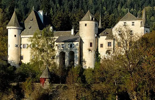 Frauenstein Historic site, Frauenstein7.6 km NE
-
Karlsberg Historic site, St. Veit an der Glan5.3 km SE
-
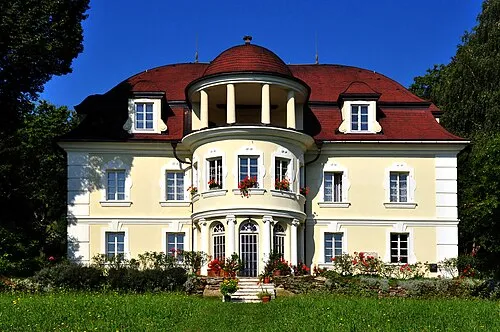 Lind Historic site, Klagenfurt8 km S
-
Krobather Berg Mountain, Glanegg5.9 km W
-
Paulsberg Mountain, St. Urban7 km W
Sources & licences
Data last updated: