Sankt Veit an der Glan District
Located in Carinthia, Austria Coordinates: 46°50′00″ N 14°24′00″ E
- Population
- 54,092
- 54.1K
- Elevation
- 675 m
- above sea level
- Local time
- UTC+01:00
- Europe/Vienna · UTC+01:00
- Places inside
- 20
- listed under Sankt Veit an der Glan District
About Sankt Veit an der Glan District
Sankt Veit an der Glan District is a district. Location: Carinthia, Austria. Population: 54,092.
In comparison
- 20 sights and natural places within 10 km Schloss Welsbach, Kriebl
- Listed here: Municipality: 20
Places in Sankt Veit an der Glan District
20 places-
St. Veit an der Glan Municipality12.5K
-
Friesach Municipality5K
-
Althofen Municipality4.8K
-
St. Georgen am Längsee Municipality3.7K
-
Frauenstein Municipality3.6K
-
Liebenfels Municipality3.3K
-
Brückl Municipality2.7K
-
Weitensfeld im Gurktal Municipality2.1K
-
Straßburg Municipality2.1K
-
Metnitz Municipality2K
-
Kappel am Krappfeld Municipality2K
-
Klein St. Paul Municipality1.9K
-
Guttaring Municipality1.5K
-
Hüttenberg Municipality1.4K
-
Mölbling Municipality1.3K
-
Eberstein Municipality1.3K
-
Gurk Municipality1.2K
-
Micheldorf Municipality1K
-
Deutsch-Griffen Municipality911
-
Glödnitz Municipality811
Nature and heritage in Sankt Veit an der Glan District
-
Ulrichsberg Mountain, St. Veit an der Glan
-
Hohenwart Mountain, Hüttenberg
-
Salzerkopf Mountain, Straßburg
-
Mödringberg Mountain, Metnitz
-
Zammelsberg Mountain, Weitensfeld im Gurktal
-
Wunderriegel Mountain, Liebenfels
Nearby attractions & nature
Everything nearby-
Längsee Lake, Carinthia5.2 km S
-
Olsabach River, Carinthia7.3 km NE
-
Langwiesenbach River, Carinthia7.5 km NW
-
Wimitzbach River, Carinthia7.8 km S
-
Gurktal Natural site, Carinthia12 km W
-
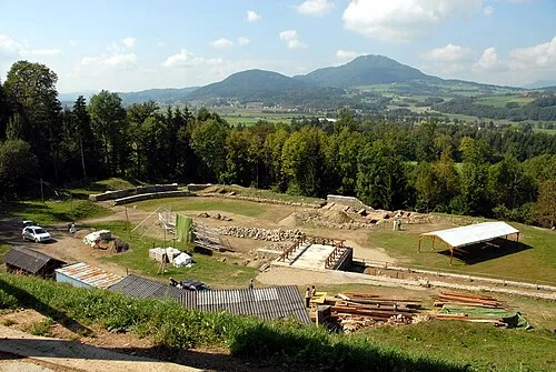 Virunum Historic site, Maria Saal15 km S
Sources & licences
Data last updated: