Gföhl
Located in Politischer Bezirk Krems, Lower Austria Coordinates: 48°30′34″ N 15°29′07″ E
- Population
- 3,749
- 3.7K
- Elevation
- 535 m
- above sea level
- Local time
- UTC+01:00
- Europe/Vienna · UTC+01:00
- Places inside
- 22
- listed under Gföhl
About Gföhl
Gföhl is a municipality. Location: Politischer Bezirk Krems, Lower Austria. Population: 3,749. Elevation: 535 m.
In comparison
- No. 2 of 30 places in Politischer Bezirk Krems by population
- Nearest larger town: Langenlois, 13 km E
- 14 sights and natural places within 10 km Waxenberg, Reisingerhöhe
- Listed here: Village: 20, Mountain: 2
Places in Gföhl
22 places-
Gföhl Village2.1K
-
Gföhleramt Village290
-
Unter-Meisling Village186
-
Moritzreith Village120
-
Felling Village103
-
Reittern Village100
-
Rastbach Village99
-
Garmanns Village76
-
Hohenstein Village66
-
Reisling Village59
-
Mittelbergeramt Village44
-
Lengenfelderamt Village38
-
Litschgraben Village24
-
Wurfenthalgraben Village19
-
Altgföhl Village
-
Latzenhof Village
-
Mitterseeb Village
-
Obermeisling Village
-
Oberseeb Village
-
Reisingerhöhe Mountain
-
Schaufel Berg Mountain
-
Unterseeb Village
Nearby attractions & nature
Everything nearby-
Waxenberg Mountain, Senftenberg3.1 km S
-
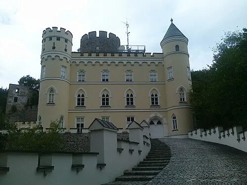 Hartenstein Historic site, Albrechtsberg an der Großen Krems9.1 km SW
-
Ulrichsberg Mountain, Jaidhof7.5 km NE
-
Steineck Mountain, Lichtenau im Waldviertel8 km W
-
Dachsberg Mountain, Langenlois8.5 km E
-
Steinwand Mountain, Rastenfeld9 km NW
-
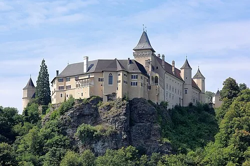 Rosenburg castle Historic site, Rosenburg-Mold17 km NE
-
Hogmannriegel Mountain, Sankt Leonhard am Hornerwald9.5 km NE
Sources & licences
Data last updated: