Ackerlhöhe
Located in Sankt Georgen am Kreischberg, Politischer Bezirk Murau Coordinates: 47°03′00″ N 14°07′00″ E
- Elevation
- 2,040 m
- above sea level
- Local time
- UTC+01:00
- Europe/Vienna · UTC+01:00
- Airports
- KLU Klagenfurt Airport48 km
- LJU Ljubljana Jože Pučnik Airport95 km
About Ackerlhöhe
Ackerlhöhe is a mountain. Location: Sankt Georgen am Kreischberg, Politischer Bezirk Murau. Elevation: 2,040 m. The nearest airport is Klagenfurt Airport (48 km). Nearby sights include Frauenalpe and Preining.
Photos of Ackerlhöhe
-
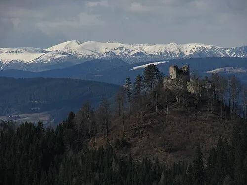
Prankerhöhe Kuhni74 · CC BY-SA 4.0 -
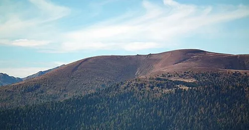
Fleischbank Bestware · CC BY-SA 3.0 -
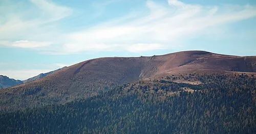
Kranawettriegel Bestware · CC BY-SA 3.0


Climate of Ackerlhöhe
This month · November
A wet month
Day -1° · Night -9° · Rain 115 mm
- Hottest month
- July (day 13°)
- Coldest month
- January (night -13°)
- Wettest month
- July (179 mm)
- Driest month
- February (68 mm)
Bars: average monthly low and high temperature. Below: precipitation. Monthly averages for 1970–2000 at about 18 km resolution, adjusted for elevation. Highlighted months are mild and relatively dry. Source: WorldClim 2.1 (CC BY 4.0).
Show values as a table
| Month | Jan | Feb | Mar | Apr | May | Jun | Jul | Aug | Sep | Oct | Nov | Dec |
|---|---|---|---|---|---|---|---|---|---|---|---|---|
| Average high (°C) | -5° | -4° | -1° | 3° | 8° | 11° | 13° | 13° | 10° | 5° | -1° | -4° |
| Average low (°C) | -13° | -13° | -10° | -7° | -2° | 1° | 3° | 3° | 0° | -4° | -9° | -12° |
| Precipitation (mm) | 71 | 68 | 96 | 113 | 129 | 173 | 179 | 155 | 139 | 117 | 115 | 96 |
How to get to Ackerlhöhe
The nearest airport is Klagenfurt Airport (KLU), 48 km to the south as the crow flies. The nearest large city is Klagenfurt, 49 km to the south.
Airports
- Klagenfurt Airport (KLU) Klagenfurt am Wörthersee 48 kmsouth
- Ljubljana Jože Pučnik Airport (LJU) Zgornji Brnik 95 kmsouth
- Graz Airport (GRZ) Feldkirchen bei Graz 101 kmeast
Nearby large cities
- Klagenfurt Population: 100.3K 49 kmsouth
- Graz Population: 303.3K 101 kmeast
- Ljubljana Population: 272.2K 115 kmsouth
- Salzburg Population: 157.2K 116 kmnorthwest
- Linz Population: 204.8K 140 kmnorth
Straight-line distances; road distances are longer. Airport data: OurAirports.
Day trips from Ackerlhöhe
Within 100 km: 274 historic and cultural sites, 3,184 natural sites, 922 lakes, rivers and coasts.
0–25 km201 places
- Schattensee Lake 20 kmNW
- Prebersee Lake 25 kmNW
- Mirtzlsee Lake 23 kmN
- Lambrecht See Lake 9 kmE
25–60 km1,512 places
- Klamm Natural site 54 kmN
- Seeriessee Lake 43 kmNW
- Untersee Lake 51 kmNW
- Wildsee Lake 41 kmNW
60–100 km2,667 places
- Hoher Dachstein Mountain 61 kmNW
- Lake Bohinj Lake 87 kmS
- Lake Bled Lake 76 kmS
- Triglav Mountain 78 kmS
Straight-line distances.
Nearest towns and villages
-
Sankt Lorenzen ob Murau Village, Sankt Georgen am Kreischberg5.5 km N
-
Auen Village, Metnitz3.1 km E
-
Sankt Georgen ob Murau Village, Sankt Georgen am Kreischberg6.4 km N
-
Lutzmannsdorf Village, Sankt Georgen am Kreischberg7 km NW
-
Metnitz Municipality, Sankt Veit an der Glan District8 km SE
-
Murau Village, Murau7.8 km NE
Nearby attractions & nature
Everything nearby-
Frauenalpe Mountain, Styria1.3 km E
-
Preining Mountain, Metnitz3.1 km SE
-
Prankerhöhe Mountain, Stadl-Predlitz4.8 km SW
-
Kranawettriegel Mountain, Metnitz5.3 km S
-
Preininger Kuster Mountain, Metnitz4.7 km SE
-
Fleischbank Mountain, Metnitz5.6 km S
-
Hauserersee Lake, Sankt Georgen am Kreischberg4.3 km W
-
Kirbisch Mountain, Stadl-Predlitz5.1 km W
Sources & licences
Data last updated: