Fladnitz an der Teichalm
Located in Politischer Bezirk Weiz, Styria Coordinates: 47°19′11″ N 15°28′05″ E
- Population
- 1,806
- 1.8K
- Elevation
- 912 m
- above sea level
- Local time
- UTC+01:00
- Europe/Vienna · UTC+01:00
- Places inside
- 26
- listed under Fladnitz an der Teichalm
About Fladnitz an der Teichalm
Fladnitz an der Teichalm is a municipality. Location: Politischer Bezirk Weiz, Styria. Population: 1,806. Elevation: 912 m.
In comparison
- No. 20 of 31 places in Politischer Bezirk Weiz by population
- Nearest larger town: Passail, 4 km SE
- 34 sights and natural places within 10 km Gerlerkogel, Gelderkogel
- Listed here: Village: 18, Mountain: 8
Airports nearest to Fladnitz an der Teichalm
- Graz Airport (GRZ) Feldkirchen bei Graz 37 km
- Maribor Edvard Rusjan Airport (MBX) Maribor 95 km
- Klagenfurt Airport (KLU) Klagenfurt am Wörthersee 114 km
Straight-line distance; airports with scheduled flights only. Source: OurAirports (public domain).
Places in Fladnitz an der Teichalm
26 places-
Fladnitz an der Teichalm Village555
-
Tulwitzdorf Village280
-
Schrems Village268
-
Tulwitzviertl Village221
-
Fladnitzberg Village168
-
Fladnitz-Tober Village110
-
Tyrnau Village110
-
Nechnitz Village41
-
Teichalm Village39
-
Egg Village
-
Gelderkogel Mountain
-
Gerlerkogel Mountain
-
Gernt Village
-
Gschaidberg Mountain
-
Gschieskogel Mountain
-
Hart Village
-
Hinterberg Village
-
Hintertober Village
-
Leisenreith Village
-
Oberreith Village
-
Osser Mountain
-
Schweineck Mountain
-
Schweinegg Village
-
Sulberg Mountain
-
Teicham Mountain
-
Vordertyrnau Village
Nearby attractions & nature
Everything nearby-
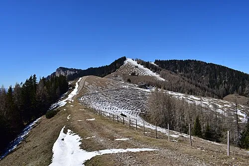 Tyrnauer Alpe Mountain, Styria3.6 km N
-
Passailer Alpe Mountain, Styria2.9 km NE
-
Buchkogel Mountain, Passail3.2 km E
-
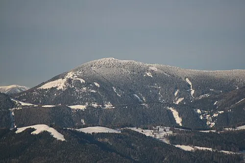 Hochlantsch Mountain, Pernegg an der Mur5.1 km NW
-
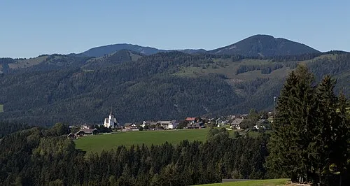 Schrottenkogel Mountain, Passail5 km E
-
Rote Wand Mountain, Styria4.2 km W
-
Frießenkogel Mountain, Breitenau am Hochlantsch4.7 km N
-
Grosser Friess Kogel Mountain, Breitenau am Hochlantsch5.2 km N
Sources & licences
Data last updated: