Gschaidberg
Located in Fladnitz an der Teichalm, Politischer Bezirk Weiz Coordinates: 47°18′19″ N 15°26′15″ E
- Elevation
- 1,240 m
- above sea level
- Local time
- UTC+01:00
- Europe/Vienna · UTC+01:00
- Airports
- GRZ Graz Airport35 km
- MBX Maribor Edvard Rusjan Airport94 km
About Gschaidberg
Gschaidberg is a mountain. Location: Fladnitz an der Teichalm, Politischer Bezirk Weiz. Elevation: 1,240 m. The best months to visit are June–August. The nearest airport is Graz Airport (35 km). Nearby sights include Gelderkogel and Sulberg.
Photos of Gschaidberg
-
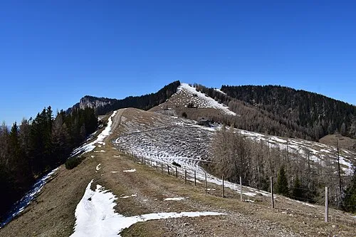
Tyrnauer Alpe Schreckgespenst · CC BY-SA 4.0 -
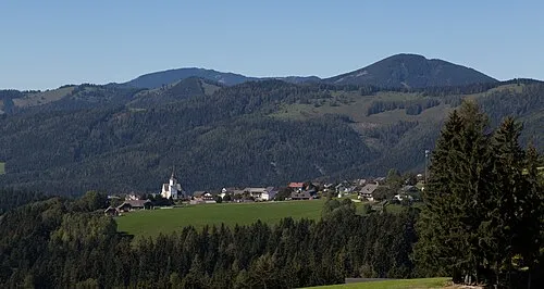
Schrottenkogel Christian Pirkl · CC BY-SA 4.0 -
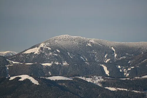
Hochlantsch Marion Schneider & Christoph Aistleitner - - - User:Mediocrity · Public domain


Climate of Gschaidberg
Best months for sightseeingBest months for sightseeing: June–August.
This month · November
A cold month
Day 3° · Night -5° · Rain 66 mm
- Hottest month
- July (day 19°)
- Coldest month
- January (night -9°)
- Wettest month
- July (139 mm)
- Driest month
- January (41 mm)
Bars: average monthly low and high temperature. Below: precipitation. Monthly averages for 1970–2000 at about 18 km resolution, adjusted for elevation. Highlighted months are mild and relatively dry. Source: WorldClim 2.1 (CC BY 4.0).
Show values as a table
| Month | Jan | Feb | Mar | Apr | May | Jun | Jul | Aug | Sep | Oct | Nov | Dec |
|---|---|---|---|---|---|---|---|---|---|---|---|---|
| Average high (°C) | -1° | 1° | 5° | 9° | 14° | 17° | 19° | 19° | 15° | 10° | 3° | 0° |
| Average low (°C) | -9° | -8° | -5° | -1° | 4° | 7° | 8° | 8° | 5° | 0° | -5° | -8° |
| Precipitation (mm) | 41 | 45 | 64 | 69 | 98 | 128 | 139 | 124 | 97 | 75 | 66 | 55 |
How to get to Gschaidberg
The nearest airport is Graz Airport (GRZ), 35 km to the south as the crow flies. The nearest large city is Graz, 26 km to the south.
Airports
- Graz Airport (GRZ) Feldkirchen bei Graz 35 kmsouth
- Maribor Edvard Rusjan Airport (MBX) Maribor 94 kmsouth
- Klagenfurt Airport (KLU) Klagenfurt am Wörthersee 111 kmsouthwest
Nearby large cities
- Graz Population: 303.3K 26 kmsouth
- Klagenfurt Population: 100.3K 115 kmsouthwest
- Linz Population: 204.8K 141 kmnorthwest
- Bratislava Population: 423.7K 156 kmnortheast
- Ljubljana Population: 272.2K 157 kmsouthwest
Straight-line distances; road distances are longer. Airport data: OurAirports.
Day trips from Gschaidberg
Within 100 km: 259 historic and cultural sites, 1,746 natural sites, 584 lakes, rivers and coasts.
0–25 km258 places
- Weißegg Mountain 18 kmS
- Zlatten Berg Mountain 11 kmW
- Zeiseleck Mountain 24 kmE
- Walzkogel Mountain 23 kmSW
25–60 km793 places
- Waldteiche Lake 43 kmSE
- Türnsee Lake 46 kmNW
- Teufelssee Lake 50 kmNW
- Sackwiesensee Lake 43 kmNW
60–100 km1,538 places
- Ribnica Lake Lake 90 kmS
- Pohorje Mountain 86 kmS
- Klamm Natural site 88 kmW
- Jezero Pernica Lake 83 kmS
Straight-line distances.
Nearest towns and villages
-
Nechnitz Village, Fladnitz an der Teichalm1 km SW
-
Tulwitzdorf Village, Fladnitz an der Teichalm2.1 km S
-
Tyrnau Village, Fladnitz an der Teichalm2 km NW
-
Vordertyrnau Village, Fladnitz an der Teichalm0.7 km SW
-
Hinterberg Village, Fladnitz an der Teichalm1.1 km SE
-
Schrems Village, Fladnitz an der Teichalm3.3 km SE
Nearby attractions & nature
Everything nearby-
Gelderkogel Mountain, Fladnitz an der Teichalm2.3 km E
-
Sulberg Mountain, Fladnitz an der Teichalm2 km SW
-
Gschieskogel Mountain, Fladnitz an der Teichalm2.9 km SW
-
Rote Wand Mountain, Styria3.5 km NW
-
Hochlantsch Mountain, Pernegg an der Mur5.2 km N
-
Gerlerkogel Mountain, Fladnitz an der Teichalm3.7 km NE
-
Tyrnauer Alpe Mountain, Styria5.1 km N
-
Röthelstein Mountain, Pernegg an der Mur4.5 km NW
Sources & licences
Data last updated: