- Elevation
- 2,758 m
- above sea level
- Local time
- UTC+01:00
- Europe/Vienna · UTC+01:00
- Airports
- INN Innsbruck Airport61 km
- BZO Bolzano Airport64 km
About Hintere Ölgrubenspitzen
Hintere Ölgrubenspitzen is a mountain. Location: Kaunertal, Landeck. Elevation: 2,758 m. The nearest airport is Innsbruck Airport (61 km). Nearby sights include Hochvernagtspitze and Vordere Ölgrubenspitzen.
Photos of Hintere Ölgrubenspitzen
-
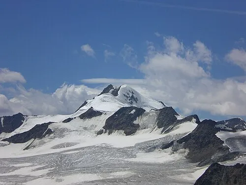
Wildspitze Pirmin Olde Weghuis · CC BY-SA 3.0 -
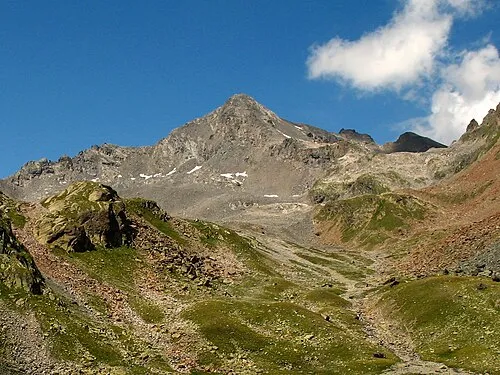
Glockturm Christoph Praxmarer · CC BY-SA 2.5 -
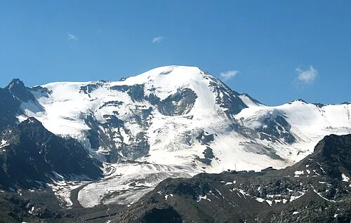
Weisssee Spitze Christoph Praxmarer · CC BY-SA 2.5


Climate of Hintere Ölgrubenspitzen
This month · November
A cold month
Day -4° · Night -9° · Rain 93 mm
- Hottest month
- August (day 8°)
- Coldest month
- February (night -14°)
- Wettest month
- July (119 mm)
- Driest month
- October (74 mm)
Bars: average monthly low and high temperature. Below: precipitation. Monthly averages for 1970–2000 at about 18 km resolution, adjusted for elevation. Highlighted months are mild and relatively dry. Source: WorldClim 2.1 (CC BY 4.0).
Show values as a table
| Month | Jan | Feb | Mar | Apr | May | Jun | Jul | Aug | Sep | Oct | Nov | Dec |
|---|---|---|---|---|---|---|---|---|---|---|---|---|
| Average high (°C) | -8° | -8° | -6° | -4° | 1° | 5° | 7° | 8° | 5° | 1° | -4° | -6° |
| Average low (°C) | -14° | -14° | -12° | -9° | -5° | -2° | 1° | 1° | -2° | -4° | -9° | -12° |
| Precipitation (mm) | 85 | 77 | 97 | 95 | 89 | 111 | 119 | 108 | 84 | 74 | 93 | 91 |
How to get to Hintere Ölgrubenspitzen
The nearest airport is Innsbruck Airport (INN), 61 km to the northeast as the crow flies. The nearest large city is Innsbruck, 64 km to the northeast.
Airports
- Innsbruck Airport (INN) Innsbruck 61 kmnortheast
- Bolzano Airport (BZO) Bolzano (BZ) 64 kmsoutheast
- Sankt Gallen Altenrhein Airport (ACH) St. Gallen 113 kmnorthwest
Nearby large cities
- Innsbruck Population: 132.5K 64 kmnortheast
- Munich Population: 1.5M 152 kmnortheast
- Augsburg Population: 301.1K 166 kmnorth
- Winterthur Population: 111.8K 170 kmnorthwest
- Zurich Population: 415.4K 177 kmwest
Straight-line distances; road distances are longer. Airport data: OurAirports.
Day trips from Hintere Ölgrubenspitzen
Within 100 km: 178 historic and cultural sites, 5,630 natural sites, 921 lakes, rivers and coasts.
0–25 km314 places
- Piz Russenna Mountain 24 kmW
- Piz Ajüz Mountain 25 kmW
- Piz Nair Mountain 24 kmW
- Mot dal Müs-chel Mountain 25 kmW
25–60 km1,651 places
- Lai da Juata Lake 42 kmSW
- Lai Sura Lake 52 kmW
- Lai Verd Lake 47 kmW
- Lai da Costainas Lake 44 kmSW
60–100 km4,764 places
- Bayerisches Oberland Mountain 97 kmNE
- Spadalone Mountain 83 kmS
- Chaviolas Island 93 kmSW
- Lajets Lake 100 kmSW
Straight-line distances.
Nearest towns and villages
Nearby attractions & nature
Everything nearby-
Hochvernagtspitze Mountain, Sölden2.2 km E
-
Vordere Ölgrubenspitzen Mountain, Tyrol2.8 km N
-
Sexegertenferner Natural site, Tyrol3.1 km NE
-
Krumgampen Bach River, Tyrol2.5 km W
-
Weisssee Spitze Mountain, Curon Venosta/Graun im Vinschgau5.6 km SW
-
Fluchtkogel Mountain, Kaunertal3.9 km S
-
Kesselwand Spitze Mountain, Sölden3.9 km S
-
Gepatsch Ferner Natural site, Austria3.9 km S
More nature in Austria
-
Glockturm Mountain, Kaunertal7.7 km W
-
Rifflerkar Spitze Mountain, Kaunertal6.6 km W
-
Blick Kopf Mountain, Kaunertal4.1 km N
-
Blickspitze Mountain, Kaunertal4.2 km N
-
Nörderberg Mountain, Kaunertal4.2 km SW
-
Adams Kogl Mountain, Kaunertal7.5 km NW
Sources & licences
Data last updated: