Ochsenwald
Located in Tyrol, Austria Coordinates: 47°08′00″ N 12°26′00″ E
- Elevation
- 2,331 m
- above sea level
- Local time
- UTC+01:00
- Europe/Vienna · UTC+01:00
About Ochsenwald
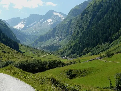
Ochsenwald is a natural site. Location: Tyrol, Austria.
In comparison
- 193 sights and natural places within 10 km Zeigerpalfen, Gschlössbach
Nearest towns and villages
-
Innergschlöss Village, Matrei in Osttirol2.2 km SE
-
Tauer Village, Matrei in Osttirol3.8 km SE
-
Hollersbach im Pinzgau Municipality, Zell am See District8.6 km N
-
Matrei in Osttirol Municipality, Politischer Bezirk Lienz10 km SE
-
Felbertauern Village, Matrei in Osttirol5.4 km E
-
Mittersill Municipality, Zell am See District12 km N
Nearby attractions & nature
Everything nearby-
Zeigerpalfen Mountain, Matrei in Osttirol<0.1 km N
-
Gschlössbach River, Tyrol<0.1 km N
-
Abretterkees Natural site, State of Salzburg1.9 km N
-
Schlattenbach River, Tyrol1.9 km S
-
Roßebenbach River, Tyrol2.2 km SE
-
Bodenbach River, Tyrol2.2 km SE
-
Vorderer Kesselkogel Mountain, Matrei in Osttirol1.3 km W
-
Salzbodensee Lake, Tyrol1.9 km S
More nature in Austria
-
 Abretter Mountain, Matrei in Osttirol1.9 km N
-
Innerer Kesselkopf Mountain, Matrei in Osttirol2.5 km W
-
Mülleter Bichl Mountain, Matrei in Osttirol2.5 km W
-
Kratzenberg Mountain, Matrei in Osttirol3.1 km NW
-
Hinterer Plattenkogel Mountain, Matrei in Osttirol3.1 km SE
-
Vorderer Plattenkogel Mountain, Matrei in Osttirol3.1 km SE
Sources & licences
Data last updated: