Habicht
Located in Gschnitz, Politischer Bezirk Innsbruck Land Coordinates: 47°02′37″ N 11°17′23″ E
- Elevation
- 3,277 m
- above sea level
- Local time
- UTC+01:00
- Europe/Vienna · UTC+01:00
- Airports
- INN Innsbruck Airport24 km
- BZO Bolzano Airport65 km
About Habicht
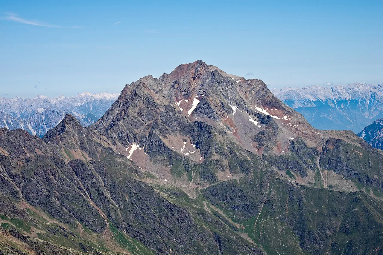
Habicht is a mountain. Location: Gschnitz, Politischer Bezirk Innsbruck Land. Elevation: 3,277 m.
The Habicht is a mountain in the Stubai Alps of Austria. For a long time, the locals believed it to be the highest mountain in Tyrol, due to its prominence above the surrounding mountains. Despite what they thought, the highest peak in the Stubai Alps is Zuckerhütl which is 230 metres higher than Habicht. The name literally means "hawk" in German.
Source: Wikipedia · CC BY-SA 4.0
At a glance
- Topographic prominence
- 523 m
Source: Wikidata
Photos of Habicht
-

FkMohr · CC BY-SA 3.0 de -

Jörg Braukmann · CC BY-SA 4.0 -

Jörg Braukmann · CC BY-SA 4.0 -

k.u.k. Militärgeographisches Institut · Public domain -

Matthias Frank · CC BY-SA 4.0


Climate of Habicht
This month · November
A cold month
Day -8° · Night -13° · Rain 81 mm
- Hottest month
- July (day 6°)
- Coldest month
- February (night -17°)
- Wettest month
- July (136 mm)
- Driest month
- February (56 mm)
Bars: average monthly low and high temperature. Below: precipitation. Monthly averages for 1970–2000 at about 18 km resolution, adjusted for elevation. Highlighted months are mild and relatively dry. Source: WorldClim 2.1 (CC BY 4.0).
Show values as a table
| Month | Jan | Feb | Mar | Apr | May | Jun | Jul | Aug | Sep | Oct | Nov | Dec |
|---|---|---|---|---|---|---|---|---|---|---|---|---|
| Average high (°C) | -11° | -11° | -8° | -6° | 0° | 3° | 6° | 6° | 3° | -2° | -8° | -10° |
| Average low (°C) | -17° | -17° | -15° | -12° | -8° | -5° | -3° | -2° | -5° | -8° | -13° | -16° |
| Precipitation (mm) | 61 | 56 | 76 | 85 | 101 | 129 | 136 | 123 | 90 | 75 | 81 | 69 |
How to get to Habicht
The nearest airport is Innsbruck Airport (INN), 24 km to the north as the crow flies. The nearest large city is Innsbruck, 26 km to the north.
Airports
- Innsbruck Airport (INN) Innsbruck 24 kmnorth
- Bolzano Airport (BZO) Bolzano (BZ) 65 kmsouth
- Memmingen Allgau Airport (FMM) Memmingen 132 kmnorthwest
Nearby large cities
- Innsbruck Population: 132.5K 26 kmnorth
- Munich Population: 1.5M 123 kmnorth
- Augsburg Population: 301.1K 151 kmnorth
- Salzburg Population: 157.2K 157 kmnortheast
- Ulm Population: 120.5K 179 kmnorthwest
Straight-line distances; road distances are longer. Airport data: OurAirports.
Day trips from Habicht
Within 100 km: 143 historic and cultural sites, 5,149 natural sites, 980 lakes, rivers and coasts.
0–25 km263 places
- Wild See Lake 21 kmE
- Wannensee Lake 20 kmSW
- Taxersee Lake 25 kmNW
- Seekar See Lake 19 kmSW
25–60 km1,443 places
- Wildsee Lake 31 kmN
- Wilder See Lake 31 kmW
- Weissensee Lake 48 kmNW
- Wasensee Lake 58 kmW
60–100 km4,566 places
- Bayerisches Oberland Mountain 68 kmN
- Schloss Hirschberg am Haarsee Historic site 86 kmN
- Lai da Juata Lake 85 kmSW
- Lai Sura Lake 95 kmW
Straight-line distances.
Nearest towns and villages
-
Gschnitz Village, Gschnitz4.7 km E
-
Laponesalm Village, Gschnitz3.1 km S
-
Neustift im Stubaital Municipality, Politischer Bezirk Innsbruck Land7.6 km N
-
Volderau Village, Neustift im Stubaital4 km NW
-
Gasteig Village, Neustift im Stubaital4 km NW
-
Neustift Village, Neustift im Stubaital8.4 km N
Nearby attractions & nature
Everything nearby-
Glättespitze Mountain, Gschnitz1 km SW
-
Manteler Mountain, Neustift im Stubaital1.6 km N
-
Kalkwand Mountain, Neustift im Stubaital2.3 km E
-
Kelderer Mountain, Neustift im Stubaital2.4 km N
-
Ilmspitze Mountain, Gschnitz3.4 km NE
-
Ochsenkogel Mountain, Neustift im Stubaital2.9 km SW
-
Schafspitze Mountain, Neustift im Stubaital3.1 km N
-
 Äußere Wetterspitze Mountain, Neustift im Stubaital4.8 km SW
Sources & licences
Data last updated: · 2 independent sources