Schwarze Wand
Located in Gschnitz, Politischer Bezirk Innsbruck Land Coordinates: 47°00′00″ N 11°21′00″ E
- Elevation
- 2,159 m
- above sea level
- Local time
- UTC+01:00
- Europe/Vienna · UTC+01:00
- Airports
- INN Innsbruck Airport29 km
- BZO Bolzano Airport60 km
About Schwarze Wand
Schwarze Wand is a mountain. Location: Gschnitz, Politischer Bezirk Innsbruck Land. Elevation: 2,159 m. The nearest airport is Innsbruck Airport (29 km). Nearby sights include Tribulaun di Dentro and Parete Bianca.
Photos of Schwarze Wand
-
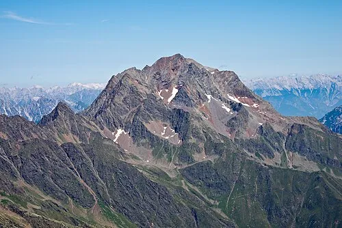
Habicht Jörg Braukmann · CC BY-SA 4.0 -
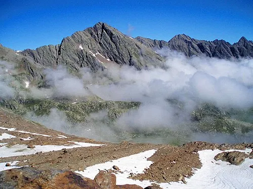
Äußere Wetterspitze Benutzer:Hejkal · CC BY-SA 3.0 -
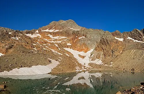
Monte della Neve Jörg Braukmann · CC BY-SA 4.0


Climate of Schwarze Wand
This month · November
A cold month
Day -1° · Night -7° · Rain 63 mm
- Hottest month
- July (day 14°)
- Coldest month
- January (night -10°)
- Wettest month
- July (121 mm)
- Driest month
- February (36 mm)
Bars: average monthly low and high temperature. Below: precipitation. Monthly averages for 1970–2000 at about 18 km resolution, adjusted for elevation. Highlighted months are mild and relatively dry. Source: WorldClim 2.1 (CC BY 4.0).
Show values as a table
| Month | Jan | Feb | Mar | Apr | May | Jun | Jul | Aug | Sep | Oct | Nov | Dec |
|---|---|---|---|---|---|---|---|---|---|---|---|---|
| Average high (°C) | -4° | -3° | 0° | 3° | 8° | 12° | 14° | 14° | 11° | 6° | -1° | -4° |
| Average low (°C) | -10° | -10° | -8° | -5° | -1° | 3° | 5° | 5° | 2° | -2° | -7° | -9° |
| Precipitation (mm) | 39 | 36 | 50 | 64 | 87 | 117 | 121 | 112 | 84 | 71 | 63 | 45 |
How to get to Schwarze Wand
The nearest airport is Innsbruck Airport (INN), 29 km to the north as the crow flies. The nearest large city is Innsbruck, 29 km to the north.
Airports
- Innsbruck Airport (INN) Innsbruck 29 kmnorth
- Bolzano Airport (BZO) Bolzano (BZ) 60 kmsouth
- Memmingen Allgau Airport (FMM) Memmingen 138 kmnorthwest
Nearby large cities
- Innsbruck Population: 132.5K 29 kmnorth
- Munich Population: 1.5M 128 kmnorth
- Salzburg Population: 157.2K 156 kmnortheast
- Augsburg Population: 301.1K 156 kmnorth
- Ulm Population: 120.5K 186 kmnorthwest
Straight-line distances; road distances are longer. Airport data: OurAirports.
Day trips from Schwarze Wand
Within 100 km: 139 historic and cultural sites, 5,061 natural sites, 950 lakes, rivers and coasts.
0–25 km237 places
- Wild See Lake 16 kmE
- Wannensee Lake 22 kmW
- Seekar See Lake 22 kmW
- Obernberger See Lake 4 kmSE
25–60 km1,345 places
- Wildsee Lake 37 kmN
- Wilder See Lake 37 kmW
- Weissensee Lake 55 kmNW
- Torseen Lake 31 kmNE
60–100 km4,568 places
- Bayerisches Oberland Mountain 73 kmN
- Schloss Hirschberg am Haarsee Historic site 91 kmN
- Lai da Juata Lake 87 kmSW
- Lai Sura Lake 98 kmW
Straight-line distances.
Nearest towns and villages
-
Gschnitz Village, Gschnitz5 km N
-
Fleres di Dentro Village, Brennero/Brenner3.9 km S
-
Obernberg am Brenner Municipality, Politischer Bezirk Innsbruck Land5.4 km E
-
Obernberg am Brenner Village, Obernberg am Brenner5.4 km E
-
Laponesalm Village, Gschnitz4.2 km NW
-
Reisenschuh Village, Brennero/Brenner6.2 km SE
Nearby attractions & nature
Everything nearby-
Tribulaun di Dentro Mountain, Tyrol1.1 km S
-
Parete Bianca Mountain, Austria4.2 km SW
-
Allerleigrubenspitze Mountain, Tyrol5.6 km E
-
Rötenspitze Mountain, Trins4.5 km NE
-
Habicht Mountain, Gschnitz6.7 km NW
-
Äußere Wetterspitze Mountain, Neustift im Stubaital7.3 km W
-
Sandesbach River, Tyrol3.9 km N
-
Monte della Neve Mountain, Brennero/Brenner7.7 km W
Sources & licences
Data last updated: · 2 independent sources