Stanzling
Located in Hopfgarten in Defereggen, Politischer Bezirk Lienz Coordinates: 46°56′38″ N 12°29′53″ E
- Elevation
- 2,715 m
- above sea level
- Local time
- UTC+01:00
- Europe/Vienna · UTC+01:00
- Airports
- INN Innsbruck Airport94 km
- SZG Salzburg Airport102 km
About Stanzling
Stanzling is a mountain. Location: Hopfgarten in Defereggen, Politischer Bezirk Lienz. Elevation: 2,715 m. The nearest airport is Innsbruck Airport (94 km). Nearby sights include Deferegger Riegel and Kreuzberg.
Photos of Stanzling
-
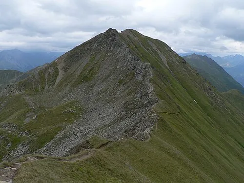
Donnerstein Martin Vavrik · Public domain -
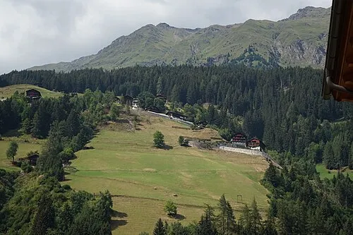
Deferegger Riegel PantheraLeo1359531 · CC BY-SA 4.0 -
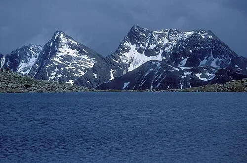
Deferegger Alpen Mathias Zehring · CC BY 3.0


Climate of Stanzling
This month · November
A wet month
Day -4° · Night -10° · Rain 103 mm
- Hottest month
- July (day 9°)
- Coldest month
- February (night -14°)
- Wettest month
- July (165 mm)
- Driest month
- February (68 mm)
Bars: average monthly low and high temperature. Below: precipitation. Monthly averages for 1970–2000 at about 18 km resolution, adjusted for elevation. Highlighted months are mild and relatively dry. Source: WorldClim 2.1 (CC BY 4.0).
Show values as a table
| Month | Jan | Feb | Mar | Apr | May | Jun | Jul | Aug | Sep | Oct | Nov | Dec |
|---|---|---|---|---|---|---|---|---|---|---|---|---|
| Average high (°C) | -8° | -7° | -5° | -2° | 4° | 7° | 9° | 9° | 6° | 2° | -4° | -7° |
| Average low (°C) | -14° | -14° | -12° | -9° | -4° | -1° | 1° | 2° | -1° | -5° | -10° | -12° |
| Precipitation (mm) | 70 | 68 | 87 | 100 | 122 | 147 | 165 | 151 | 113 | 100 | 103 | 80 |
How to get to Stanzling
The nearest airport is Innsbruck Airport (INN), 94 km to the west as the crow flies. The nearest large city is Innsbruck, 91 km to the northwest.
Airports
- Innsbruck Airport (INN) Innsbruck 94 kmwest
- Salzburg Airport (SZG) Salzburg 102 kmnorth
- Bolzano Airport (BZO) Bolzano (BZ) 105 kmsouthwest
Nearby large cities
- Innsbruck Population: 132.5K 91 kmnorthwest
- Salzburg Population: 157.2K 104 kmnortheast
- Klagenfurt Population: 100.3K 142 kmeast
- Munich Population: 1.5M 150 kmnorthwest
- Ljubljana Population: 272.2K 183 kmsoutheast
Straight-line distances; road distances are longer. Airport data: OurAirports.
Day trips from Stanzling
Within 100 km: 149 historic and cultural sites, 4,032 natural sites, 767 lakes, rivers and coasts.
0–25 km633 places
- Sille River 19 kmS
- Fürlegsee Lake 23 kmNE
- Vorderer Langtalsee Lake 23 kmE
- Eissee Lake 16 kmNW
25–60 km1,632 places
- Brandlsee Lake 38 kmNE
- Brechlsee Lake 37 kmNE
- Schmiedingersee Lake 32 kmNE
- Hacklsee Lake 31 kmN
60–100 km2,683 places
- Prestreljenik Mountain 99 kmSE
- Piz Gralba Mountain 72 kmSW
- Piz Miara Mountain 71 kmSW
- Croda Nera Mountain 79 kmSW
Straight-line distances.
Nearest towns and villages
-
Hof Village, Hopfgarten in Defereggen2.1 km S
-
Moos Village, St. Veit in Defereggen2.1 km SW
-
Plon Village, Hopfgarten in Defereggen3.2 km S
-
Rajach Village, Hopfgarten in Defereggen2.7 km SE
-
Hopfgarten in Defereggen Village, Hopfgarten in Defereggen4 km SE
-
Dölach Village, Hopfgarten in Defereggen4.1 km E
Nearby attractions & nature
Everything nearby-
Deferegger Riegel Mountain, Matrei in Osttirol0.7 km N
-
Kreuzberg Mountain, Matrei in Osttirol0.7 km N
-
Großer Zunig Mountain, Matrei in Osttirol2 km NE
-
Reiterboden Mountain, Virgen3.2 km N
-
Kleine Zunig Mountain, Matrei in Osttirol2.9 km NE
-
Donnerstein Mountain, Virgen5.3 km W
-
Firstkogel Mountain, Hopfgarten in Defereggen5 km SE
-
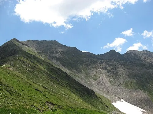 Roter Kogel Mountain, Kals am Großglockner8.7 km NE
Sources & licences
Data last updated: