Hochstadel
Located in Lavant, Politischer Bezirk Lienz Coordinates: 46°45′37″ N 12°51′24″ E
- Elevation
- 2,681 m
- above sea level
- Local time
- UTC+01:00
- Europe/Vienna · UTC+01:00
- Airports
- TRS Trieste Airport114 km
- KLU Klagenfurt Airport114 km
About Hochstadel
Hochstadel is a mountain. Location: Lavant, Politischer Bezirk Lienz. Elevation: 2,681 m.
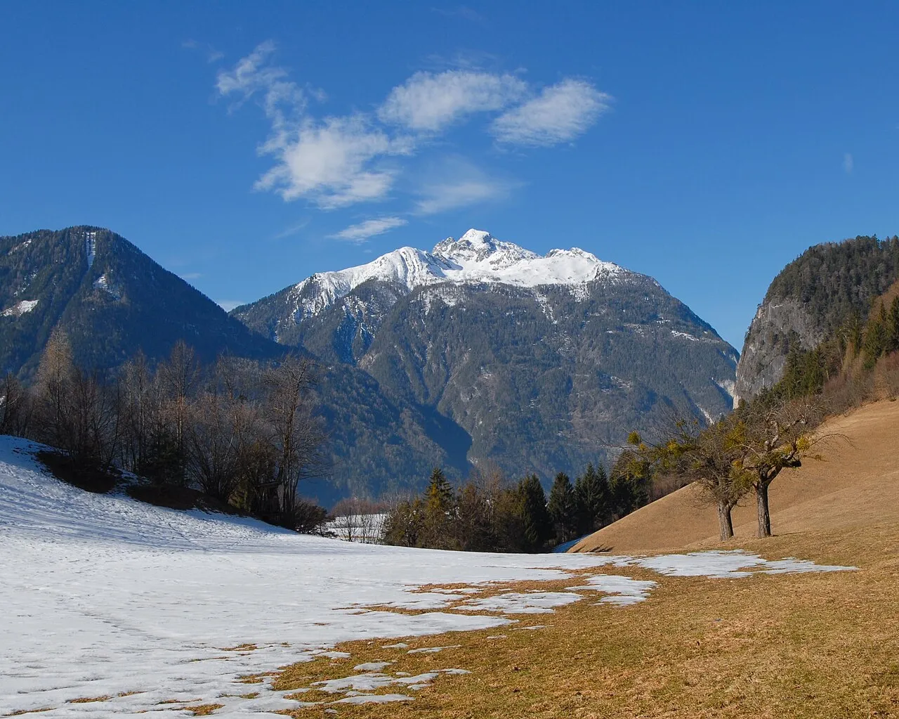
Hochstadel (2,681 m) is a mountain of the Lienz Dolomites in Carinthia, Austria. A solitary peak on the eastern edge of the range, it's towering 1,300 m high north face represents one of the toughest climbs in the Eastern Alps. The normal route is from the east-west Drei Törl Weg (Three Passes Trail) which passes at the southern foot of the mountain. The extensive views from its summit include the rest of Lienz Dolomites, the High Tauern to the north and the Carnic Alps to the south.
Source: Wikipedia · CC BY-SA 4.0
At a glance
- Topographic prominence
- 334 m
Source: Wikidata
Photos of Hochstadel
-

Dan ST wik · CC BY-SA 4.0 -

Tesla Delacroix · CC BY-SA 4.0 -

PantheraLeo1359531 · CC BY-SA 4.0 -

Naturpuur · CC BY-SA 4.0 -

Tesla Delacroix · CC BY-SA 4.0


Climate of Hochstadel
This month · November
A cold month
Day -5° · Night -12° · Rain 99 mm
- Hottest month
- July (day 11°)
- Coldest month
- January (night -17°)
- Wettest month
- July (150 mm)
- Driest month
- February (52 mm)
Bars: average monthly low and high temperature. Below: precipitation. Monthly averages for 1970–2000 at about 18 km resolution, adjusted for elevation. Highlighted months are mild and relatively dry. Source: WorldClim 2.1 (CC BY 4.0).
Show values as a table
| Month | Jan | Feb | Mar | Apr | May | Jun | Jul | Aug | Sep | Oct | Nov | Dec |
|---|---|---|---|---|---|---|---|---|---|---|---|---|
| Average high (°C) | -9° | -7° | -4° | 0° | 5° | 8° | 11° | 10° | 7° | 2° | -5° | -9° |
| Average low (°C) | -17° | -16° | -13° | -10° | -5° | -2° | 0° | 0° | -3° | -7° | -12° | -16° |
| Precipitation (mm) | 57 | 52 | 72 | 92 | 114 | 139 | 150 | 135 | 117 | 112 | 99 | 70 |
How to get to Hochstadel
The nearest airport is Trieste Airport (TRS), 114 km to the southeast as the crow flies. The nearest large city is Klagenfurt, 112 km to the east.
Airports
- Trieste Airport (TRS) Ronchi dei Legionari/Trieste 114 kmsoutheast
- Klagenfurt Airport (KLU) Klagenfurt am Wörthersee 114 kmeast
- Salzburg Airport (SZG) Salzburg 115 kmnorth
Nearby large cities
- Klagenfurt Population: 100.3K 112 kmeast
- Salzburg Population: 157.2K 116 kmnorth
- Innsbruck Population: 132.5K 124 kmnorthwest
- Munich Population: 1.5M 181 kmnorthwest
- Graz Population: 303.3K 200 kmeast
Straight-line distances; road distances are longer. Airport data: OurAirports.
Day trips from Hochstadel
Within 100 km: 131 historic and cultural sites, 3,530 natural sites, 664 lakes, rivers and coasts.
0–25 km269 places
- Wolayersee Lake 16 kmS
- Wagenitzsee Lake 19 kmN
- Striedensee Lake 25 kmNE
- Gössnitzersee Lake 24 kmNE
25–60 km1,619 places
- Sille River 32 kmW
- Fürlegsee Lake 45 kmNW
- Vorderer Langtalsee Lake 27 kmN
- Eissee Lake 50 kmNW
60–100 km2,437 places
- Hoher Dachstein Mountain 98 kmNE
- Piz Gralba Mountain 86 kmW
- Piz Miara Mountain 85 kmW
- Croda Nera Mountain 90 kmSW
Straight-line distances.
Nearest towns and villages
-
Lavant Village, Lavant4.5 km N
-
Tristach Municipality, Politischer Bezirk Lienz5.4 km NW
-
Nikolsdorf Municipality, Politischer Bezirk Lienz5.5 km NE
-
Nikolsdorf Village, Nikolsdorf5.2 km NE
-
Lengberg Village, Nikolsdorf5 km NE
-
Nörsach Village, Nikolsdorf5.2 km E
Nearby attractions & nature
Everything nearby-
Ober Lavanter Kolben Mountain, Lavant0.9 km NW
-
Kuhleitentörl Mountain, Lavant2.1 km SW
-
Große Sandspitze Mountain, Lavant2.7 km W
-
Kolbner Spitz Mountain, Oberdrauburg3.5 km E
-
Laserzkopf Mountain, Lavant3.1 km W
-
Rastenkogel Mountain, Oberdrauburg3.5 km E
-
 Riebenkofel Mountain, Lesachtal5.4 km SW
-
Roter Turm Mountain, Tristach4 km W
Sources & licences
Data last updated: · 2 independent sources