Politischer Bezirk Linz-Land
Located in Upper Austria, Austria Coordinates: 48°10′00″ N 14°18′00″ E
- Population
- 146,920
- 146.9K
- Elevation
- 297 m
- above sea level
- Local time
- UTC+01:00
- Europe/Vienna · UTC+01:00
- Places inside
- 22
- listed under Politischer Bezirk Linz-Land
About Politischer Bezirk Linz-Land
Politischer Bezirk Linz-Land is a district. Location: Upper Austria, Austria. Population: 146,920.
In comparison
- 9 sights and natural places within 10 km Sendeturm Fleckendorf, Mayrbäuerlfeld
- Listed here: Municipality: 22
Places in Politischer Bezirk Linz-Land
22 places-
Leonding Municipality28.1K
-
Traun Municipality24.3K
-
Ansfelden Municipality16K
-
Enns Municipality11.8K
-
Pasching Municipality7.5K
-
Asten Municipality6.6K
-
Neuhofen an der Krems Municipality6.2K
-
Sankt Florian Municipality6.1K
-
Hörsching Municipality6K
-
Wilhering Municipality5.9K
-
Sankt Marien Municipality4.7K
-
Pucking Municipality3.9K
-
Kronstorf Municipality3.4K
-
Kematen an der Krems Municipality2.8K
-
Kirchberg-Thening Municipality2.4K
-
Oftering Municipality2.1K
-
Niederneukirchen Municipality2K
-
Hofkirchen im Traunkreis Municipality1.9K
-
Piberbach Municipality1.9K
-
Hargelsberg Municipality1.4K
-
Allhaming Municipality1.1K
-
Eggendorf im Traunkreis Municipality929
Nature and heritage in Politischer Bezirk Linz-Land
-
Rosenberg Mountain, Hargelsberg
-
Rabenberg Mountain, Enns
-
Mayrbäuerlfeld Mountain, Niederneukirchen
-
Kürnbergburg Mountain, Wilhering
-
Basilika St. Laurentius Attraction, Enns
-
Römerturm Landmark, Wilhering
Nearby attractions & nature
Everything nearby-
Sipbach River, Upper Austria6.7 km NW
-
Krems River, Upper Austria7.5 km N
-
NDB-Funkfeuer LNZ Landmark, Linz8 km N
-
Schillen Berg Mountain, Linz8.3 km NE
-
Mühlbach River, Upper Austria9.4 km NW
-
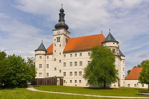 Hartheim Euthanasia Centre Historic site, Alkoven19 km NW
Sources & licences
Data last updated: