Pramet
Located in Ried im Innkreis District, Upper Austria Coordinates: 48°08′35″ N 13°29′14″ E
- Population
- 1,002
- 1K
- Elevation
- 508 m
- above sea level
- Local time
- UTC+01:00
- Europe/Vienna · UTC+01:00
- Places inside
- 11
- listed under Pramet
About Pramet
Pramet is a municipality. Location: Ried im Innkreis District, Upper Austria. Population: 1,002. Elevation: 508 m.
In comparison
- No. 22 of 36 places in Ried im Innkreis District by population
- Nearest larger town: Schildorn, 2 km W
- 6 sights and natural places within 10 km Göblberg, Göblberg
- Listed here: Village: 11
Places in Pramet
11 places-
Pramet Village410
-
Gutensham Village80
-
Hartlhof Village44
-
Lungdorf Village44
-
Gumpling Village43
-
Rödt Village43
-
Kleinpiesenham Village35
-
Feitzing Village23
-
Schmieding Village19
-
Ecklham Village5
-
Grosspiesenham Village
Nearby attractions & nature
Everything nearby-
Göblberg Mountain, Ampflwang im Hausruckwald5.9 km SE
-
Göblberg Mountain, Frankenburg am Hausruck6.3 km SE
-
Urhammer Berg Mountain, Ottnang am Hausruck7.7 km E
-
Hausruck Mountain, Upper Austria7.7 km E
-
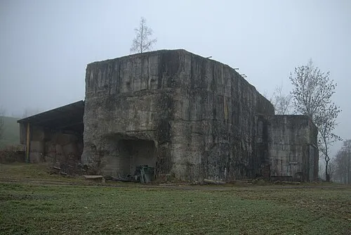 Redl Zipf Concentration Camp (Schlier) Historic site, Neukirchen an der Vöckla12 km S
-
Federnberg Mountain, Mehrnbach8.2 km NW
-
Turmberg Mountain, Haag am Hausruck9.7 km E
-
Schramer Höhe Mountain, Redleiten11 km SW
Sources & licences
Data last updated: