Eberschwang
Located in Ried im Innkreis District, Upper Austria Coordinates: 48°09′22″ N 13°33′39″ E
- Population
- 3,345
- 3.3K
- Elevation
- 520 m
- above sea level
- Local time
- UTC+01:00
- Europe/Vienna · UTC+01:00
- Places inside
- 37
- listed under Eberschwang
About Eberschwang
Eberschwang is a municipality. Location: Ried im Innkreis District, Upper Austria. Population: 3,345. Elevation: 520 m.
In comparison
- No. 2 of 36 places in Ried im Innkreis District by population
- Nearest larger town: Ampflwang im Hausruckwald, 7 km S
- 5 sights and natural places within 10 km Turmberg, Urhammer Berg
- Listed here: Village: 37
Places in Eberschwang
37 places-
Maierhof Village622
-
Eberschwang Village497
-
Leopoldshofstatt Village251
-
Mühring Village120
-
Feichtet Village114
-
Oberbreitsach Village111
-
Albertsham Village108
-
Vocking Village105
-
Teichterberg Village101
-
Am Sportplatz Village97
-
Pumberg Village92
-
Königsberger Straße Village80
-
Fleischhacken Village77
-
An der Malzmühle Village69
-
Mitterbreitsach Village57
-
Ötzling Village49
-
Wappeltsham Village48
-
Wolfharting Village46
-
Antiesen Village44
-
Anetsham Village41
-
Hötzing Village41
-
Moos Village41
-
Greifenedt Village40
-
Walling Village37
-
Illing Village33
-
Reinthal Village32
-
Anhang Village31
-
Eichetsham Village29
-
Aspach Village28
-
Königsberg Village28
-
Felling Village25
-
Prinsach Village25
-
Edt Village21
-
Putting Village21
-
Wörling Village10
-
Leopoldshofstadt Village
-
Strass Village
Nearby attractions & nature
Everything nearby-
Turmberg Mountain, Haag am Hausruck4.2 km E
-
Urhammer Berg Mountain, Ottnang am Hausruck4.7 km S
-
Hausruck Mountain, Upper Austria4.7 km S
-
Göblberg Mountain, Ampflwang im Hausruckwald6.6 km S
-
Göblberg Mountain, Frankenburg am Hausruck7.5 km S
-
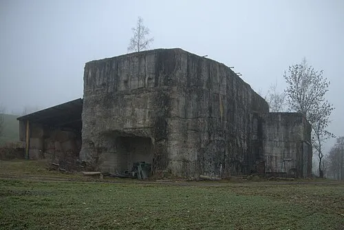 Redl Zipf Concentration Camp (Schlier) Historic site, Neukirchen an der Vöckla14 km S
-
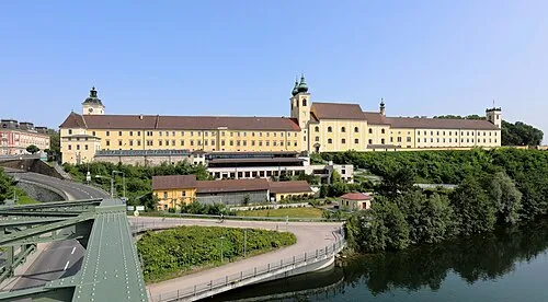 Lambach Abbey Attraction, Lambach25 km E
-
Reschfeld Mountain, Taiskirchen im Innkreis10 km N
Sources & licences
Data last updated: