Grabner
Located in Großraming, Steyr-Land District Coordinates: 47°49′21″ N 14°31′37″ E
- Elevation
- 577 m
- above sea level
- Local time
- UTC+01:00
- Europe/Vienna · UTC+01:00
About Grabner
Grabner is a village. Location: Großraming, Steyr-Land District. Elevation: 577 m.
In comparison
- Nearest larger town: Brunnbach, 2 km NW
- 48 sights and natural places within 10 km Hehenberg, Gamsstein
Nearby attractions & nature
Everything nearby-
Hehenberg Mountain, Großraming0.8 km SE
-
Gamsstein Mountain, Großraming1.3 km N
-
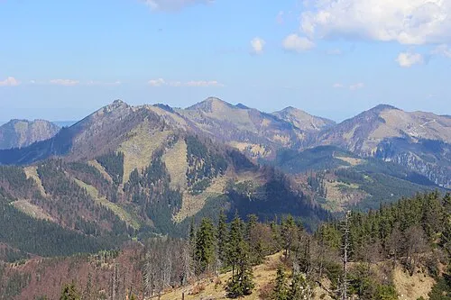 Grosser Alpkogel Mountain, Weyer3.1 km E
-
Sonnwendkogel Mountain, Großraming2.8 km SW
-
Sender Lumplgraben Landmark, Großraming3 km NW
-
Kleiner Reithpfadkogel Mountain, Reichraming3.5 km W
Sources & licences
Data last updated: