Niederthalheim
Located in Vöcklabruck District, Upper Austria Coordinates: 48°05′59″ N 13°45′12″ E
- Population
- 1,092
- 1.1K
- Elevation
- 445 m
- above sea level
- Local time
- UTC+01:00
- Europe/Vienna · UTC+01:00
- Places inside
- 18
- listed under Niederthalheim
About Niederthalheim
Niederthalheim is a municipality. Location: Vöcklabruck District, Upper Austria. Population: 1,092. Elevation: 445 m.
In comparison
- No. 41 of 52 places in Vöcklabruck District by population
- Nearest larger town: Atzbach, 4 km SW
- 7 sights and natural places within 10 km Bachmanning Concentration Camp, Ager
- Listed here: Village: 18
Places in Niederthalheim
18 places-
Niederthalheim Village478
-
Iming Village87
-
Windham Village62
-
Hehenberg Village42
-
Albertsham Village39
-
Kaiting Village39
-
Rankar Village37
-
Penetzdorf Village36
-
Wufing Village34
-
Viert Village31
-
Pengering Village26
-
Hainbach Village24
-
Öldenberg Village23
-
Obersteindlberg Village15
-
Bergham Village14
-
Untersteindlberg Village12
-
Koppl Village7
-
Weikharting Village6
Nearby attractions & nature
Everything nearby-
Bachmanning Concentration Camp Historic site, Bachmanning4.6 km NE
-
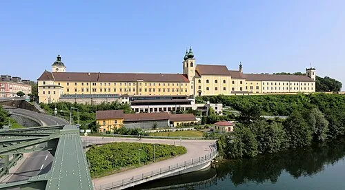 Lambach Abbey Attraction, Lambach9.3 km E
-
Schloss Würting Historic site, Offenhausen7.7 km NE
-
Ager River, Upper Austria7.4 km E
-
Sankt Veit Attraction, Meggenhofen8.8 km NE
-
Traunfall Natural site, Desselbrunn9.9 km S
-
Redl Bach River, Upper Austria9.2 km S
-
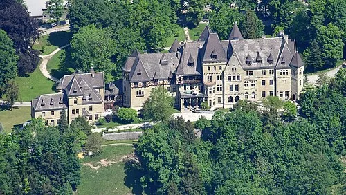 Cumberland Castle Historic site, Gmunden20 km S
Sources & licences
Data last updated: