Rüstorf
Located in Vöcklabruck District, Upper Austria Coordinates: 48°02′49″ N 13°48′26″ E
- Population
- 2,110
- 2.1K
- Elevation
- 405 m
- above sea level
- Local time
- UTC+01:00
- Europe/Vienna · UTC+01:00
- Places inside
- 13
- listed under Rüstorf
About Rüstorf
Rüstorf is a municipality. Location: Vöcklabruck District, Upper Austria. Population: 2,110. Elevation: 405 m.
In comparison
- No. 21 of 52 places in Vöcklabruck District by population
- Nearest larger town: Schwanenstadt, 2 km W
- 12 sights and natural places within 10 km Traunfall, Ager
- Listed here: Village: 13
Places in Rüstorf
13 places-
Kaufing Village551
-
Rüstorf Village498
-
Mühlwang Village334
-
Johannisthal Village219
-
Pfaffenberg Village118
-
Neudorf Village64
-
Mitterbergholz Village49
-
Eglau Village47
-
Kreut Village23
-
Buchleiten Village21
-
Roith Village19
-
Ebersäuln Village8
-
Niederharrern Village
Nearby attractions & nature
Everything nearby-
Traunfall Natural site, Desselbrunn3.5 km S
-
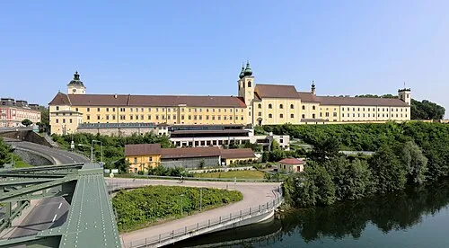 Lambach Abbey Attraction, Lambach7.1 km NE
-
Ager River, Upper Austria5.2 km NE
-
Redl Bach River, Upper Austria5.4 km SW
-
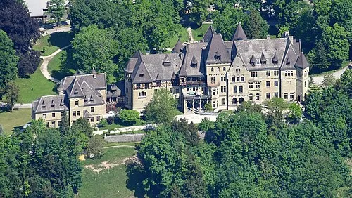 Cumberland Castle Historic site, Gmunden13 km S
-
Aurach River, Upper Austria7.6 km SW
-
Schloss Almegg Historic site, Steinerkirchen an der Traun8.5 km E
-
Laudachbach River, Upper Austria8.3 km E
Sources & licences
Data last updated: