Oberwang
Located in Vöcklabruck District, Upper Austria Coordinates: 47°51′42″ N 13°26′16″ E
- Population
- 1,676
- 1.7K
- Elevation
- 562 m
- above sea level
- Local time
- UTC+01:00
- Europe/Vienna · UTC+01:00
- Places inside
- 15
- listed under Oberwang
About Oberwang
Oberwang is a municipality. Location: Vöcklabruck District, Upper Austria. Population: 1,676. Elevation: 562 m.
In comparison
- No. 25 of 52 places in Vöcklabruck District by population
- Nearest larger town: Mondsee, 6 km SW
- 23 sights and natural places within 10 km Kulmspitze, Rossmoos
- Listed here: Village: 15
Places in Oberwang
15 places-
Oberwang Village608
-
Grossenschwandt Village320
-
Oberaschau Village240
-
Traschwandt Village190
-
Gessenschwandt Village186
-
Radau Village164
-
Bachau Village
-
Haslau Village
-
Hochegg Village
-
Ifang Village
-
Moar Village
-
Riedlbach Village
-
Riedschwandt Village
-
Sankt Konrad Village
-
Widmais Village
Nearby attractions & nature
Everything nearby-
Kulmspitze Mountain, Innerschwand2.7 km SW
-
Rossmoos Mountain, Nußdorf am Attersee3.3 km E
-
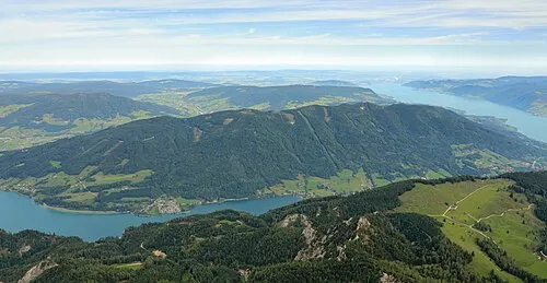 Hochplettspitz Mountain, Unterach am Attersee5 km SE
-
Ruezing River, Upper Austria4.3 km N
-
Mondseeberg Mountain, Tiefgraben5 km W
-
Kronberg Mountain, Straß im Attergau5.3 km NE
-
Saurüssel Mountain, Tiefgraben5.6 km NW
-
Lackenberg Mountain, Tiefgraben7.2 km W
Sources & licences
Data last updated: