Pfaffing
Located in Vöcklabruck District, Upper Austria Coordinates: 48°01′07″ N 13°28′00″ E
- Population
- 1,510
- 1.5K
- Elevation
- 564 m
- above sea level
- Local time
- UTC+01:00
- Europe/Vienna · UTC+01:00
- Places inside
- 23
- listed under Pfaffing
About Pfaffing
Pfaffing is a municipality. Location: Vöcklabruck District, Upper Austria. Population: 1,510. Elevation: 564 m.
In comparison
- No. 30 of 52 places in Vöcklabruck District by population
- Nearest larger town: Vöcklamarkt, 2 km SE
- 9 sights and natural places within 10 km Redl Bach, Redl Zipf Concentration Camp (Schlier)
- Listed here: Village: 23
Places in Pfaffing
23 places-
Pfaffing Village150
-
Sonnleiten Village131
-
Oberalberting Village112
-
Graben Village107
-
Weixlbaumerberg Village65
-
Holzpoint Village60
-
Außerreith Village55
-
Hausham Village54
-
Mesnerleiten Village49
-
Schweiber Village49
-
Forsterreith Village46
-
Kienleiten Village45
-
Frieding Village41
-
Tiefenbach Village41
-
Sieberer Village37
-
Kropfling Village32
-
Teicht Village28
-
Mitterberg Village26
-
Unterkogl Village20
-
Weixlbaum Village15
-
Oberkogl Village4
-
Obermoos Village1
-
Ausserhörgersteig Village
Nearby attractions & nature
Everything nearby-
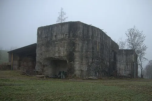 Redl Zipf Concentration Camp (Schlier) Historic site, Neukirchen an der Vöckla3.3 km NE
-
Redl Bach River, Upper Austria2.1 km S
-
Hobelsberg Mountain, Frankenburg am Hausruck4.3 km NW
-
Grosse Ach River, Upper Austria5.4 km SW
-
Schramer Höhe Mountain, Redleiten7.3 km NW
-
Halteis Mountain, Pöndorf7.6 km W
-
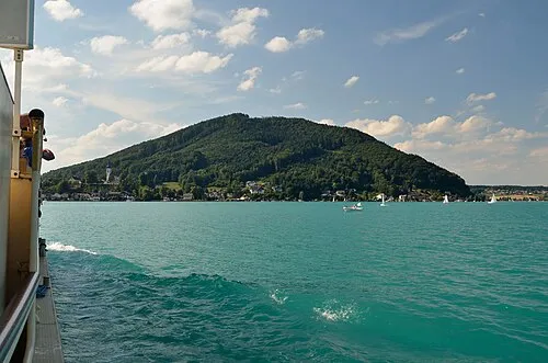 Buchberg Mountain, St Georgen im Attergau11 km SE
-
Schoibernberg Mountain, Oberhofen am Irrsee13 km SW
Sources & licences
Data last updated: