Klösterle
Located in Bludenz District, Vorarlberg Coordinates: 47°07′20″ N 10°07′42″ E
- Population
- 677
- 677
- Elevation
- 1,682 m
- above sea level
- Local time
- UTC+01:00
- Europe/Vienna · UTC+01:00
- Places inside
- 33
- listed under Klösterle
About Klösterle
Klösterle is a municipality. Location: Bludenz District, Vorarlberg. Population: 677. Elevation: 1,682 m.
In comparison
- No. 23 of 29 places in Bludenz District by population
- Nearest larger town: Dalaas, 8 km NW
- 142 sights and natural places within 10 km Oberer Rauher Kopf, Alpenkopf
- Listed here: Mountain: 29, Village: 4
Places in Klösterle
33 places-
Klösterle Village596
-
Stuben Village92
-
Alpenkopf Mountain
-
Arlberg Höhe Mountain
-
Blasegg Mountain
-
Blisadona Mountain
-
Blisadonagrat Mountain
-
Blisadonakopf Mountain
-
Blisadonaspitze Mountain
-
Burtschakopf Mountain
-
Eisentalerspitzen Mountain
-
Erzbergspitze Mountain
-
Goppelspitze Mountain
-
Große Grubenspitze Mountain
-
Kaltenberg Mountain
-
Langen Village
-
Oberer Rauher Kopf Mountain
-
Ochsenbodenkopf Mountain
-
Östliche Eisentalerspitze Mountain
-
Pfannenkopf Mountain
-
Plattingrat Mountain
-
Rohnspitze Mountain
-
Ronspitze Mountain
-
Roter Turm Mountain
-
Schnauzlberg Mountain
-
Schnauzlberg (Blisadonele) Mountain
-
Schwarzer Turm Mountain
-
Schwarzer Turm bei Klösterle Mountain
-
Trittkopf Mountain
-
Westliche Eisentalerspitze Mountain
-
Westliche Pazülfernerspitze Mountain
-
Westliche Wasenspitze Mountain
-
Wilden Village
Nearby attractions & nature
Everything nearby-
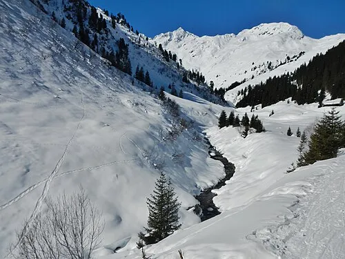 Albonkopf Mountain, St. Anton am Arlberg3 km SE
-
Maroispitze Mountain, Tyrol2.5 km SE
-
Stubener Albonakopf Mountain, St. Anton am Arlberg2.7 km SE
-
Krachelgrat Mountain, Tyrol2.8 km SE
-
Östlicher Maroikopf Mountain, St. Anton am Arlberg2.8 km E
-
Maroiköpfe Mountain, St. Anton am Arlberg3 km E
-
Krachenspitze Mountain, St. Anton am Arlberg3.1 km SE
-
Satteinser Spitze Mountain, Tyrol3.2 km S
Sources & licences
Data last updated: