Sankt Anton im Montafon
Located in Bludenz District, Vorarlberg Coordinates: 47°07′05″ N 9°52′25″ E
- Population
- 727
- 727
- Elevation
- 921 m
- above sea level
- Local time
- UTC+01:00
- Europe/Vienna · UTC+01:00
- Places inside
- 5
- listed under Sankt Anton im Montafon
About Sankt Anton im Montafon
Sankt Anton im Montafon is a municipality. Location: Bludenz District, Vorarlberg. Population: 727. Elevation: 921 m.
In comparison
- No. 19 of 29 places in Bludenz District by population
- Nearest larger town: Vandans, 3 km S
- 108 sights and natural places within 10 km Davenna, Davennakopf
- Listed here: Mountain: 3, Village: 2
Places in Sankt Anton im Montafon
5 places-
Sankt Anton im Montafon Village715
-
Davennaspitz Mountain
-
Garnilakopf Mountain
-
Gipsberg Mountain
-
Valleu Village
Nearby attractions & nature
Everything nearby-
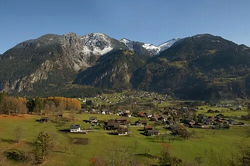 Davenna Mountain, Bartholomäberg0.7 km E
-
Davennakopf Mountain, Lorüns1.4 km NE
-
Spitzguf Mountain, Bartholomäberg2.3 km E
-
Zwölferkopf Mountain, Bartholomäberg2.4 km NE
-
Hüehnerwand Mountain, Bartholomäberg2.9 km E
-
Monteneu Mountain, Bartholomäberg3.1 km E
-
Steinwandeck Mountain, Lorüns3.4 km W
-
Gavalinakopf Mountain, Vandans3.6 km W
Sources & licences
Data last updated: