Namur Province
Local name: Namur
Located in Wallonia, Belgium Coordinates: 50°20′00″ N 4°50′00″ E
- Population
- 503,895
- 503.9K
- Elevation
- 195 m
- above sea level
- Local time
- UTC+01:00
- Europe/Brussels · UTC+01:00
- Places inside
- 434
- listed under Namur Province
- Airports
- CRL Brussels South Charleroi Airport30 km
- LGG Liège Airport55 km
About Namur Province
Namur Province is a district. Location: Wallonia, Belgium. Population: 503,895.
Namur (French: [namyʁ] ; Walloon: Nameur; Dutch: Namen [ˈnaːmə(n)] ) is a province of Wallonia, one of the three regions of Belgium. It borders (clockwise from the West) on the Walloon provinces of Hainaut, Walloon Brabant, Liège and Luxembourg in Belgium, and the French department of Ardennes. Its capital and largest city is the city of Namur. As of January 2024, the province of Namur has a population of about 0.5 million.
Source: Wikipedia · CC BY-SA 4.0
Travel notes for Namur Province
From Wikivoyage
Namur (Namen in Dutch) is a province in the Wallonia region of Belgium.
Get in+
By train:
There are frequent trains from Brussels to many destinations in Namur.
By car:
You can drive into Namur from the rest of Belgium and from France. Because both countries are members of the Schengen treaty, there are no border controls.
Source: Wikivoyage · CC BY-SA 4.0 · abridged
Places bordering Namur Province
- Hainaut Province
- Luxembourg Province
- Ardennes
Population of Namur Province over time
| 2014 | 484,737 | |
|---|---|---|
| 2016 | 487,145 | |
| 2018 | 493,073 | |
| 2024 | 503,582 | |
| 2025 | 505,348 |
Censuses and official estimates; source: Wikidata.
Climate of Namur Province
Best months for sightseeingBest months for sightseeing: June–August.
This month · November
A cold month
Day 9° · Night 3° · Rain 76 mm
- Hottest month
- August (day 23°)
- Coldest month
- February (night 0°)
- Wettest month
- June (79 mm)
- Driest month
- February (58 mm)
Bars: average monthly low and high temperature. Below: precipitation. Monthly averages for 1970–2000 at about 18 km resolution, adjusted for elevation. Highlighted months are mild and relatively dry. Source: WorldClim 2.1 (CC BY 4.0).
Show values as a table
| Month | Jan | Feb | Mar | Apr | May | Jun | Jul | Aug | Sep | Oct | Nov | Dec |
|---|---|---|---|---|---|---|---|---|---|---|---|---|
| Average high (°C) | 5° | 6° | 9° | 13° | 17° | 20° | 22° | 23° | 19° | 14° | 9° | 6° |
| Average low (°C) | 0° | 0° | 2° | 4° | 8° | 10° | 12° | 12° | 10° | 7° | 3° | 1° |
| Precipitation (mm) | 68 | 58 | 68 | 60 | 72 | 79 | 74 | 66 | 65 | 70 | 76 | 75 |
How to get to Namur Province
The nearest airport is Brussels South Charleroi Airport (CRL), 30 km to the northwest as the crow flies. The nearest large city is Namur, 15 km to the north.
Airports
- Brussels South Charleroi Airport (CRL) Charleroi 30 kmnorthwest
- Liège Airport (LGG) Grâce-Hollogne 55 kmnortheast
- Brussels Airport (BRU) Zaventem 68 kmnorth
Nearby large cities
- Namur Population: 110.9K 15 kmnorth
- Charleroi Population: 200.1K 29 kmwest
- Leuven Population: 101K 61 kmnorth
- Liège Population: 195.3K 62 kmnortheast
- Anderlecht Population: 160.6K 67 kmnorthwest
Straight-line distances; road distances are longer. Airport data: OurAirports.
Day trips from Namur Province
Within 100 km: 232 historic and cultural sites, 1,450 natural sites, 1,036 lakes, rivers and coasts.
0–25 km243 places
- Île d'Androssart Island 17 kmS
- Grand Étang de Fosse Lake 11 kmW
- La Belle Vue Mountain 24 kmSE
- Tilleul de Ronveau Mountain 22 kmSE
25–60 km958 places
- Étang de Virelles Lake 45 kmSW
- Étang de Séloignes Lake 53 kmSW
- Étang d'Oise Lake 56 kmSW
- Étang du Moulin Lake 46 kmSW
60–100 km1,517 places
- Île du Moulin Island 60 kmNE
- Île Monsin Island 67 kmNE
- Île de Franche Garenne Island 73 kmNE
- Hofstademeer Lake 76 kmN
Straight-line distances.
Places in Namur Province
434 placesMountains & nature60
- Bois de Castillon · Natural site
- Bois de Cerfontaine · Natural site
- Bois de Chacoux · Natural site
- Bois de Champelle · Natural site
- Bois de Charneuse · Natural site
- Bois de Chêne · Natural site
- Bois de Chevaly · Natural site
- Bois de Chevaudos · Natural site
- Bois de Ciney · Natural site
- Bois de Clavia Crimont · Natural site
- Bois d'Eclaye · Natural site
- Bois de Clermont · Natural site
- Bois de Coraie · Natural site
- Bois de Corenne · Natural site
- Bois de Couvin · Natural site
- Bois de Croy · Natural site
- Bois de Crupet · Natural site
- Bois de Dave · Natural site
- Bois de Dessous · Natural site
- Bois de Fagnes · Natural site
- Bois de Failon · Natural site
- Bois de Famenne · Natural site
- Bois de Fernelmont · Natural site
- Bois de Fessenne · Natural site
- Bois de Fioche · Natural site
- Bois de Fir · Natural site
- Bois de Floreffe · Natural site
- Bois de Florennes · Natural site
- Bois de Fontaine · Natural site
- Bois de Foy · Natural site
- Bois de Franc Lieu · Natural site
- Bois de Frasnes · Natural site
- Bois de Frasnoy · Natural site
- Bois de Freyr · Natural site
- Bois de Froide Veau · Natural site
- Bois de Froidfontaine · Natural site
- Bois de Ftroul · Natural site
- Bois de Geauvelant · Natural site
- Bois de Gerlin · Natural site
- Bois de Gesves · Natural site
- Bois de Godinne · Natural site
- Bois de Gola · Natural site
- Bois de Gommereux · Natural site
- Bois de Gonrieux · Natural site
- Bois de Grainchy · Natural site
- Bois de Grand-Leez · Natural site
- Bois de Grand Pré · Natural site
- Bois de Halleux · Natural site
- Bois de Ham · Natural site
- Bois de Hautmont · Natural site
- Bois de Heronnerie · Natural site
- Bois de Hestrait · Natural site
- Bois de Hubeumont · Natural site
- Bois de Jawet · Natural site
- Bois de Jeneffe · Natural site
- Bois de Jeumont · Natural site
- Bois de Jomino · Natural site
- Bois de la Basse Marlagne · Natural site
- Bois de la Dame · Natural site
- Bois de la Flache · Natural site
Nature and heritage in Namur Province
Nearby attractions & nature
Everything nearby-
Bois du Prince Natural site, Wallonia17 km W
-
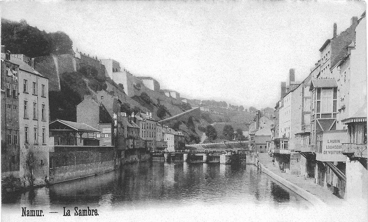
Sambre River, Wallonia15 km N
-
Bois de Presles Natural site, Hainaut Province18 km W
-
Bois du Tournibus Natural site, Hainaut Province18 km W
-
Bois de Vantelle Natural site, Hainaut Province19 km NW
-
Bois de Frêcheux Natural site, Hainaut Province20 km W
Sources & licences
Data last updated: · 2 independent sources