Grun de Saint-Maurice
Located in Isère, Auvergne-Rhône-Alpes Coordinates: 44°48′59″ N 6°03′26″ E
- Elevation
- 2,775 m
- above sea level
- Local time
- UTC+01:00
- Europe/Paris · UTC+01:00
- Airports
- GNB Grenoble Alpes Isère Airport84 km
- CMF Chambéry Aix les Bains airport92 km
About Grun de Saint-Maurice
Grun de Saint-Maurice is a mountain. Location: Isère, Auvergne-Rhône-Alpes. Elevation: 2,775 m. The nearest airport is Grenoble Alpes Isère Airport (84 km). Nearby sights include Pic Grun du Roux and Grand Chapelet.
Photos of Grun de Saint-Maurice
-
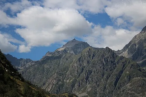
Pic Turbat Tartetatindu03 · CC BY-SA 4.0

Climate of Grun de Saint-Maurice
This month · November
A wet month
Day -2° · Night -10° · Rain 141 mm
- Hottest month
- July (day 13°)
- Coldest month
- January (night -14°)
- Wettest month
- November (141 mm)
- Driest month
- July (60 mm)
Bars: average monthly low and high temperature. Below: precipitation. Monthly averages for 1970–2000 at about 18 km resolution, adjusted for elevation. Highlighted months are mild and relatively dry. Source: WorldClim 2.1 (CC BY 4.0).
Show values as a table
| Month | Jan | Feb | Mar | Apr | May | Jun | Jul | Aug | Sep | Oct | Nov | Dec |
|---|---|---|---|---|---|---|---|---|---|---|---|---|
| Average high (°C) | -7° | -6° | -3° | 0° | 5° | 9° | 13° | 13° | 9° | 3° | -2° | -6° |
| Average low (°C) | -14° | -14° | -11° | -9° | -5° | -2° | 1° | 1° | -2° | -5° | -10° | -13° |
| Precipitation (mm) | 107 | 94 | 95 | 95 | 104 | 93 | 60 | 80 | 98 | 122 | 141 | 117 |
How to get to Grun de Saint-Maurice
The nearest airport is Grenoble Alpes Isère Airport (GNB), 84 km to the northwest as the crow flies. The nearest large city is Grenoble, 48 km to the northwest.
Airports
- Grenoble Alpes Isère Airport (GNB) Grenoble 84 kmnorthwest
- Chambéry Aix les Bains airport (CMF) Chambéry 92 kmnorth
- Annecy Meythet airport (NCY) Annecy 124 kmnorth
Nearby large cities
- Grenoble Population: 158.6K 48 kmnorthwest
- Villeurbanne Population: 131.4K 140 kmnorthwest
- Lyon Population: 520.8K 141 kmnorthwest
- Saint-Etienne Population: 176.3K 148 kmnorthwest
- Aix-en-Provence Population: 146.8K 151 kmsouth
Straight-line distances; road distances are longer. Airport data: OurAirports.
Day trips from Grun de Saint-Maurice
Within 100 km: 103 historic and cultural sites, 1,465 natural sites, 296 lakes, rivers and coasts.
0–25 km142 places
- Lac du Vallon Lake 18 kmN
- Lac du Saulet Lake 10 kmW
- Lac de la Muzelle Lake 15 kmN
- Lac Lauvitel Lake 17 kmN
25–60 km725 places
- Lac Mort Lake 32 kmNW
- Clapes River 55 kmSE
- Lake Pierre-Châtel Lake 28 kmNW
- Lac de Petichet Lake 29 kmNW
60–100 km997 places
- St Alban Plage Beach 85 kmN
- Grande Île Island 84 kmN
- Petite Île Island 84 kmN
- Lac Premier Lake 69 kmSE
Straight-line distances.
Nearest towns and villages
-
Saint-Maurice-en-Valgodemard Village, Arrondissement of Gap3.3 km SE
-
Saint-Maurice-en-Valgaudemar Village, Saint-Maurice-en-Valgodemard3.3 km SE
-
Saint-Firmin Village, Arrondissement of Gap4.5 km SW
-
Saint-Jacques-en-Valgodemard Village, Arrondissement of Gap4.6 km S
-
Saint-Firmin Village, Saint-Firmin4.5 km SW
-
Saint-Jacques-en-Valgodemard Village, Saint-Jacques-en-Valgodemard4.6 km S
Nearby attractions & nature
Everything nearby-
Pic Grun du Roux Mountain, Isère2.3 km NE
-
Grand Chapelet Mountain, Valjouffrey3.4 km NW
-
Pic Gazonne Mountain, Isère4 km W
-
Val Godemard Natural site, Hautes-Alpes4.7 km E
-
Tête du Clotonnet Mountain, Valjouffrey4.4 km NE
-
Roche Courbe Mountain, Aspres-lès-Corps5.4 km W
-
Montagne du Petit Chaillol Mountain, La Motte-en-Champsaur6.5 km S
-
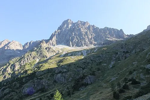 Pic des Souffles Mountain, Valjouffrey8.1 km NE
More nature in France
-
Pic Turbat Mountain, Valjouffrey7.5 km N
-
Gargas Mountain, Entraigues8.9 km NW
-
Aiguille des Marmes Mountain, Valjouffrey9.4 km N
-
Pic de Turbat Mountain, Valjouffrey9.8 km NE
-
Sommet du Colombier Mountain, Valbonnais11 km NW
-
Pic Vert Mountain, Chantepérier12 km N
Sources & licences
Data last updated: