Bois du Landet
Located in Doubs, Bourgogne-Franche-Comté Coordinates: 47°04′59″ N 5°55′11″ E
- Elevation
- 548 m
- above sea level
- Local time
- UTC+01:00
- Europe/Paris · UTC+01:00
About Bois du Landet
Bois du Landet is a natural site. Location: Doubs, Bourgogne-Franche-Comté.
In comparison
- 6 sights and natural places within 10 km Abbaye Notre-Dame de Billon, Lison
Airports nearest to Bois du Landet
- Dole Tavaux Airport (DLE) Dole 38 km
- Geneva International Airport (GVA) Geneva 95 km
- Bern Airport (BRN) Bern 122 km
Straight-line distance; airports with scheduled flights only. Source: OurAirports (public domain).
Nearest towns and villages
-
Goux-sous-Landet Village, Arrondissement of Besançon1.1 km E
-
Goux-sous-Landet Village, Goux-sous-Landet1.1 km E
-
Palantine Village, Arrondissement of Besançon1.9 km E
-
Le Val Village, Arrondissement of Besançon2.6 km SW
-
Cessey Village, Arrondissement of Besançon2.9 km N
-
Palantine Village, Palantine2 km E
Nearby attractions & nature
Everything nearby-
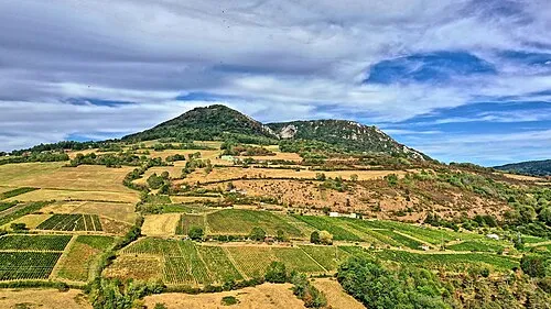 Mont Poupet Mountain, Saint-Thiébaud13 km S
-
Lison River, Doubs5.3 km E
-
Abbaye Notre-Dame de Billon Historic site, Chenecey-Buillon4.2 km NE
-
Les Corvées Natural site, Doubs9.2 km NE
-
Ruisseau la Conche River, Doubs6 km S
-
Forêt de Fertans Natural site, Doubs11 km S
-
Mont Begon Mountain, Pretin18 km SW
-
Le Grand Bois Natural site, Doubs14 km NE
Sources & licences
Data last updated: