Ruisseau la Conche
Located in Doubs, Bourgogne-Franche-Comté Coordinates: 47°02′00″ N 5°57′00″ E
- Elevation
- 355 m
- above sea level
- Local time
- UTC+01:00
- Europe/Paris · UTC+01:00
About Ruisseau la Conche
Ruisseau la Conche is a river. Location: Doubs, Bourgogne-Franche-Comté.
In comparison
- 7 sights and natural places within 10 km Lison, Forêt de Fertans
Nearest towns and villages
-
Myon Village, Arrondissement of Besançon1.1 km SW
-
Myon Village, Myon1.1 km SW
-
Échay Village, Arrondissement of Besançon1.3 km N
-
Échay Village, Échay1.3 km N
-
Bartherans Village, Arrondissement of Besançon1.9 km NW
-
Bartherans Village, Bartherans1.9 km NW
Nearby attractions & nature
Everything nearby-
Lison River, Doubs5.1 km NE
-
Forêt de Fertans Natural site, Doubs5.5 km S
-
Bois du Landet Natural site, Doubs6 km N
-
Ruisseau la Furieuse River, Jura8.3 km W
-
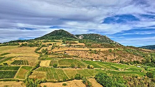 Mont Poupet Mountain, Saint-Thiébaud8.3 km SW
-
Forêt du Jura Natural site, Doubs12 km SE
-
Les Corvées Natural site, Doubs12 km NE
-
Abbaye de Val-Sainte-Marie Historic site, Malans6.4 km NE
Sources & licences
Data last updated: