Monte Rotondo
Located in Corte, Arrondissement of Corte Coordinates: 42°12′59″ N 9°03′29″ E
- Elevation
- 2,625 m
- above sea level
- Local time
- UTC+01:00
- Europe/Paris · UTC+01:00
- Airports
- AJA Ajaccio Napoléon Bonaparte airport39 km
- CLY Calvi Sainte Catherine Airport41 km
About Monte Rotondo
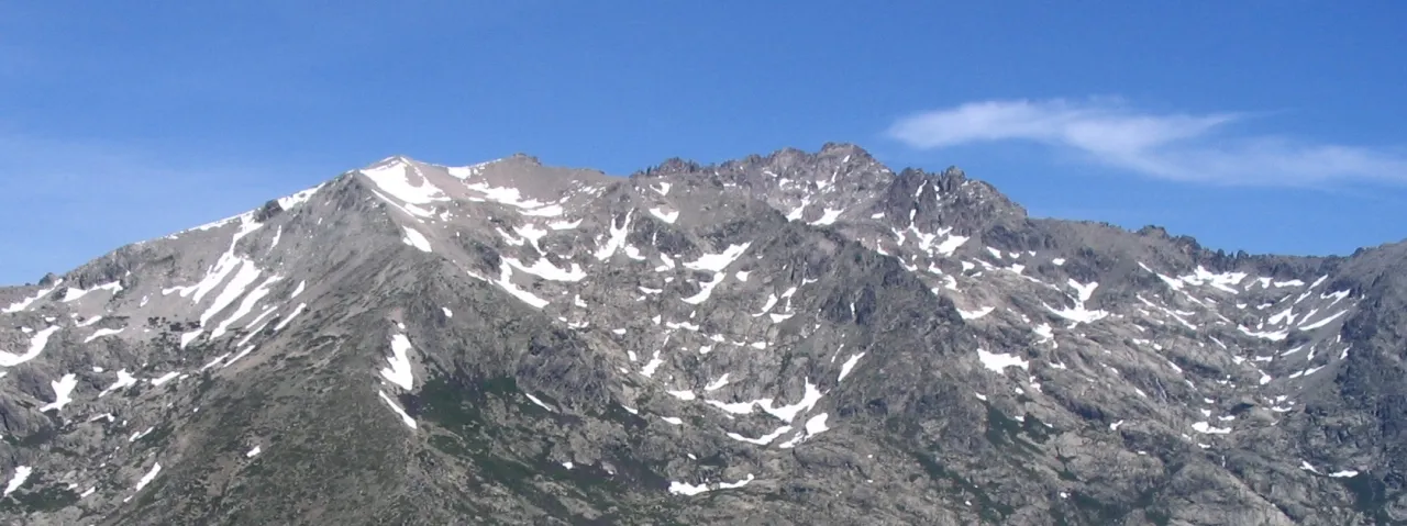
Monte Rotondo is a mountain. Location: Corte, Arrondissement of Corte. Elevation: 2,625 m.
Monte Rotondo (Corsican: Monte Ritondu) is a mountain in the department of Haute-Corse on the island of Corsica, France. At 2,622 metres (8,602 ft) it is the second highest in Corsica, after Monte Cinto. It is the highest point on the Monte Rotondo Massif.
Source: Wikipedia · CC BY-SA 4.0
At a glance
- Topographic prominence
- 1,170 m
Source: Wikidata
Photos of Monte Rotondo
-

Pierre Bona · CC BY-SA 3.0 -

Pierre Bona · CC BY-SA 4.0 -

Rémih · CC BY-SA 4.0 -

Rémih · CC BY-SA 4.0 -
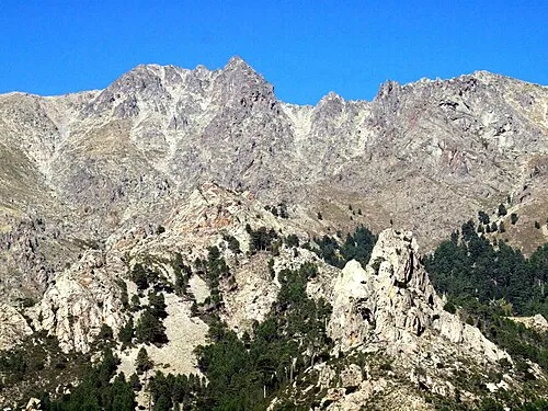
Mont Cardo Pierre Bona · CC BY-SA 3.0


Climate of Monte Rotondo
This month · November
A wet month
Day 0° · Night -4° · Rain 121 mm
- Hottest month
- July (day 13°)
- Coldest month
- February (night -8°)
- Wettest month
- November (121 mm)
- Driest month
- July (19 mm)
Bars: average monthly low and high temperature. Below: precipitation. Monthly averages for 1970–2000 at about 18 km resolution, adjusted for elevation. Highlighted months are mild and relatively dry. Source: WorldClim 2.1 (CC BY 4.0).
Show values as a table
| Month | Jan | Feb | Mar | Apr | May | Jun | Jul | Aug | Sep | Oct | Nov | Dec |
|---|---|---|---|---|---|---|---|---|---|---|---|---|
| Average high (°C) | -4° | -4° | -2° | 0° | 5° | 9° | 13° | 13° | 9° | 5° | 0° | -3° |
| Average low (°C) | -8° | -8° | -7° | -5° | -1° | 2° | 6° | 6° | 3° | 0° | -4° | -7° |
| Precipitation (mm) | 104 | 91 | 88 | 77 | 60 | 40 | 19 | 30 | 70 | 112 | 121 | 107 |
How to get to Monte Rotondo
The nearest airport is Ajaccio Napoléon Bonaparte airport (AJA), 39 km to the southwest as the crow flies. For international flights: Bastia-Poretta International airport (BIA) (51 km). The nearest large city is Nice, 221 km to the northwest.
Airports
- Ajaccio Napoléon Bonaparte airport (AJA) Ajaccio 39 kmsouthwest
- Calvi Sainte Catherine Airport (CLY) Calvi 41 kmnorthwest
- Bastia-Poretta International airport (BIA) Bastia 51 kmnortheast
Nearby large cities
- Nice Population: 342.7K 221 kmnorthwest
- Toulon Population: 168.7K 276 kmnorthwest
- Marseille Population: 877.2K 324 kmnorthwest
- Aix-en-Provence Population: 146.8K 329 kmnorthwest
Straight-line distances; road distances are longer. Airport data: OurAirports.
Day trips from Monte Rotondo
Within 100 km: 144 historic and cultural sites, 577 natural sites, 324 lakes, rivers and coasts.
0–25 km251 places
- Corsica Island 7 kmSE
- Lac de Bastani Lake 18 kmS
- Capu di a Borba Mountain 11 kmN
- Punta di a Vita Mountain 25 kmSW
25–60 km563 places
- Plage du Ruppione Beach 48 kmSW
- Plage d'Albitreccia Beach 45 kmSW
- Banda Bianca Beach 58 kmNE
- Plage de Cupabia Beach 58 kmSW
60–100 km231 places
- Plage de Carataggio Beach 75 kmS
- Plage de Capu Laurosu Beach 63 kmS
- Plage de Purraja Beach 62 kmS
- Plage de Baraci Beach 60 kmS
Straight-line distances.
Nearest towns and villages
-
Venaco Village, Arrondissement of Corte9.7 km E
-
Venaco Village, Venaco9.6 km E
-
Casanova Village, Casanova11 km NE
-
Vivario Village, Arrondissement of Corte10 km SE
-
Santo-Pietro-di-Venaco Village, Arrondissement of Corte10 km E
-
Santo-Pietro-di-Venaco Village, Santo-Pietro-di-Venaco10 km E
Nearby attractions & nature
Everything nearby-
Petra Niella Mountain, Venaco1.4 km SE
-
La Moniccia Mountain, Corte2.4 km SW
-
Punta Felicina Mountain, Corsica2.4 km E
-
Pointe Diciotte Mountain, Corte3.6 km E
-
Punta Alle Porte Mountain, Guagno4.3 km W
-
Capu a i Sorbi Mountain, Corte4.9 km W
-
Capu a Chiostru Mountain, Corte4.1 km W
-
Mont Cardo Mountain, Venaco5.8 km E
Sources & licences
Data last updated: · 2 independent sources