Arrondissement of Péronne
Located in Somme, Hauts-de-France Coordinates: 49°56′03″ N 2°49′10″ E
- Population
- 91,970
- 92K
- Elevation
- 90 m
- above sea level
- Local time
- UTC+01:00
- Europe/Paris · UTC+01:00
- Places inside
- 208
- listed under Arrondissement of Péronne
- Airports
- LIL Lille Airport73 km
- BVA Beauvais-Tillé airport74 km
About Arrondissement of Péronne
Arrondissement of Péronne is a municipality. Location: Somme, Hauts-de-France. Population: 91,970. Elevation: 90 m. The best months to visit are July–August. The nearest airport is Lille Airport (73 km). Nearby sights include Cologne and Bois de Saint-Pierre-Vaast.
Photos of Arrondissement of Péronne
-
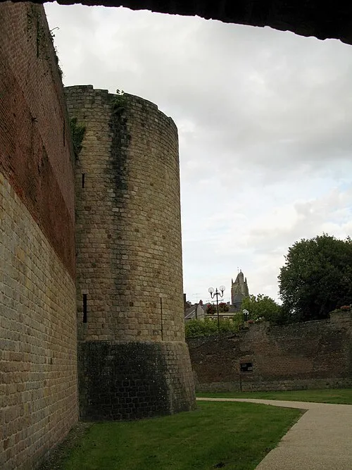
Museum of the Great War Markus3 · CC BY-SA 3.0

Climate of Arrondissement of Péronne
Best months for sightseeingBest months for sightseeing: July–August.
This month · November
A cold month
Day 9° · Night 3° · Rain 61 mm
- Hottest month
- August (day 23°)
- Coldest month
- February (night 1°)
- Wettest month
- June (63 mm)
- Driest month
- February (45 mm)
Bars: average monthly low and high temperature. Below: precipitation. Monthly averages for 1970–2000 at about 18 km resolution, adjusted for elevation. Highlighted months are mild and relatively dry. Source: WorldClim 2.1 (CC BY 4.0).
Show values as a table
| Month | Jan | Feb | Mar | Apr | May | Jun | Jul | Aug | Sep | Oct | Nov | Dec |
|---|---|---|---|---|---|---|---|---|---|---|---|---|
| Average high (°C) | 5° | 7° | 10° | 13° | 17° | 20° | 22° | 23° | 19° | 15° | 9° | 6° |
| Average low (°C) | 1° | 1° | 3° | 4° | 8° | 10° | 12° | 12° | 10° | 7° | 3° | 2° |
| Precipitation (mm) | 54 | 45 | 51 | 47 | 59 | 63 | 55 | 50 | 58 | 60 | 61 | 63 |
How to get to Arrondissement of Péronne
The nearest airport is Lille Airport (LIL), 73 km to the north as the crow flies. The nearest large city is Amiens, 37 km to the west.
Airports
- Lille Airport (LIL) Lesquin 73 kmnorth
- Beauvais-Tillé airport (BVA) Beauvais 74 kmsouthwest
- Charles de Gaulle International Airport (CDG) Paris (Roissy-en-France, Val-d'Oise) 105 kmsouth
Nearby large cities
- Amiens Population: 143.1K 37 kmwest
- Lille Population: 238.7K 80 kmnorth
- Cergy-Pontoise Population: 183.4K 113 kmsouthwest
- Reims Population: 196.6K 115 kmsoutheast
- Argenteuil Population: 101.5K 117 kmsouth
Straight-line distances; road distances are longer. Airport data: OurAirports.
Day trips from Arrondissement of Péronne
Within 100 km: 198 historic and cultural sites, 200 natural sites, 191 lakes, rivers and coasts.
0–25 km11 places
- Bois des Vaux Natural site 13 kmNE
- Bois de Saint-Pierre-Vaast Natural site 12 kmNE
- Bois d'Havrincourt Natural site 24 kmNE
- Bois Delville Natural site 11 kmN
25–60 km115 places
- Sensée River 43 kmNE
- Mont du Tremble Mountain 58 kmS
- Mont Saint-Marc Mountain 60 kmS
- Mont Ganelon Mountain 53 kmS
60–100 km463 places
- Étang de la Forge Gérard Lake 99 kmE
- Lac des Herbieres Lake 91 kmNE
- Les marais d'HArchies Lake 85 kmNE
- Rode Berg Mountain 95 kmN
Straight-line distances.
Arrondissement of Péronne and similar cities
Side by side with cities of similar size in the same country: population, elevation and climate.
| Measure | Arrondissement of Péronne | Avignon | Nanterre | Poitiers |
|---|---|---|---|---|
| Population | 92K | 89.8K | 86.7K | 86K |
| Elevation | 90 m | 31 m | 50 m | 118 m |
| Summer day (hottest month) | 23° | 31° | 25° | 25° |
| Winter night (coldest month) | 1° | 2° | 2° | 2° |
| Annual rainfall | 666 mm | 765 mm | 632 mm | 694 mm |
| Best months | Jul–Aug | May–Jun, Sep | May–Sep | Jun–Sep |
| Distance | — | 682 km | 124 km | 416 km |
Climate values are 1970–2000 monthly averages; straight-line distance.
Places in Arrondissement of Péronne
208 places- 121 Chilly 187
- 122 Herleville 187
- 123 Frise 186
- 124 Harponville 186
- 125 Suzanne 182
- 126 Hervilly 181
- 127 Maucourt 180
- 128 Grandcourt 178
- 129 Maricourt 177
- 130 Billancourt 176
- 131 Soyécourt 175
- 132 Forceville 174
- 133 Lesbœufs 174
- 134 Éterpigny 173
- 135 Templeux-le-Guérard 173
- 136 Laviéville 172
- 137 Authuille 167
- 138 Léalvillers 167
- 139 Arquèves 166
- 140 Tertry 165
- 141 Fouquescourt 164
- 142 Sorel 163
- 143 Bécordel-Bécourt 161
- 144 Curlu 159
- 145 Vauchelles-lès-Authie 157
- 146 Berny-en-Santerre 155
- 147 Bouvincourt-en-Vermandois 154
- 148 Chuignolles 154
- 149 Courcelette 153
- 150 Belloy-en-Santerre 152
- 151 Fransart 149
- 152 Falvy 148
- 153 Vermandovillers 148
- 154 Warvillers 147
- 155 Feuillères 146
- 156 Quivières 144
- 157 Vraignes-en-Vermandois 144
- 158 Auchonvillers 143
- 159 Guyencourt-Saulcourt 143
- 160 Folies 142
- 161 Templeux-la-Fosse 141
- 162 Guillemont 140
- 163 Fresnes-Mazancourt 136
- 164 Bus-lès-Artois 135
- 165 Chuignes 135
- 166 Thiepval 131
- 167 Béthencourt-sur-Somme 129
- 168 Mesnil-en-Arrouaise 128
- 169 Pœuilly 128
- 170 Hédauville 125
- 171 Hem-Monacu 125
- 172 Épénancourt 123
- 173 Pys 119
- 174 Contalmaison 118
- 175 Marieux 118
- 176 Rouy-le-Petit 114
- 177 Rouy-le-Grand 109
- 178 Irles 107
- 179 Fay 105
- 180 Potte 105
Bar: population relative to the most populous place in this list.
Nearby attractions & nature
Everything nearby-
Cologne River, Somme8.4 km E
-
Bois de Saint-Pierre-Vaast Natural site, Somme12 km NE
-
Omignon River, Somme11 km SE
-
Bois Delville Natural site, Somme11 km N
-
Bois des Vaux Natural site, Somme13 km NE
-
Ancre River, Somme25 km W
-
Abbatiale Saint-Pierre de Corbie Historic site, Corbie22 km W
-
Ancienne Abbaye Saint-Pierre de Corbie Historic site, Corbie22 km W
Other cities and towns in Somme
-
Péronne Town, Péronne8.4 km E
-
Arrondissement of Montdidier Municipality, Somme31 km SW
-
Arrondissement of Amiens Municipality, Somme47 km W
-
Albert Town, Albert14 km NW
-
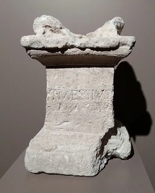 Amiens City, Amiens37 km W
-
Corbie Town, Corbie23 km W
Sources & licences
Data last updated: