Oléron
Located in Charente-Maritime, New Aquitaine Coordinates: 45°56′00″ N 1°18′00″ W
- Elevation
- 7 m
- above sea level
- Local time
- UTC+01:00
- Europe/Paris · UTC+01:00
- Population
- 21,790
- 21.8K
About Oléron
Oléron is an island. Location: Charente-Maritime, New Aquitaine. Population: 21,790.
In comparison
- 4 sights and natural places within 10 km Plage des Sables Vigniers, Forêt domaniale de Domino
Nearest towns and villages
-
Saint-Pierre-d'Oléron Village, Arrondissement of Rochefort1.2 km N
-
Saint-Pierre-d'Oléron Town, Saint-Pierre-d'Oléron1.2 km N
-
Dolus-d'Oléron Village, Dolus-d'Oléron3.2 km SE
-
Dolus-d'Oléron Village, Arrondissement of Rochefort4 km SE
-
L'Ile d'Oléron Village, Saint-Pierre-d'Oléron1 km S
-
Rulong Village, Saint-Pierre-d'Oléron1.6 km N
Nearby attractions & nature
Everything nearby-
Forêt domaniale de Domino Natural site, Charente-Maritime8 km NW
-
Plage des Sables Vigniers Beach, New Aquitaine7.4 km NW
-
Forêt Domaniale de Saint-Trojan Natural site, Charente-Maritime11 km SE
-
Bois de l'Achenau Natural site, New Aquitaine9.2 km NW
-
Île de Nole Island, New Aquitaine15 km SE
-
Dunes de Saint-Trojan Natural site, Charente-Maritime14 km SE
-
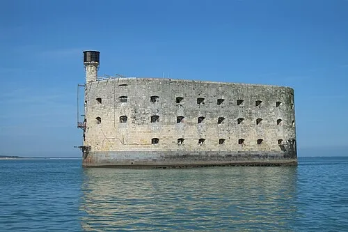 Fort Boyard Historic site, New Aquitaine9.9 km NE
-
Le Peu Princet Mountain, Saint-Trojan-les-Bains12 km SE
Sources & licences
Data last updated: