- Elevation
- 9 m
- above sea level
- Local time
- UTC+01:00
- Europe/Paris · UTC+01:00
- Airports
- LRH La Rochelle Île de Ré Airport25 km
- NTE Nantes Atlantique Airport130 km
About Bois de l'Achenau
Bois de l'Achenau is a natural site. Location: New Aquitaine, France. The best months to visit are June–September. The nearest airport is La Rochelle Île de Ré Airport (25 km). Nearby sights include Forêt domaniale de Domino and Plage des Sables Vigniers.
Climate of Bois de l'Achenau
Best months for sightseeingBest months for sightseeing: June–September.
This month · November
Outside the best season
Day 14° · Night 7° · Rain 96 mm
- Hottest month
- August (day 25°)
- Coldest month
- January (night 4°)
- Wettest month
- November (96 mm)
- Driest month
- July (35 mm)
Bars: average monthly low and high temperature. Below: precipitation. Monthly averages for 1970–2000 at about 18 km resolution, adjusted for elevation. Highlighted months are mild and relatively dry. Source: WorldClim 2.1 (CC BY 4.0).
Show values as a table
| Month | Jan | Feb | Mar | Apr | May | Jun | Jul | Aug | Sep | Oct | Nov | Dec |
|---|---|---|---|---|---|---|---|---|---|---|---|---|
| Average high (°C) | 10° | 11° | 13° | 15° | 19° | 22° | 24° | 25° | 22° | 18° | 14° | 11° |
| Average low (°C) | 4° | 4° | 6° | 8° | 11° | 13° | 16° | 16° | 14° | 11° | 7° | 5° |
| Precipitation (mm) | 86 | 73 | 56 | 59 | 55 | 41 | 35 | 41 | 66 | 89 | 96 | 91 |
Other places to visit in this season: June July August September
How to get to Bois de l'Achenau
The nearest airport is La Rochelle Île de Ré Airport (LRH), 25 km to the northeast as the crow flies. For international flights: Nantes Atlantique Airport (NTE) (130 km). The nearest large city is Nantes, 137 km to the north.
Airports
- La Rochelle Île de Ré Airport (LRH) La Rochelle 25 kmnortheast
- Nantes Atlantique Airport (NTE) Nantes 130 kmnorth
- Bordeaux–Mérignac Airport (BOD) Bordeaux 140 kmsouth
Nearby large cities
- Nantes Population: 325.1K 137 kmnorth
- Bordeaux Population: 265.3K 143 kmsoutheast
- Angers Population: 168.3K 176 kmnorth
- Limoges Population: 141.2K 205 kmeast
- Tours Population: 141.6K 223 kmnortheast
Straight-line distances; road distances are longer. Airport data: OurAirports.
Nearest towns and villages
-
Saint-Georges-d'Oléron Village, Arrondissement of Rochefort4.1 km SE
-
La Brée-les-Bains Village, Arrondissement of Rochefort3.6 km NE
-
La Brée-les-Bains Village, La Brée-les-Bains3.5 km NE
-
Chaucre Village, Saint-Georges-d'Oléron1 km SE
-
Saint-Denis-d'Oléron Village, Arrondissement of Rochefort4.4 km N
-
La Sablière Village, Saint-Georges-d'Oléron1.2 km E
Nearby attractions & nature
Everything nearby-
Forêt domaniale de Domino Natural site, Charente-Maritime2.1 km S
-
Plage des Sables Vigniers Beach, New Aquitaine3.5 km S
-
Oléron Island, Charente-Maritime9.2 km SE
-
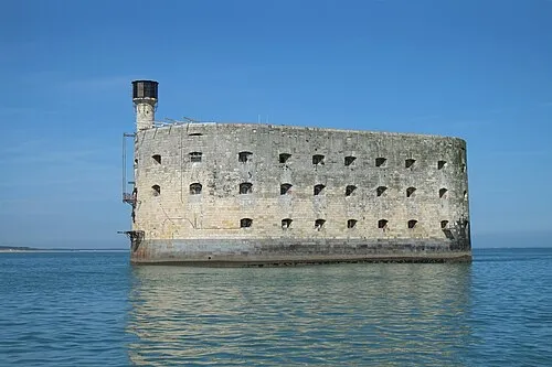 Fort Boyard Historic site, New Aquitaine13 km E
-
Île de Nole Island, New Aquitaine24 km SE
-
Le Peu Princet Mountain, Saint-Trojan-les-Bains22 km SE
-
Forêt Domaniale de Saint-Trojan Natural site, Charente-Maritime20 km SE
-
Sablanceaux Natural site, Charente-Maritime21 km NE
Sources & licences
Data last updated: