- Elevation
- 2,910 m
- above sea level
- Local time
- UTC+01:00
- Europe/Paris · UTC+01:00
- Airports
- LEU Pirineus - la Seu d'Urgel Airport59 km
- PGF Perpignan-Rivesaltes (Llabanère) Airport74 km
About Puigmal
Puigmal is a mountain. Location: Err, Arrondissement of Prades. Elevation: 2,910 m.
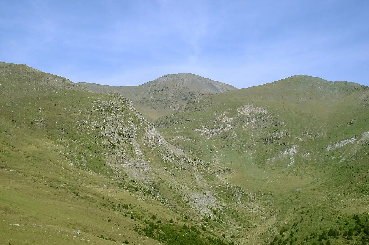
The Peak of Puigmal (Catalan pronunciation: [ˌpudʒˈmal]), also called Puigmal d'Err, is a mountain in the Pyrenees, in the Spanish-French border, within the limits of the municipality of Queralbs and the commune of Err. Its summit is 2,909.6 metres (9,546 ft) above sea level, one of the highest peaks in the eastern Pyrenees. Puigmal d'Err is near the west end of a fine ridge over 2500m high for 16 km.
Source: Wikipedia · CC BY-SA 4.0
At a glance
- Topographic prominence
- 1,331 m
Source: Wikidata
Photos of Puigmal
-

Alan Mattingly · CC0 -

Alan Mattingly · CC0 -

Rémih · CC BY-SA 4.0 -

Pere López Brosa · CC BY-SA 4.0 -

Pedraferit · CC BY-SA 3.0


Climate of Puigmal
This month · November
A wet month
Day -2° · Night -9° · Rain 136 mm
- Hottest month
- July (day 14°)
- Coldest month
- January (night -13°)
- Wettest month
- October (137 mm)
- Driest month
- July (62 mm)
Bars: average monthly low and high temperature. Below: precipitation. Monthly averages for 1970–2000 at about 18 km resolution, adjusted for elevation. Highlighted months are mild and relatively dry. Source: WorldClim 2.1 (CC BY 4.0).
Show values as a table
| Month | Jan | Feb | Mar | Apr | May | Jun | Jul | Aug | Sep | Oct | Nov | Dec |
|---|---|---|---|---|---|---|---|---|---|---|---|---|
| Average high (°C) | -6° | -5° | -2° | 0° | 4° | 9° | 14° | 14° | 10° | 4° | -2° | -4° |
| Average low (°C) | -13° | -12° | -11° | -9° | -5° | -2° | 1° | 2° | -1° | -5° | -9° | -11° |
| Precipitation (mm) | 115 | 100 | 94 | 97 | 127 | 98 | 62 | 80 | 88 | 137 | 136 | 117 |
How to get to Puigmal
The nearest airport is Pirineus - la Seu d'Urgel Airport (LEU), 59 km to the west as the crow flies. For international flights: Girona-Costa Brava Airport (GRO) (75 km). The nearest large city is Perpignan, 73 km to the northeast.
Airports
- Pirineus - la Seu d'Urgel Airport (LEU) La Seu d'Urgell Pyrenees and Andorra 59 kmwest
- Perpignan-Rivesaltes (Llabanère) Airport (PGF) Perpignan/Rivesaltes 74 kmnortheast
- Girona-Costa Brava Airport (GRO) Girona 75 kmsoutheast
Nearby large cities
- Perpignan Population: 110.7K 73 kmnortheast
- Girona Population: 100.3K 73 kmsoutheast
- Terrassa Population: 218.5K 91 kmsouth
- Sabadell Population: 211.7K 93 kmsouth
- Mataró Population: 127K 97 kmsouth
Straight-line distances; road distances are longer. Airport data: OurAirports.
Day trips from Puigmal
Within 100 km: 363 historic and cultural sites, 1,821 natural sites, 343 lakes, rivers and coasts.
0–25 km215 places
- Llac de Núria Lake 3 kmNE
- Pic Bastiments Mountain 10 kmE
- Puig de Dòrria Mountain 4 kmSW
- Roca Colom Mountain 17 kmE
25–60 km851 places
- Pantà de Susqueda Lake 56 kmSE
- Pantà de Sau Lake 51 kmSE
- Pantà de Darinus - Boadella Lake 58 kmE
- Puig del Torn Mountain 46 kmE
60–100 km1,461 places
- Platja de Perafita Beach 86 kmE
- Puig Joan Mountain 84 kmE
- Artigue River 89 kmNW
- Platja de Lloret Beach 97 kmSE
Straight-line distances.
Nearest towns and villages
-
Queralbs Municipality, Girona3.8 km E
-
Station d'Err-Puigmal Village, Err4.3 km NW
-
Queralbs Village, Queralbs5.4 km SE
-
Planoles Municipality, Girona6.5 km S
-
Vall de Núria Village, Queralbs3.4 km NE
-
Valcebollère Village, Valcebollère6.8 km W
Nearby attractions & nature
Everything nearby-
Cim de l'Ortigar Mountain, Queralbs1.2 km E
-
Puigmal Petit de Segre Mountain, Err1.2 km N
-
Puigmal de Llo Mountain, Err1.7 km NW
-
Puig de Coma Dolça Mountain, Llo2.3 km NW
-
Pic del Segre Mountain, Llo1.9 km N
-
les Artigues Mountain, Queralbs2.1 km SW
-
la Tossa del Pas dels Lladres Mountain, Queralbs2.5 km SW
-
 Pic de l'Àliga Mountain, Queralbs3.9 km NE
Sources & licences
Data last updated: · 2 independent sources