Lac Long
Located in Hautes-Alpes, Provence-Alpes-Côte d'Azur Region Coordinates: 44°43′30″ N 6°20′24″ E
- Elevation
- 2,490 m
- above sea level
- Local time
- UTC+01:00
- Europe/Paris · UTC+01:00
- Airports
- CUF Cuneo International Airport104 km
- GNB Grenoble Alpes Isère Airport107 km
About Lac Long
Lac Long is a lake. Location: Hautes-Alpes, Provence-Alpes-Côte d'Azur Region. Elevation: 2,490 m. The nearest airport is Cuneo International Airport (104 km). Nearby sights include Lac Profond and Lac des Sirènes.
Photos of Lac Long
-
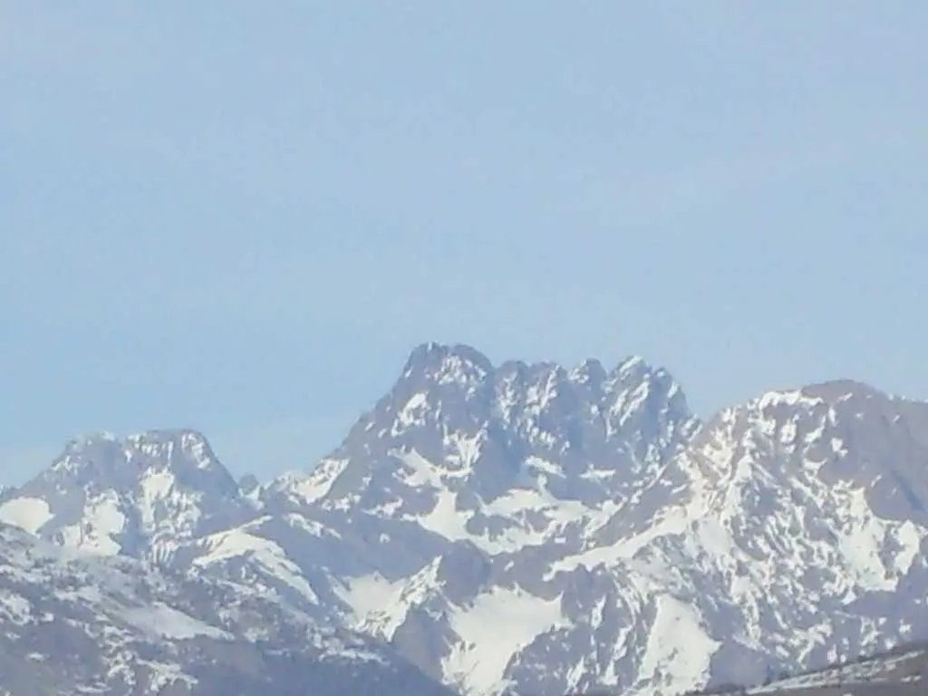
Sirac Aups · CC BY-SA 3.0

Climate of Lac Long
This month · November
A wet month
Day 0° · Night -6° · Rain 146 mm
- Hottest month
- August (day 14°)
- Coldest month
- January (night -10°)
- Wettest month
- November (146 mm)
- Driest month
- July (62 mm)
Bars: average monthly low and high temperature. Below: precipitation. Monthly averages for 1970–2000 at about 18 km resolution, adjusted for elevation. Highlighted months are mild and relatively dry. Source: WorldClim 2.1 (CC BY 4.0).
Show values as a table
| Month | Jan | Feb | Mar | Apr | May | Jun | Jul | Aug | Sep | Oct | Nov | Dec |
|---|---|---|---|---|---|---|---|---|---|---|---|---|
| Average high (°C) | -4° | -4° | -2° | 0° | 6° | 10° | 14° | 14° | 10° | 5° | 0° | -3° |
| Average low (°C) | -10° | -10° | -8° | -6° | -2° | 1° | 5° | 5° | 2° | -1° | -6° | -9° |
| Precipitation (mm) | 129 | 110 | 108 | 113 | 117 | 89 | 62 | 79 | 96 | 132 | 146 | 132 |
How to get to Lac Long
The nearest airport is Cuneo International Airport (CUF), 104 km to the east as the crow flies. The nearest large city is Grenoble, 71 km to the northwest.
Airports
- Cuneo International Airport (CUF) Levaldigi (CN) 104 kmeast
- Grenoble Alpes Isère Airport (GNB) Grenoble 107 kmnorthwest
- Chambéry Aix les Bains airport (CMF) Chambéry 108 kmnorth
Nearby large cities
- Grenoble Population: 158.6K 71 kmnorthwest
- Nice Population: 342.7K 136 kmsoutheast
- Aix-en-Provence Population: 146.8K 151 kmsouthwest
- Villeurbanne Population: 131.4K 163 kmnorthwest
- Lyon Population: 520.8K 163 kmnorthwest
Straight-line distances; road distances are longer. Airport data: OurAirports.
Day trips from Lac Long
Within 100 km: 87 historic and cultural sites, 1,547 natural sites, 271 lakes, rivers and coasts.
0–25 km161 places
- Lac Faravel Lake 7 kmE
- Lac Palluel Lake 6 kmE
- Grand Lac des Estaris Lake 1 kmN
- Lac de la Dublée Lake 9 kmS
25–60 km698 places
- Lac Mort Lake 55 kmNW
- Clapes River 40 kmS
- Lac Premier Lake 45 kmSE
- Lac Vert Lake 38 kmSE
60–100 km1,046 places
- Lakes of Vens Lake 65 kmSE
- Lac des Vaches Lake 82 kmNE
- Lacs de Ténibres Lake 70 kmSE
- Lac Rond Lake 82 kmNE
Straight-line distances.
Nearest towns and villages
-
Orcières Village, Arrondissement of Gap4.7 km S
-
Orcières Village, Orcières4.6 km S
-
Les Estaris Village, Orcières3.2 km S
-
Champoléon Village, Arrondissement of Gap6.3 km W
-
Forest des Baniols Village, Orcières3.3 km SW
-
Orcières-Merlette Village, Orcières3.4 km SW
Nearby attractions & nature
Everything nearby-
Lac Profond Lake, Hautes-Alpes0.3 km E
-
Lac des Sirènes Lake, Hautes-Alpes0.6 km S
-
Grand Lac des Estaris Lake, Hautes-Alpes0.8 km N
-
Sommet de Prelles Mountain, Orcières1.3 km NW
-
Lac de Jujal Lake, Hautes-Alpes1.7 km S
-
Lac des Pisses Lake, Hautes-Alpes3.2 km E
-
Grand Pinier Mountain, Orcières4.8 km E
-
Puy Rivarol Mountain, Champoléon5.6 km NW
Sources & licences
Data last updated: