Bischof
Located in Farchant, Landkreis Garmisch-Partenkirchen Coordinates: 47°32′27″ N 11°10′32″ E
- Elevation
- 2,033 m
- above sea level
- Local time
- UTC+01:00
- Europe/Berlin · UTC+01:00
- Airports
- INN Innsbruck Airport34 km
- FMM Memmingen Allgau Airport86 km
About Bischof
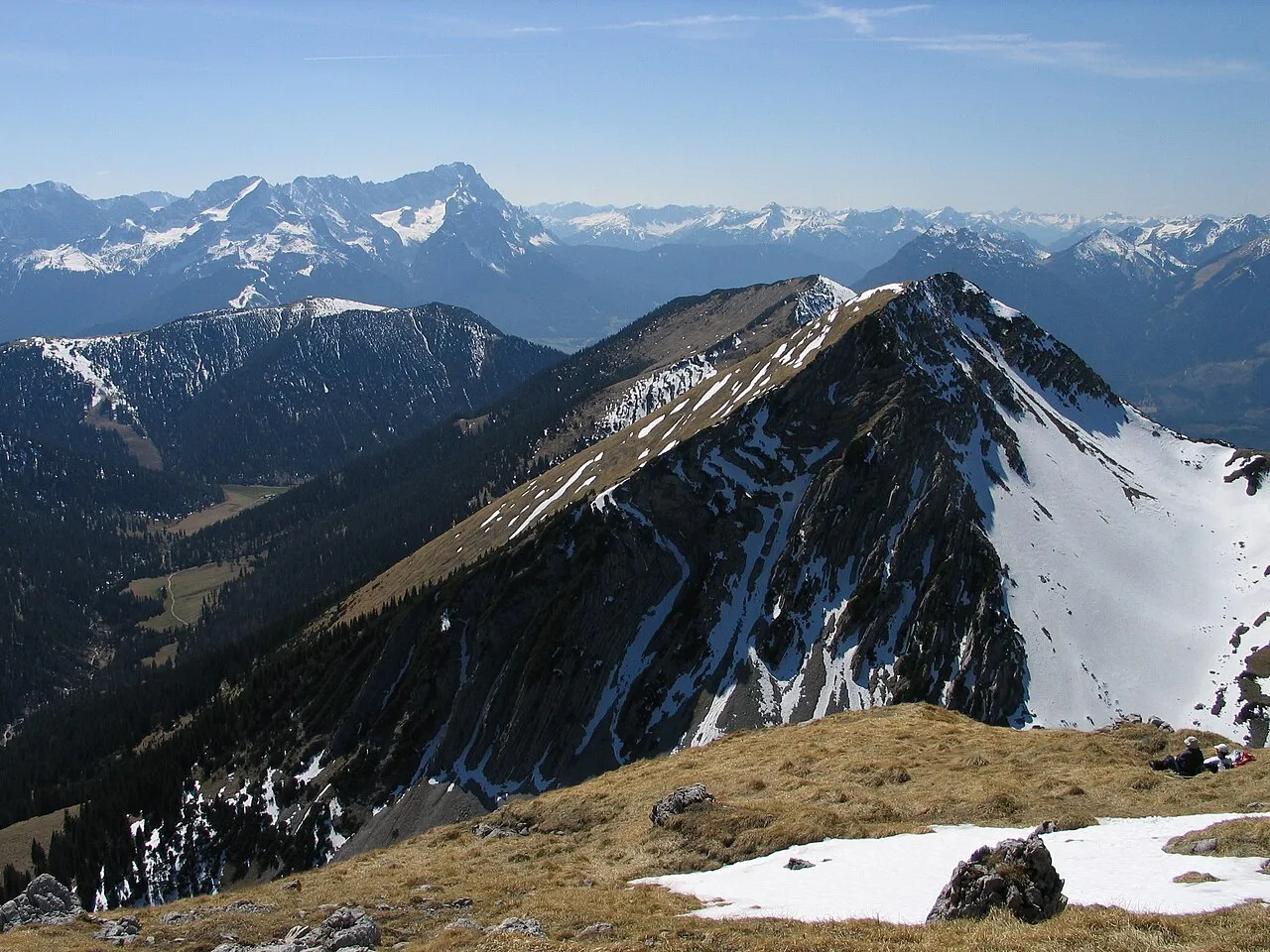
Bischof is a mountain. Location: Farchant, Landkreis Garmisch-Partenkirchen. Elevation: 2,033 m.
The Bischof (2,033 metres) is a mountain peak in the Bavarian Prealps of southern Germany. It lies in the westernmost part of the Bavarian Prealps in the Ester Mountains near Garmisch-Partenkirchen. The usual climb to the top runs from Oberau via the Oberauer Steig to the saddle between the Bischof and the Hoher Fricken and on over the western ridge on good tracks through the Latschen to the summit (a total of about 3.5 hours climb).
Source: Wikipedia · CC BY-SA 4.0
Photos of Bischof
-

Dreizung · CC BY-SA 4.0 -

Dreizung · CC BY-SA 4.0 -

Wasquewhat · CC BY-SA 4.0 -

Mölchlein · CC BY-SA 4.0 -

Jürgen Hamann · CC BY-SA 3.0


Climate of Bischof
This month · November
A cold month
Day -1° · Night -8° · Rain 90 mm
- Hottest month
- July (day 14°)
- Coldest month
- January (night -11°)
- Wettest month
- July (182 mm)
- Driest month
- February (66 mm)
Bars: average monthly low and high temperature. Below: precipitation. Monthly averages for 1970–2000 at about 18 km resolution, adjusted for elevation. Highlighted months are mild and relatively dry. Source: WorldClim 2.1 (CC BY 4.0).
Show values as a table
| Month | Jan | Feb | Mar | Apr | May | Jun | Jul | Aug | Sep | Oct | Nov | Dec |
|---|---|---|---|---|---|---|---|---|---|---|---|---|
| Average high (°C) | -4° | -3° | 0° | 3° | 9° | 11° | 14° | 13° | 10° | 5° | -1° | -3° |
| Average low (°C) | -11° | -11° | -8° | -6° | -1° | 2° | 4° | 4° | 1° | -3° | -8° | -10° |
| Precipitation (mm) | 67 | 66 | 84 | 98 | 127 | 173 | 182 | 168 | 111 | 84 | 90 | 80 |
How to get to Bischof
The nearest airport is Innsbruck Airport (INN), 34 km to the south as the crow flies. The nearest large city is Innsbruck, 35 km to the southeast.
Airports
- Innsbruck Airport (INN) Innsbruck 34 kmsouth
- Memmingen Allgau Airport (FMM) Memmingen 86 kmnorthwest
- Munich Airport (MUC) Munich 101 kmnortheast
Nearby large cities
- Innsbruck Population: 132.5K 35 kmsoutheast
- Munich Population: 1.5M 73 kmnortheast
- Augsburg Population: 301.1K 95 kmnorth
- Ulm Population: 120.5K 130 kmnorthwest
- Ingolstadt Population: 120.7K 137 kmnorth
Straight-line distances; road distances are longer. Airport data: OurAirports.
Day trips from Bischof
Within 100 km: 439 historic and cultural sites, 4,528 natural sites, 1,183 lakes, rivers and coasts.
0–25 km780 places
- Bayerisches Oberland Mountain 19 kmNE
- Wildsee Lake 25 kmS
- Igel See Lake 24 kmSW
- Schönjöchl Mountain 24 kmW
25–60 km1,881 places
- Schloss Hirschberg am Haarsee Historic site 30 kmN
- Zireiner See Lake 49 kmE
- Wilder See Lake 55 kmSW
- Weissensee Lake 30 kmSW
60–100 km3,489 places
- Herreninsel Island 98 kmE
- elf-pavlik's tent Historic site 79 kmNE
- Kapfkopf Mountain 77 kmSW
- Vesilspitze Mountain 94 kmSW
Straight-line distances.
Nearest towns and villages
-
Oberau Village, Landkreis Garmisch-Partenkirchen4 km NW
-
Farchant Village, Farchant5 km W
-
Garmisch-Partenkirchen Village, Landkreis Garmisch-Partenkirchen7.3 km SW
-
Eschenlohe Village, Landkreis Garmisch-Partenkirchen6.6 km N
-
Ettal Village, Landkreis Garmisch-Partenkirchen6.4 km NW
-
Oberau Village, Oberau3.5 km NW
Nearby attractions & nature
Everything nearby-
Henneneck Mountain, Oberau0.6 km N
-
Kareck Mountain, Oberau0.9 km N
-
Niederer Fricken Mountain, Farchant1.4 km W
-
Oberer Rißkopf Mountain, Oberau1.2 km NE
-
Krottenkopf Mountain, Eschenlohe1.2 km NE
-
Schindlerskopf Mountain, Oberau1.9 km NE
-
Hoher Fricken Mountain, Farchant1.9 km SW
-
Wasserstein Mountain, Bavaria2.4 km NE
Sources & licences
Data last updated: · 2 independent sources