- Elevation
- 1,756 m
- above sea level
- Local time
- UTC+01:00
- Europe/Berlin · UTC+01:00
- Airports
- SZG Salzburg Airport25 km
- MUC Munich Airport101 km
About Aibleck
Aibleck is a mountain. Location: Ruhpolding, Landkreis Traunstein. Elevation: 1,756 m. The nearest airport is Salzburg Airport (25 km). Nearby sights include Sonntagshorn and Ochsenhorn.
Photos of Aibleck
-
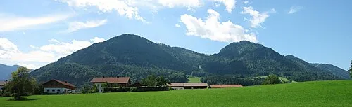
Unternberg Max1235 · CC BY-SA 3.0 -
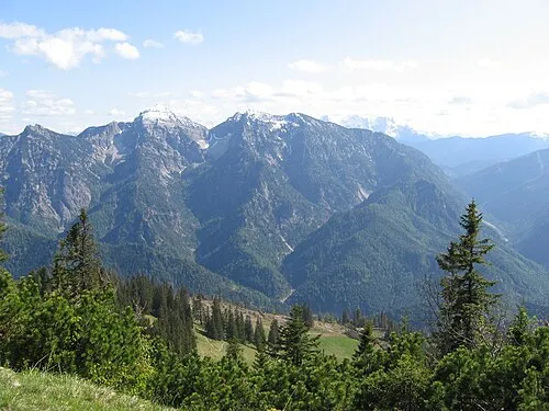
Sonntagshorn 20percent · Public domain -
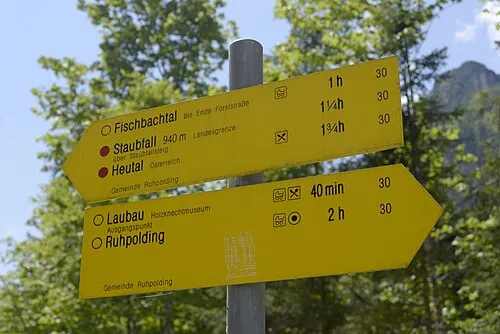
Saurüsselkopf Carl von Einem · CC BY-SA 4.0


Climate of Aibleck
This month · November
A cold month
Day 0° · Night -7° · Rain 96 mm
- Hottest month
- July (day 15°)
- Coldest month
- January (night -11°)
- Wettest month
- July (180 mm)
- Driest month
- February (77 mm)
Bars: average monthly low and high temperature. Below: precipitation. Monthly averages for 1970–2000 at about 18 km resolution, adjusted for elevation. Highlighted months are mild and relatively dry. Source: WorldClim 2.1 (CC BY 4.0).
Show values as a table
| Month | Jan | Feb | Mar | Apr | May | Jun | Jul | Aug | Sep | Oct | Nov | Dec |
|---|---|---|---|---|---|---|---|---|---|---|---|---|
| Average high (°C) | -4° | -3° | 1° | 5° | 10° | 13° | 15° | 15° | 11° | 7° | 0° | -3° |
| Average low (°C) | -11° | -10° | -7° | -4° | 0° | 3° | 5° | 5° | 2° | -2° | -7° | -9° |
| Precipitation (mm) | 86 | 77 | 96 | 95 | 117 | 169 | 180 | 160 | 111 | 83 | 96 | 101 |
How to get to Aibleck
The nearest airport is Salzburg Airport (SZG), 25 km to the northeast as the crow flies. The nearest large city is Salzburg, 28 km to the northeast.
Airports
- Salzburg Airport (SZG) Salzburg 25 kmnortheast
- Munich Airport (MUC) Munich 101 kmnorthwest
- Innsbruck Airport (INN) Innsbruck 113 kmsouthwest
Nearby large cities
- Salzburg Population: 157.2K 28 kmnortheast
- Munich Population: 1.5M 98 kmnorthwest
- Innsbruck Population: 132.5K 110 kmsouthwest
- Linz Population: 204.8K 136 kmnortheast
- Ingolstadt Population: 120.7K 153 kmnorthwest
Straight-line distances; road distances are longer. Airport data: OurAirports.
Day trips from Aibleck
Within 100 km: 325 historic and cultural sites, 3,835 natural sites, 1,140 lakes, rivers and coasts.
0–25 km450 places
- Wiesensee Lake 22 kmS
- Piller See Lake 20 kmSW
- Taubensee Lake 21 kmW
- Dießbachstausee Lake 22 kmSE
25–60 km1,357 places
- Frauenchiemsee Island 29 kmNW
- Herreninsel Island 30 kmNW
- Brandlsee Lake 51 kmS
- Brechlsee Lake 55 kmS
60–100 km3,493 places
- Hoher Dachstein Mountain 72 kmE
- elf-pavlik's tent Historic site 98 kmNW
- Fürlegsee Lake 62 kmS
- Vorderer Langtalsee Lake 77 kmS
Straight-line distances.
Nearest towns and villages
-
Niederland Village, Unken3.2 km SE
-
Unken Municipality, Zell am See District5.9 km S
-
Unken Village, Unken4.7 km S
-
Schneizlreuth Village, Berchtesgadener Land6.9 km E
-
Inzell Village, Landkreis Traunstein8.1 km NE
-
Schneizlreuth Village, Schneizlreuth6.9 km E
Nearby attractions & nature
Everything nearby-
Sonntagshorn Mountain, Germany1.3 km SW
-
Ochsenhorn Mountain, Schneizlreuth0.8 km E
-
Augenstein Mountain, Ruhpolding1.3 km NE
-
Hochgern (Sonntagshorn) Mountain, Unken1 km S
-
Vorderlahner Kopf Mountain, Ruhpolding1.9 km SW
-
Bogenhorn Mountain, Schneizlreuth1.9 km E
-
Lanzel Eck Mountain, Ruhpolding2 km N
-
Reifelberg Mountain, Germany2.4 km W
More nature in Germany
-
Saurüsselkopf Mountain, Ruhpolding4.5 km W
-
Adlerkopf Mountain, Ruhpolding3.1 km W
-
Unternberg Mountain, Ruhpolding6.7 km NW
-
Streicher Mountain, Ruhpolding5.2 km N
-
Zeno Kopf Mountain, Ruhpolding4.9 km N
-
Richtstrich Kopf Mountain, Ruhpolding6 km W
Sources & licences
Data last updated: · 2 independent sources