Sonntagshorn
Located in Germany Coordinates: 47°40′53″ N 12°41′48″ E
- Elevation
- 1,961 m
- above sea level
- Local time
- UTC+01:00
- Europe/Berlin · UTC+01:00
About Sonntagshorn
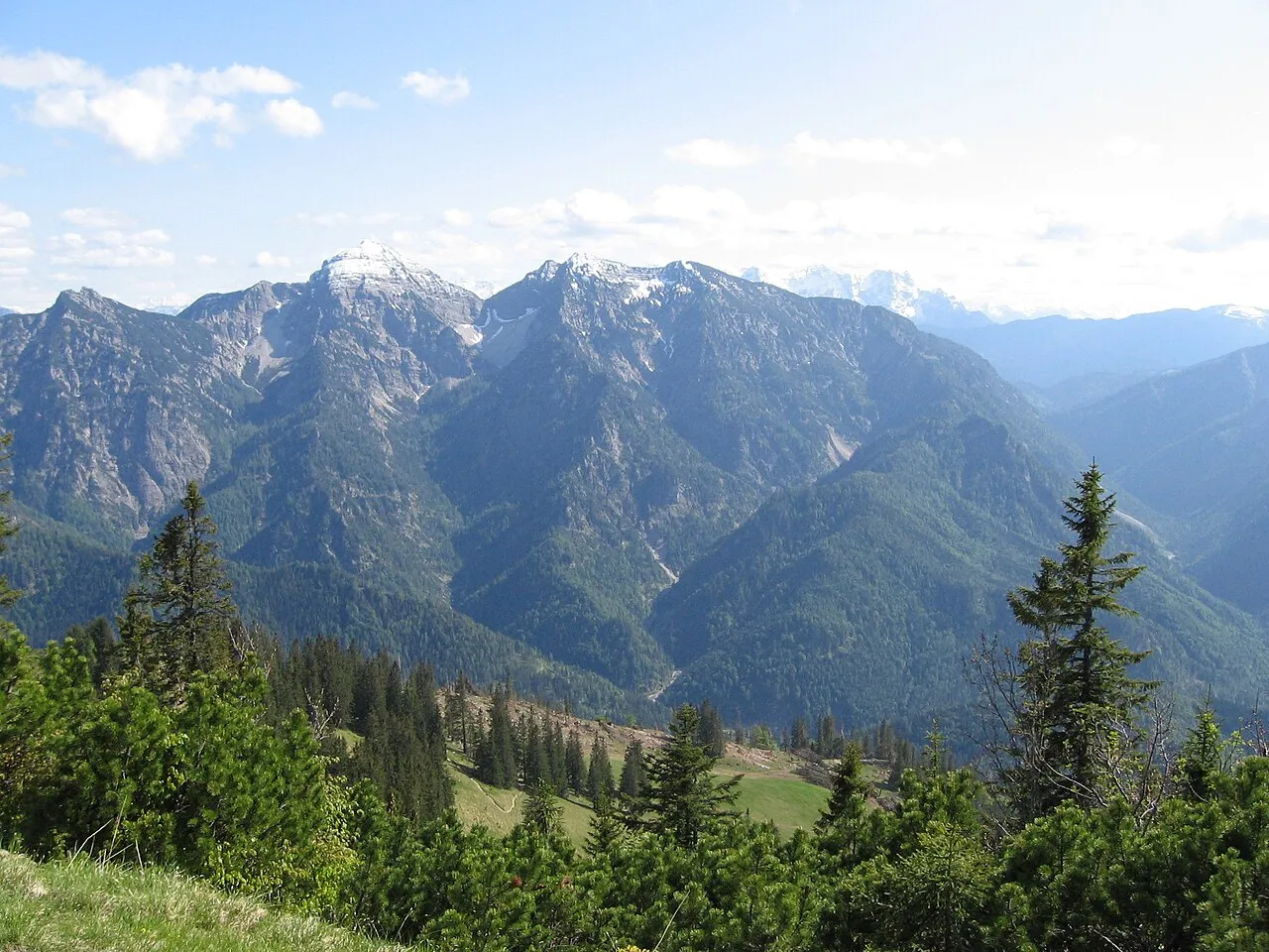
Sonntagshorn is a mountain. Location: Germany. Elevation: 1,961 m.
The Sonntagshorn, at 1,961 metres above sea level, is the highest mountain in the Chiemgau Alps. The international border between Germany and Austria, and hence between the states of Bavaria and Salzburg, runs over the summit of the mountain, which rises south-southeast of Ruhpolding and south-southwest of Inzell. The name Sonntagshorn has nothing to do with the Sonntag (German for "Sunday"), but is derived from Sonnendach, which means "sun roof".
Read more on Wikipedia Text: Wikipedia contributors · CC BY-SA 4.0 · shortened
At a glance
- Topographic prominence
- 1,181 m
Source: Wikidata
In comparison
- No. 207 of 25787 mountains in Germany by elevation
- 83 sights and natural places within 10 km Hochgern (Sonntagshorn), Vorderlahner Kopf
Nearest towns and villages
-
Niederland Village, Unken3.2 km SE
-
Unken Municipality, Zell am See District4.8 km S
-
Unken Village, Unken4.3 km SE
-
Unkenberg Village, Unken5.4 km S
-
Gföll Village, Unken5.8 km SW
-
Ruhpolding Village, Landkreis Traunstein8.1 km NW
Nearby attractions & nature
Everything nearby-
Hochgern (Sonntagshorn) Mountain, Unken0.6 km E
-
Vorderlahner Kopf Mountain, Ruhpolding0.9 km W
-
Aibleck Mountain, Ruhpolding1.3 km NE
-
Reifelberg Mountain, Germany1.4 km W
-
Ochsenhorn Mountain, Schneizlreuth1.9 km NE
-
Gämers Berg Mountain, Bavaria4.3 km E
-
Fischbachkopf Mountain, Unken2.3 km W
-
Augenstein Mountain, Ruhpolding2.5 km NE
More nature in Germany
-
Adlerkopf Mountain, Ruhpolding2.6 km NW
-
Lanzel Eck Mountain, Ruhpolding2.9 km N
-
Bogenhorn Mountain, Schneizlreuth3 km E
-
Kaserkopf Mountain, Schneizlreuth3.5 km NE
-
Litzlbach Hörnl Mountain, Schneizlreuth3.9 km NE
-
 Saurüsselkopf Mountain, Ruhpolding4 km NW
Sources & licences
Data last updated: · 2 independent sources